Bryce Canyon National Park: The Navajo Loop Trail

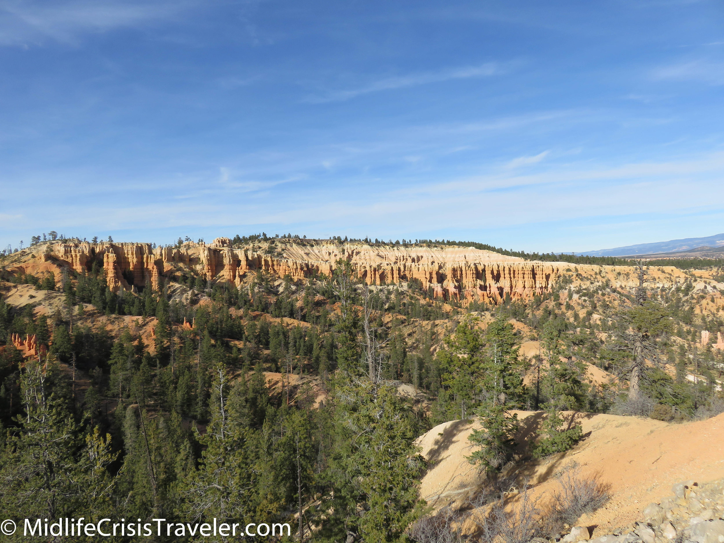
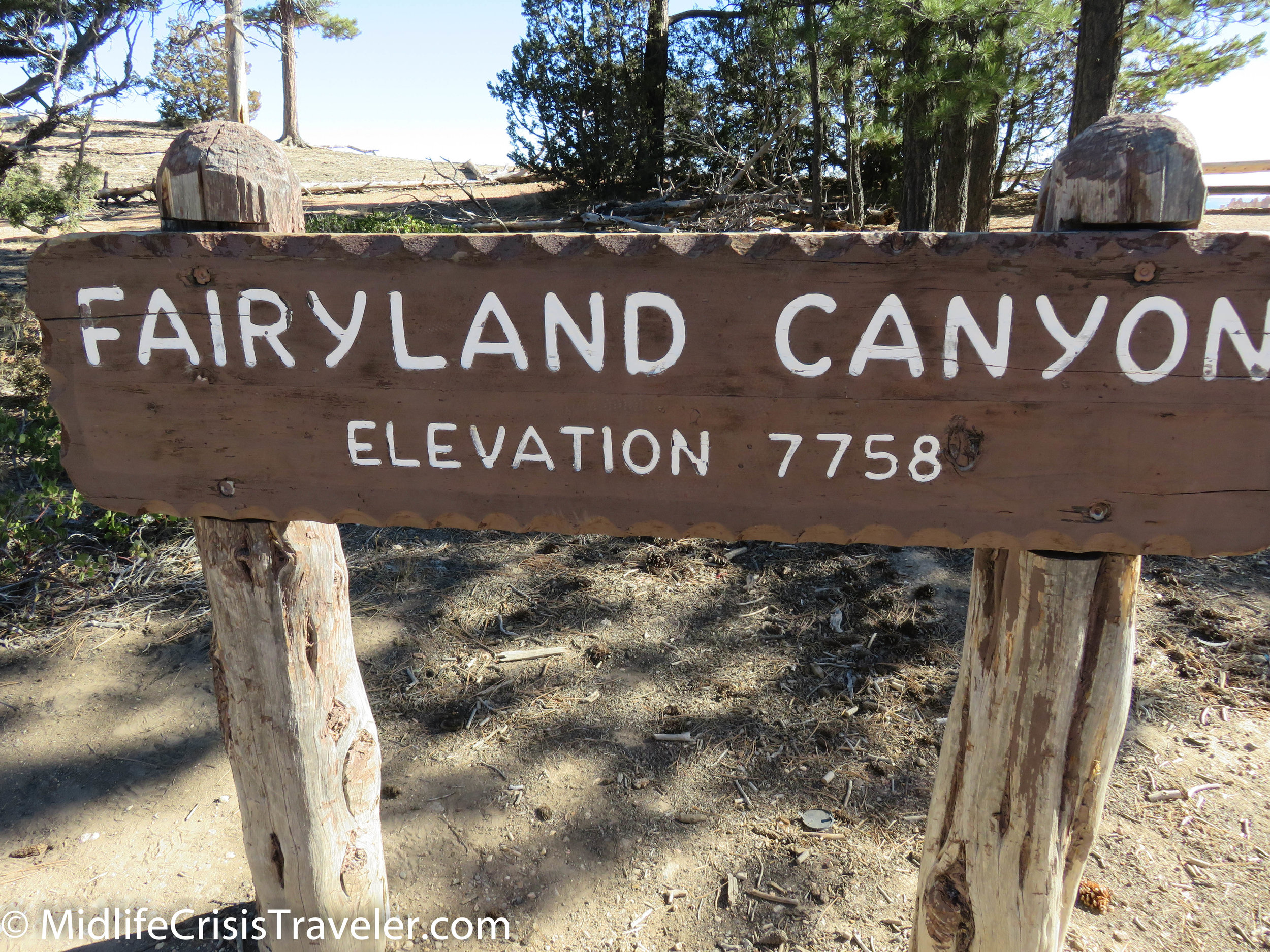
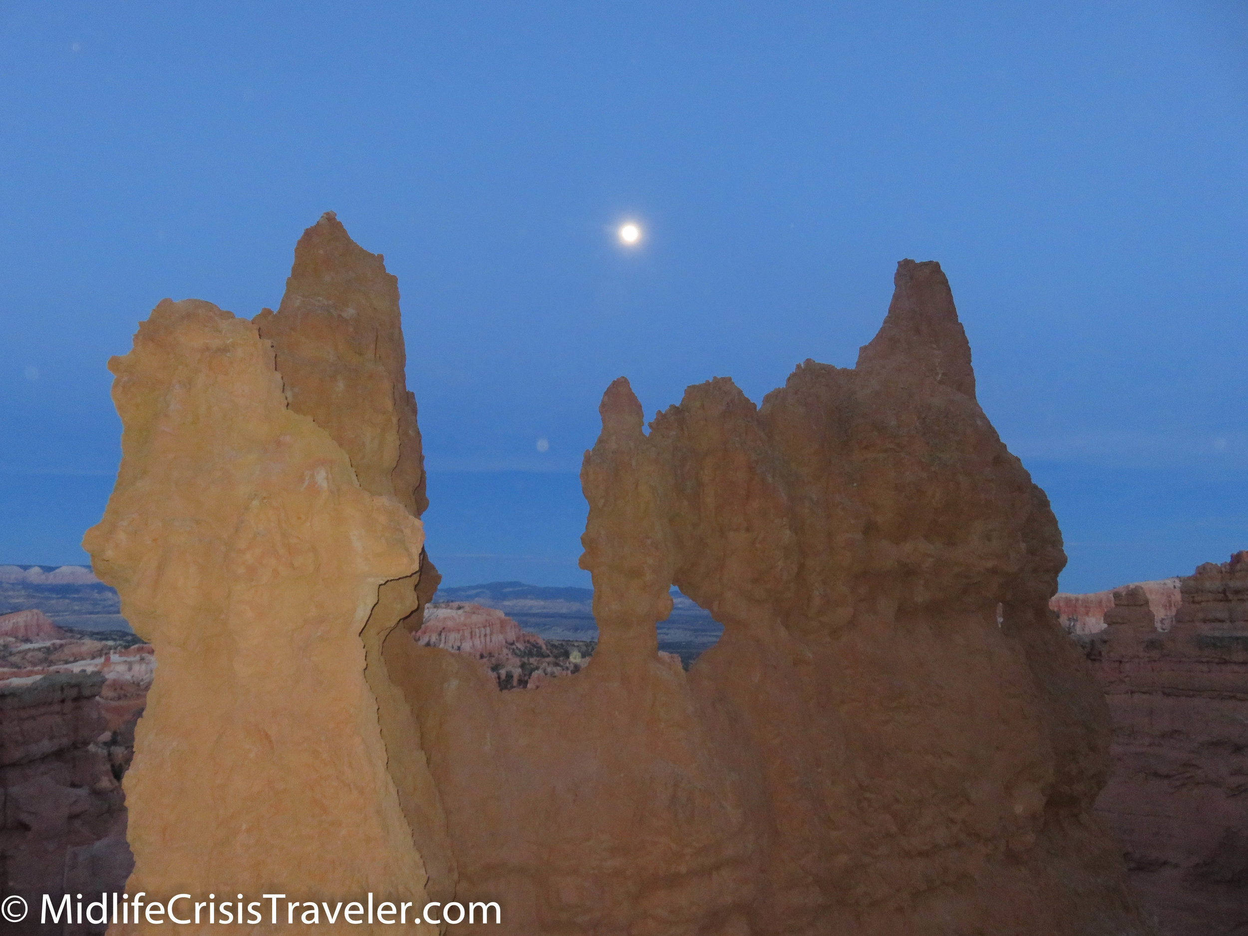
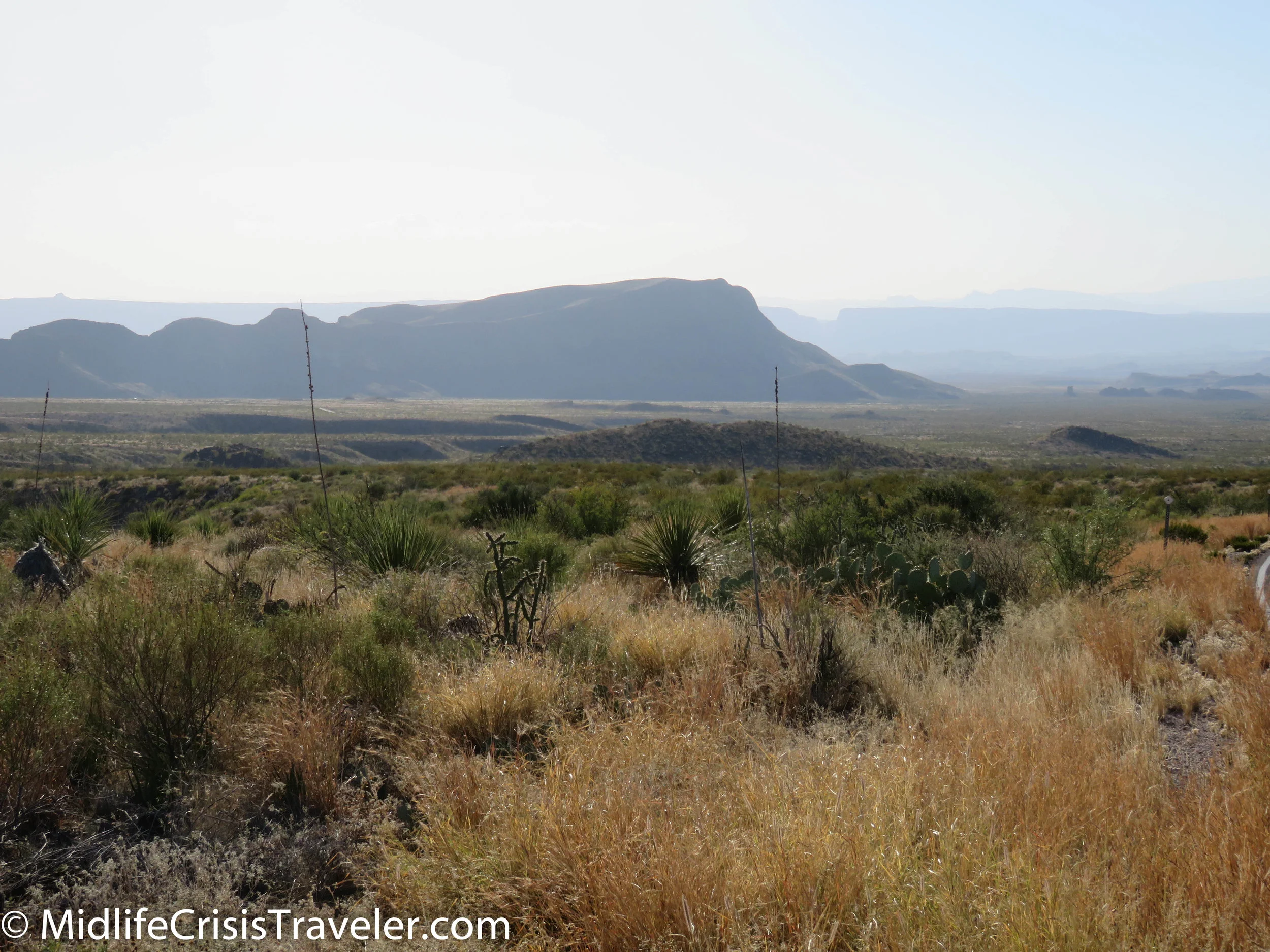
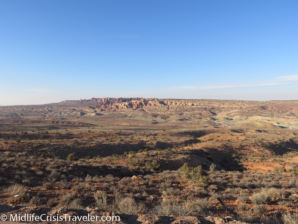
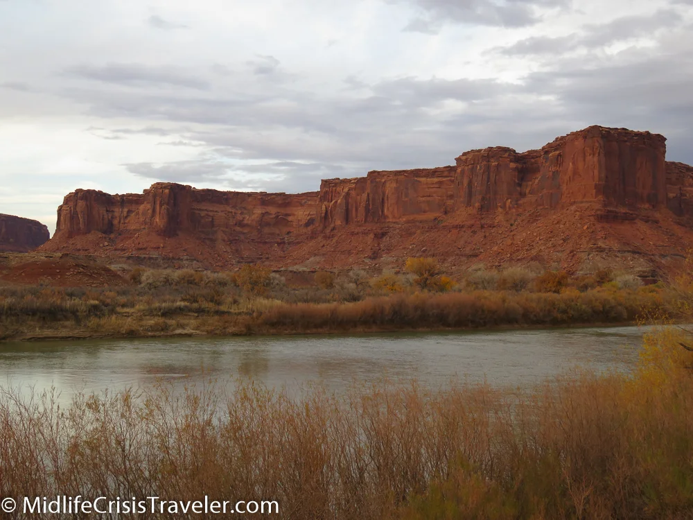
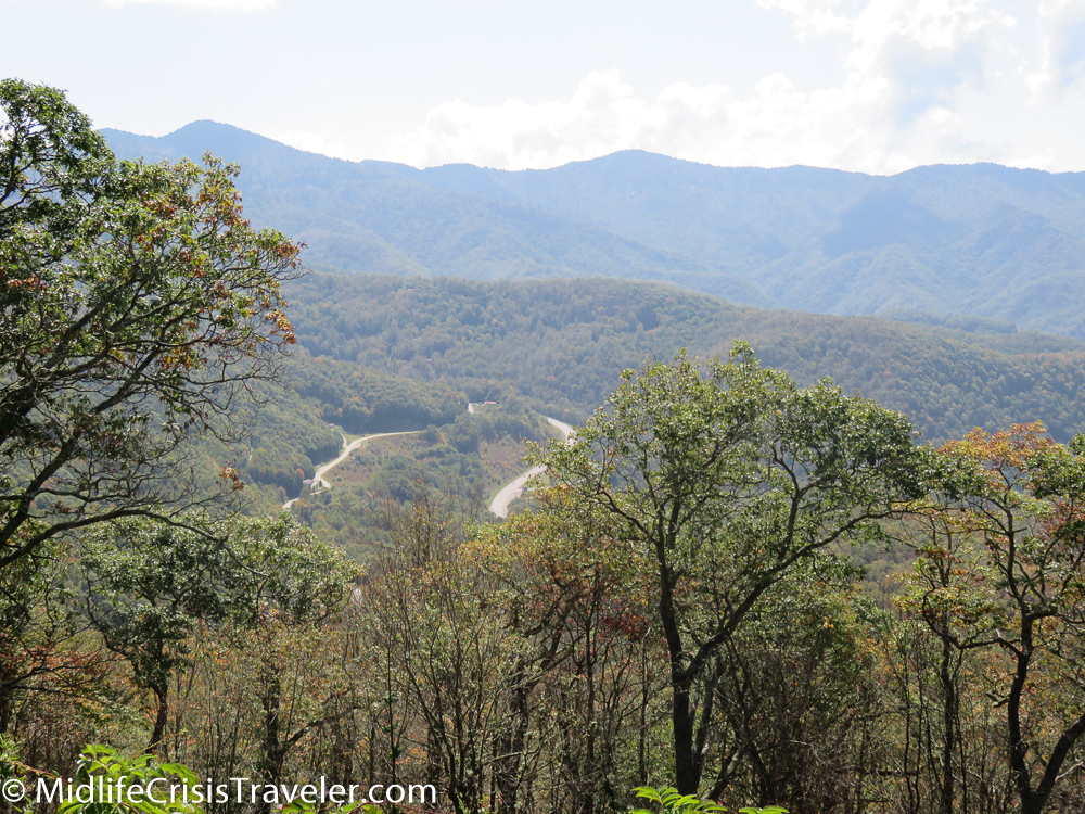
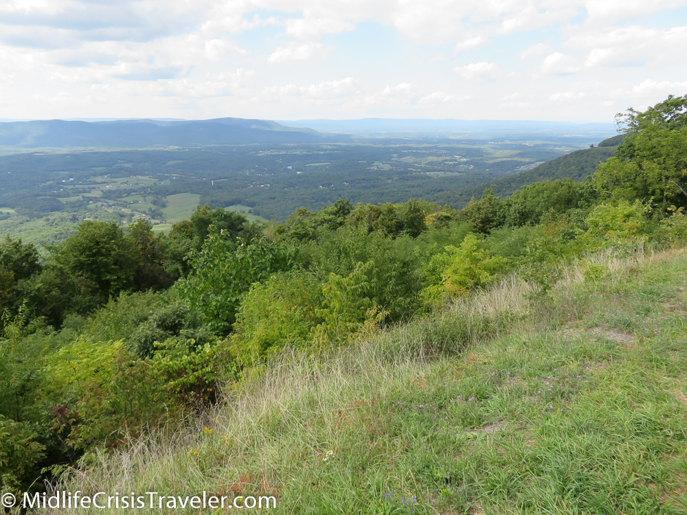
I visited Bryce Canyon multiple times from November through April.  It is a beautiful park and it is in an excellent location to visit multiple parks within a couple hours drive time.  

Bryce Canyon NP Navajo Loop-1.jpg
Bryce Canyon NP Navajo Loop-2.jpg
Bryce Canyon NP Navajo Loop-3.jpg
Bryce Canyon NP Navajo Loop-4.jpg
Bryce Canyon NP Navajo Loop-5.jpg
Bryce Canyon NP Navajo Loop-6.jpg

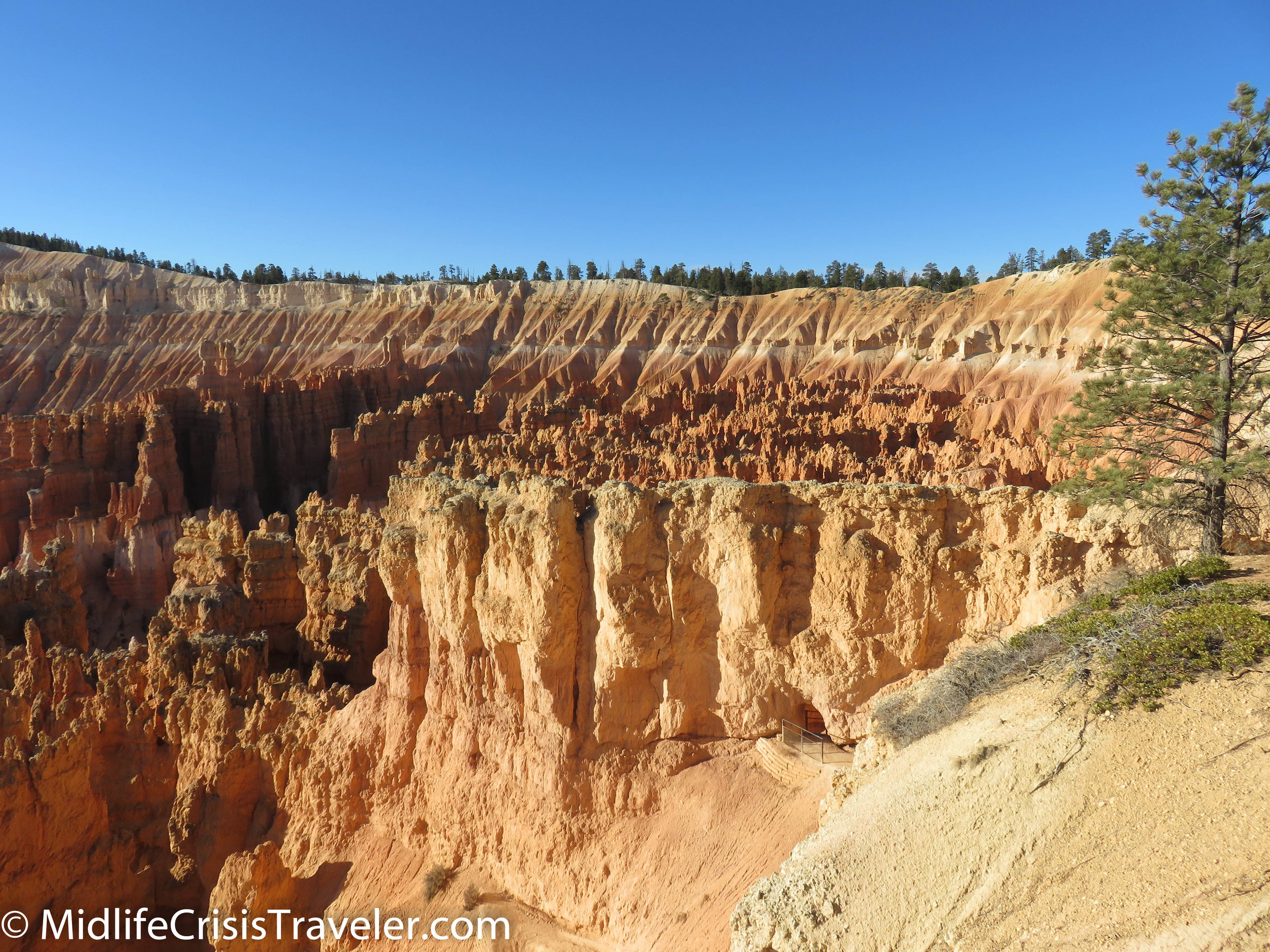
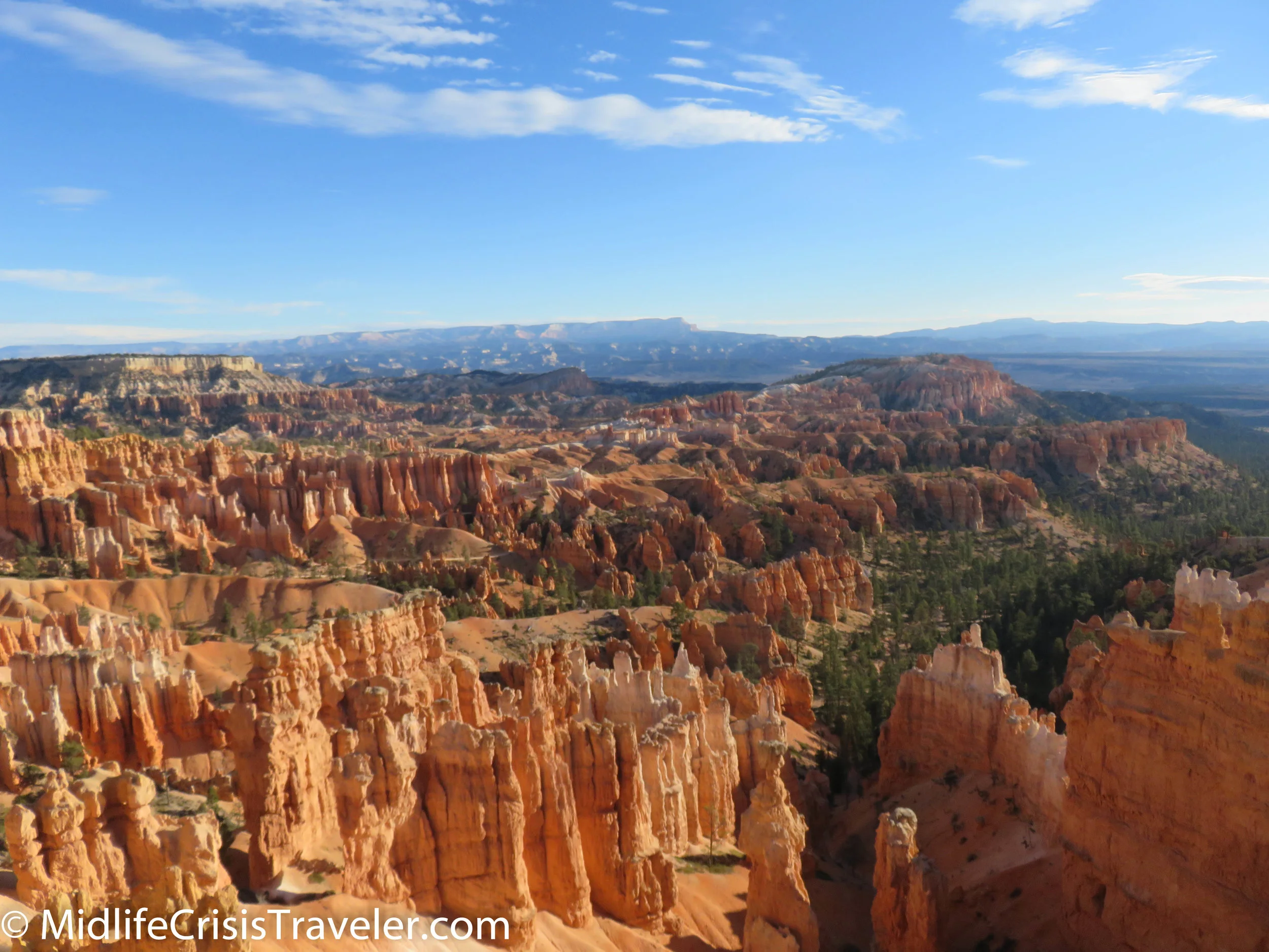
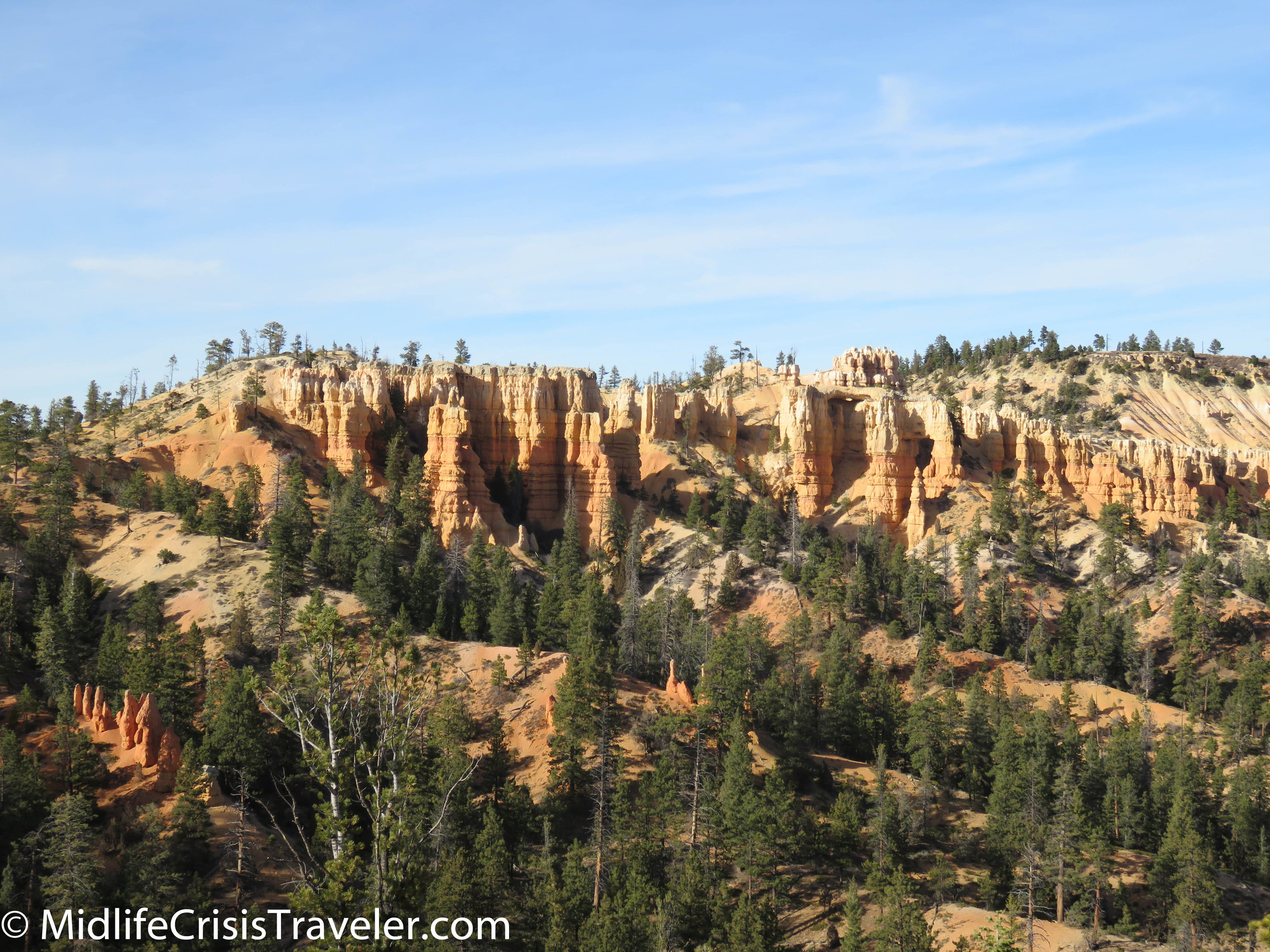
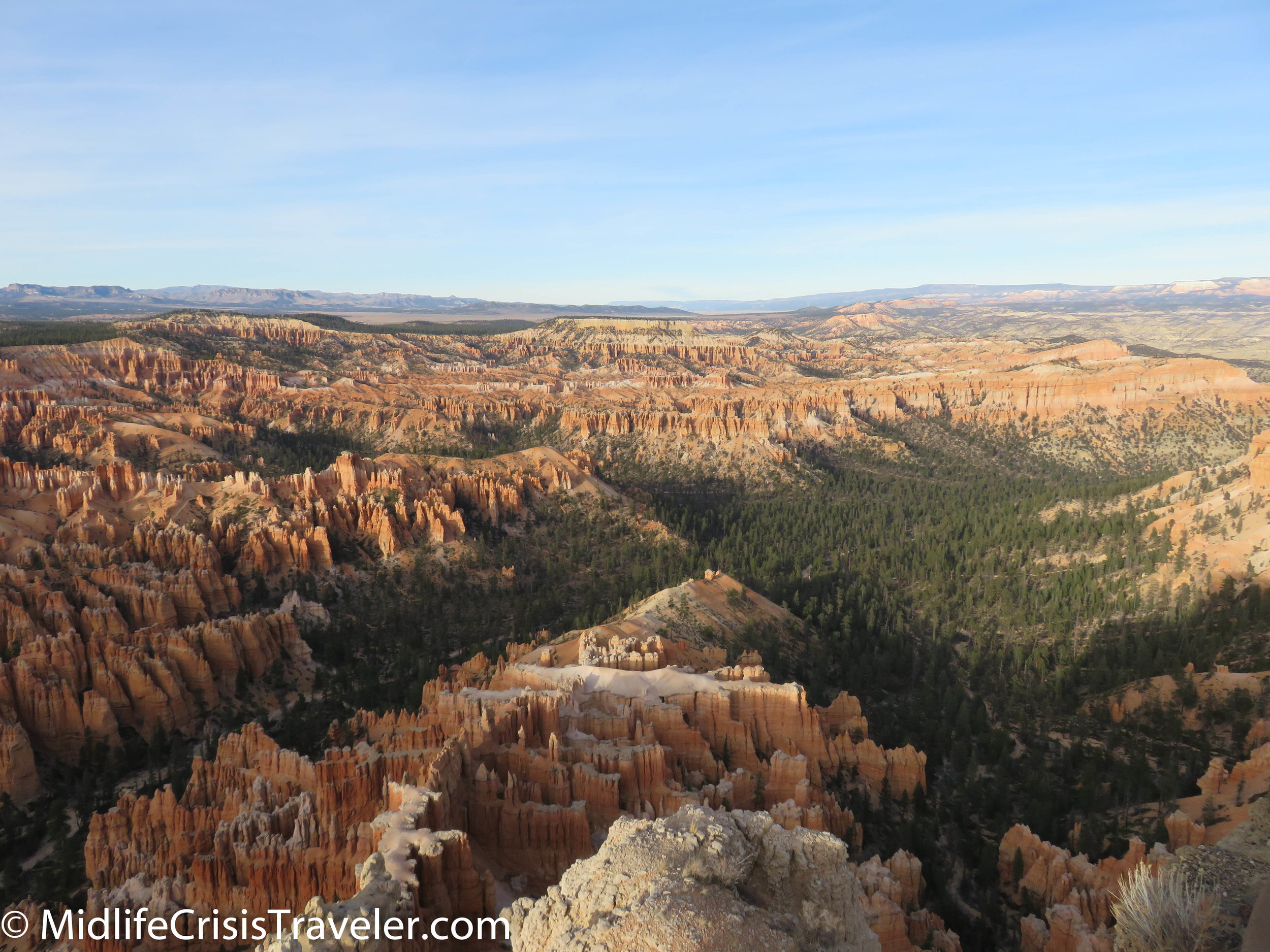
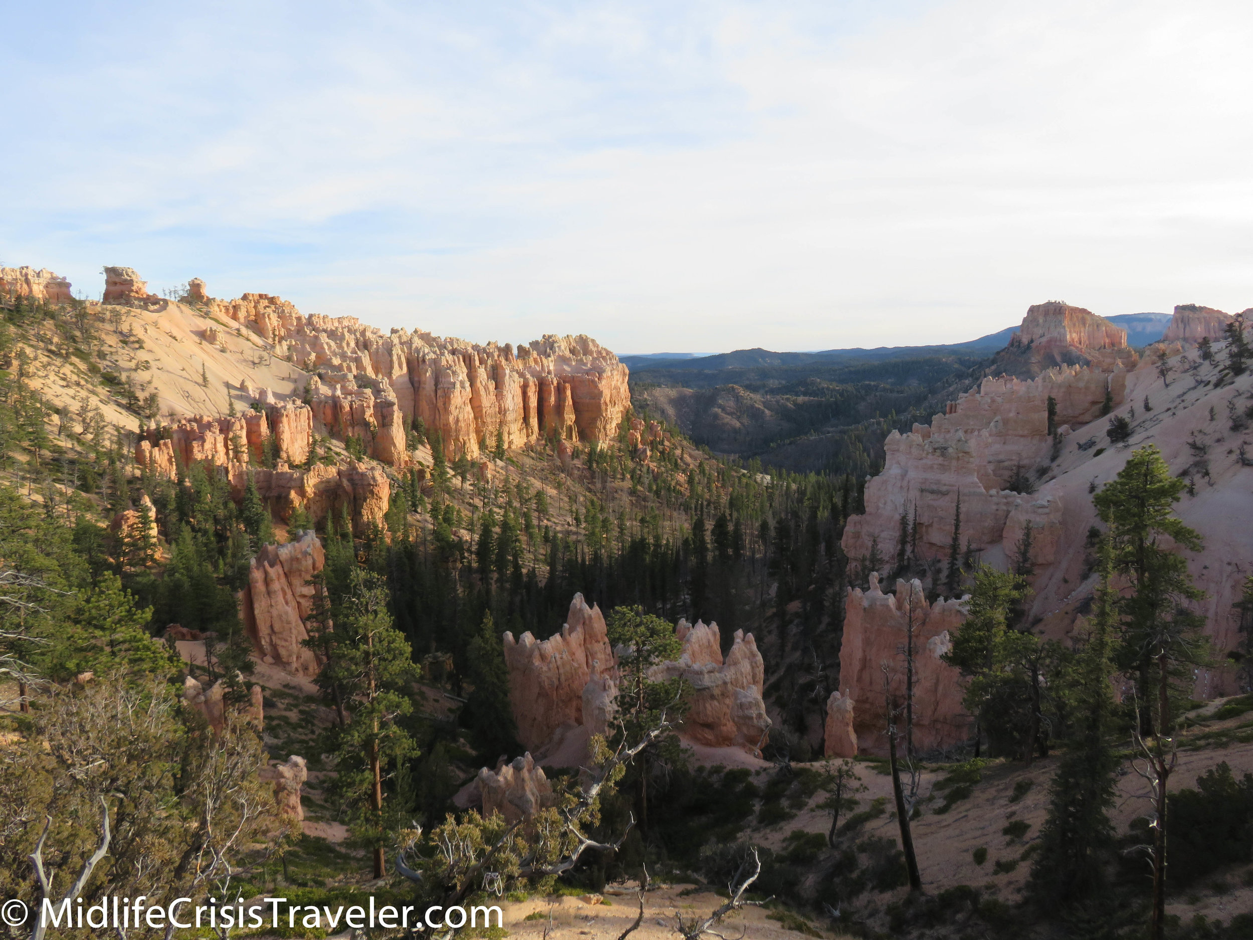
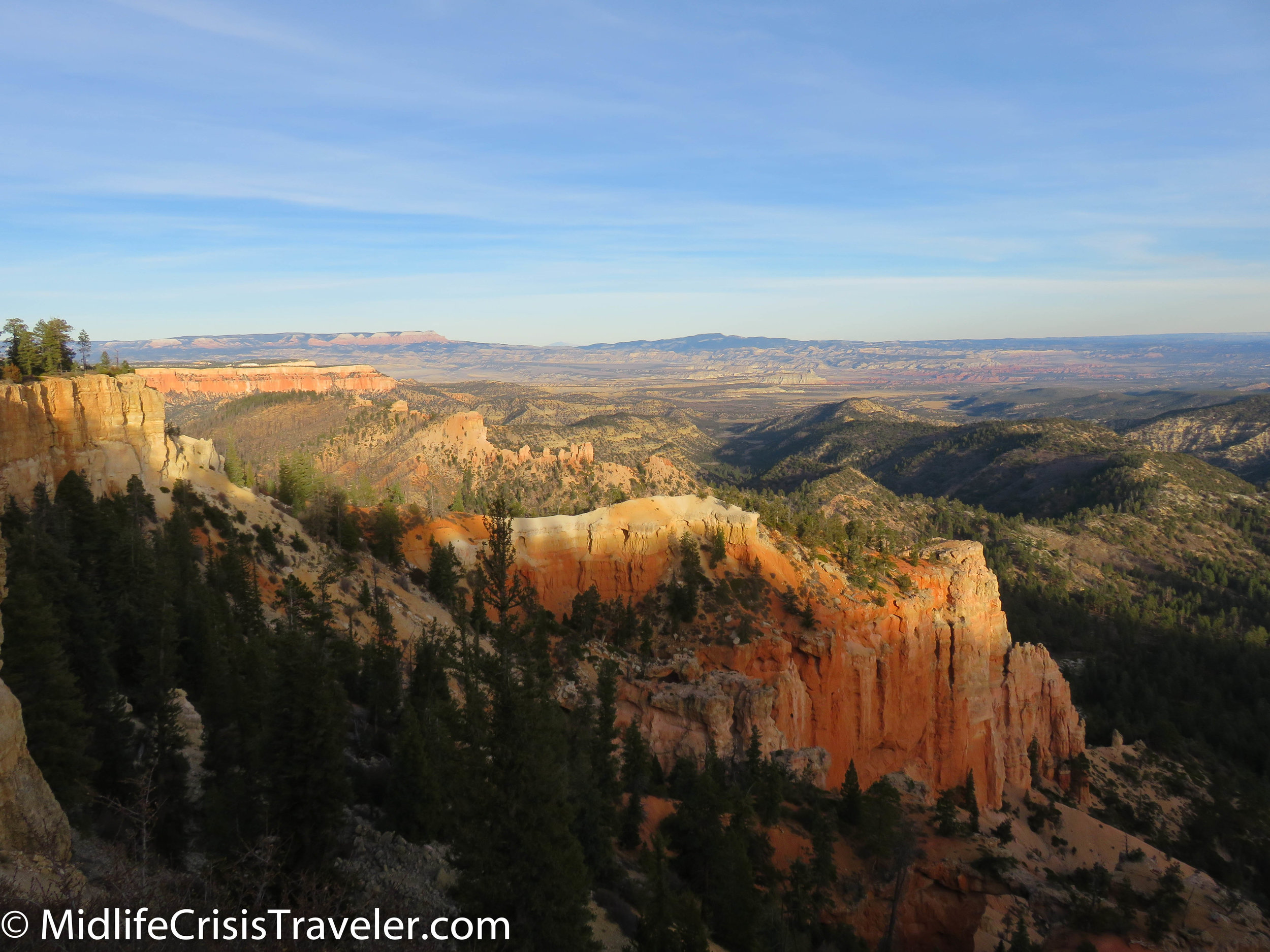
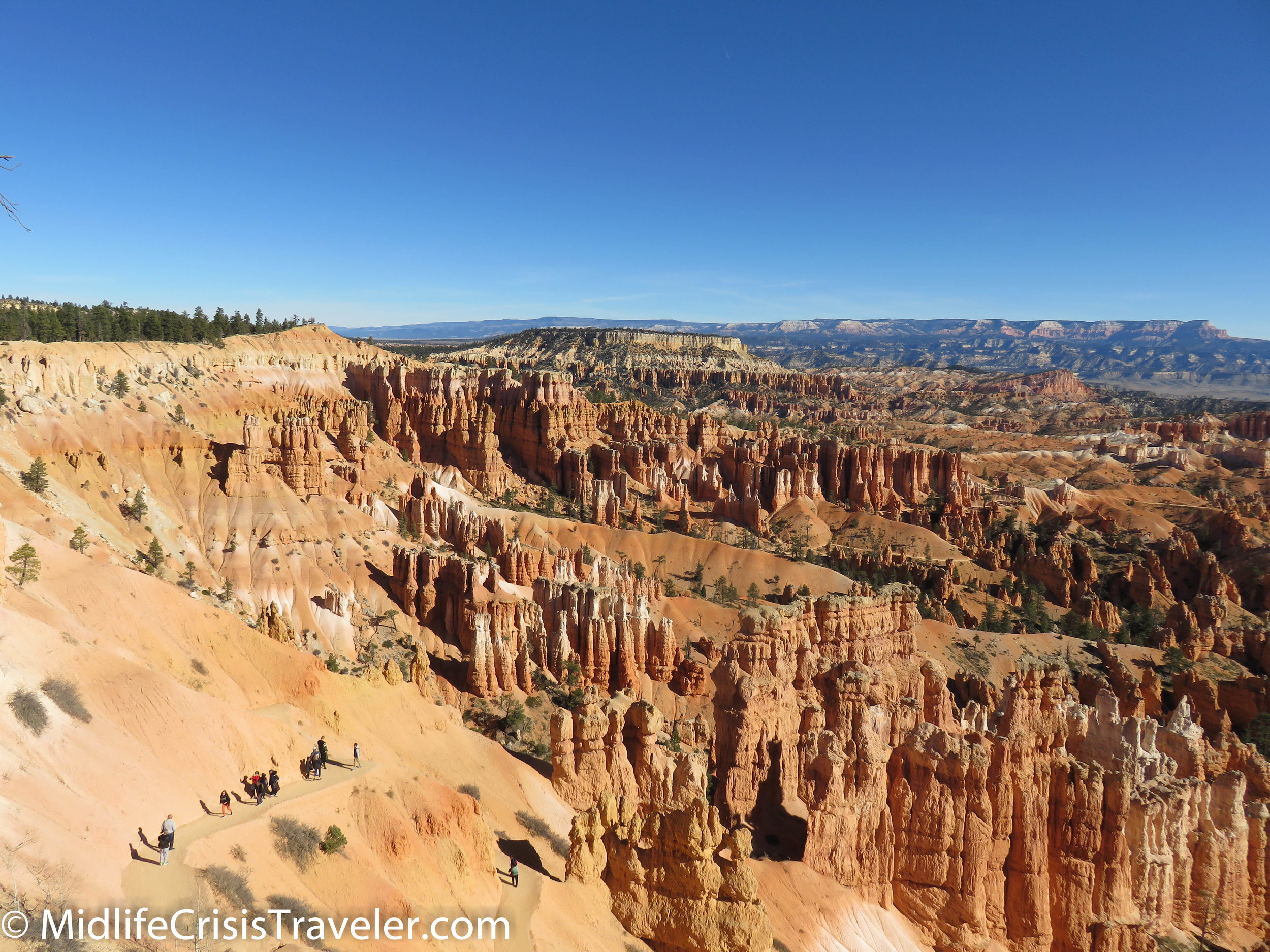
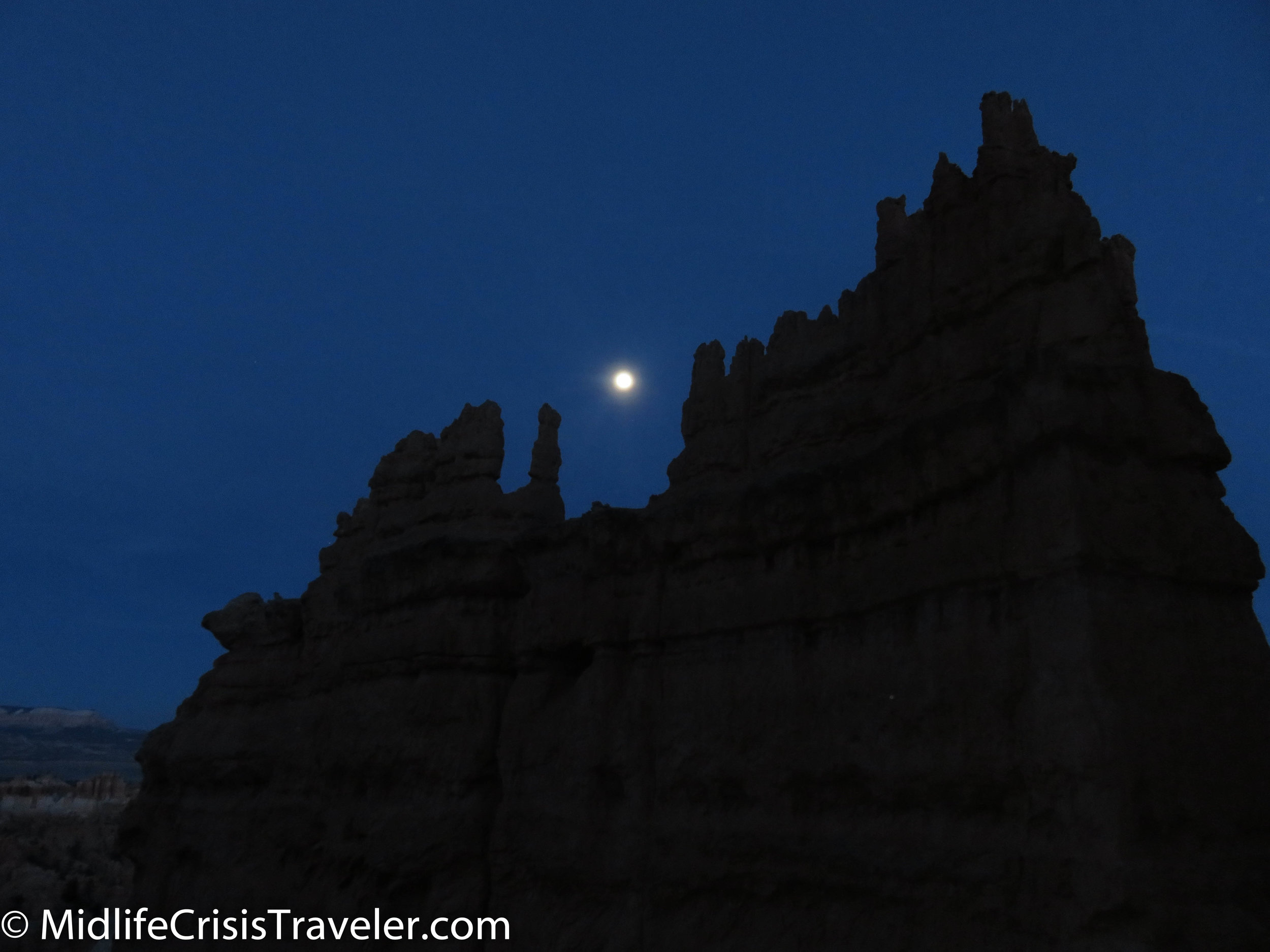
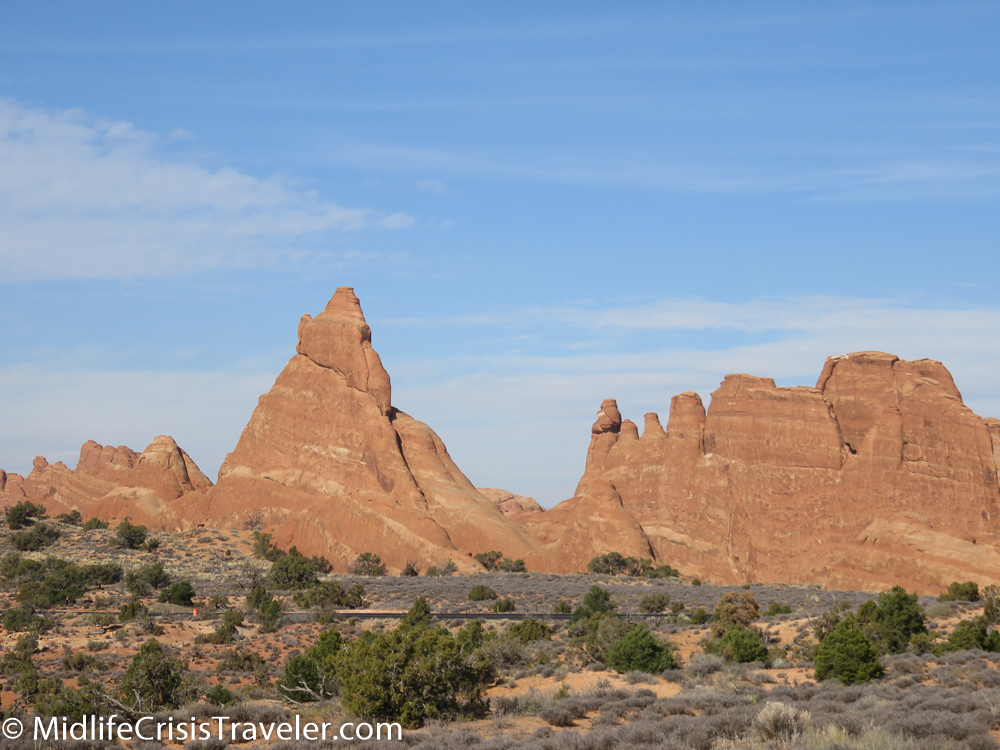
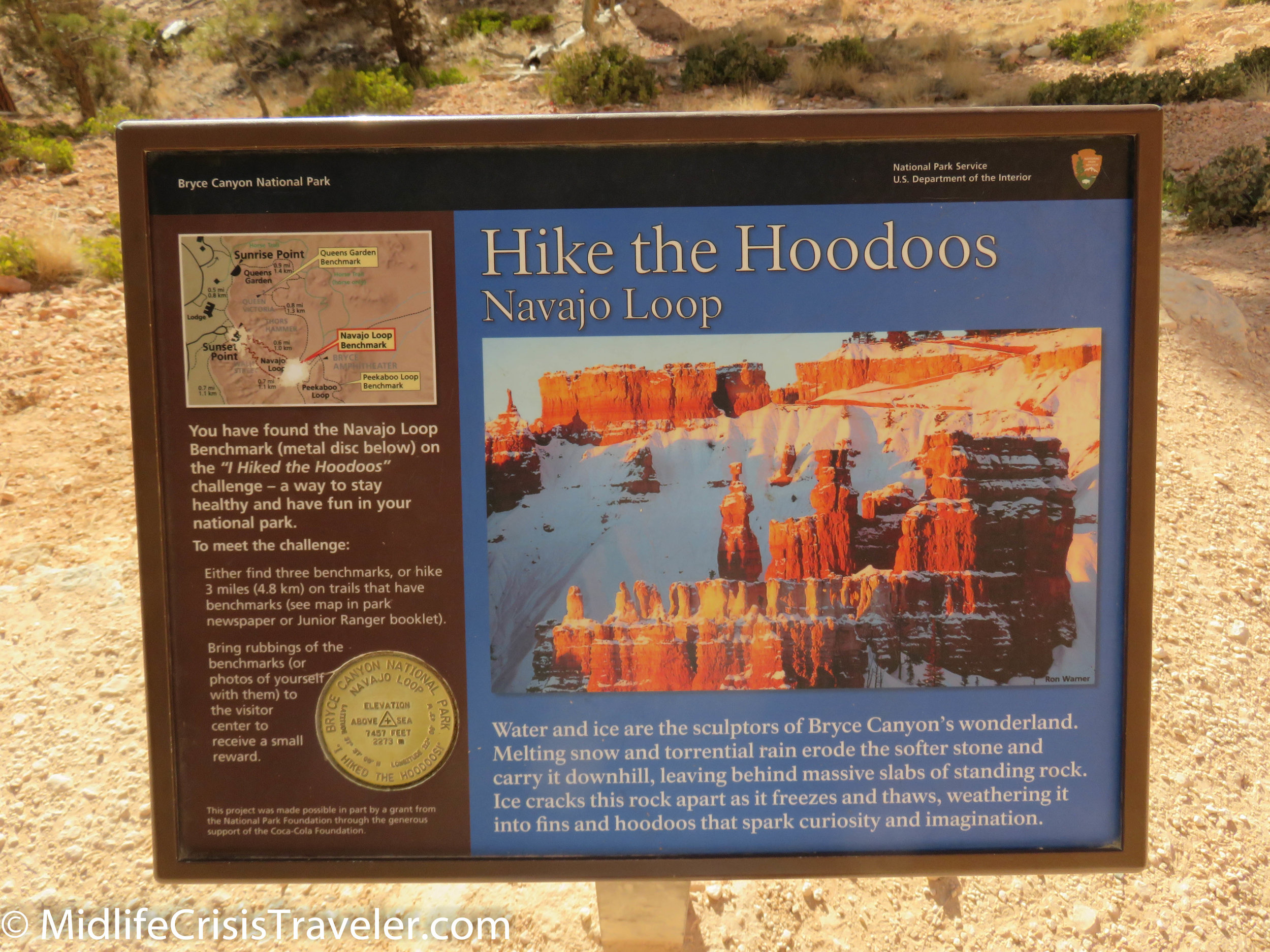
Sunset Point is the center of the universe at Bryce Canyon National Park.  The panoramic view of the park is a photographer’s paradise.  If you head to your left, you can take the Rim Trail to Sunrise Point.  From there, you can continue to the Fairyland Loop Trail or the Queens Garden Trail which take you deep into Hoodoo country.  A shorter and easier trail which provides a healthy dose of Hoodoos is the Navajo Loop Trail.  This trail heads off to the right of Sunset Point and allows you an up close and personal experience that you can’t get from the pedestrian viewing areas next to the parking lots. 

Bryce Canyon NP Navajo Loop-7.jpg
Bryce Canyon NP Navajo Loop-9.jpg
Bryce Canyon NP Navajo Loop-11.jpg
Bryce Canyon NP Navajo Loop-12.jpg
Bryce Canyon NP Navajo Loop-14.jpg

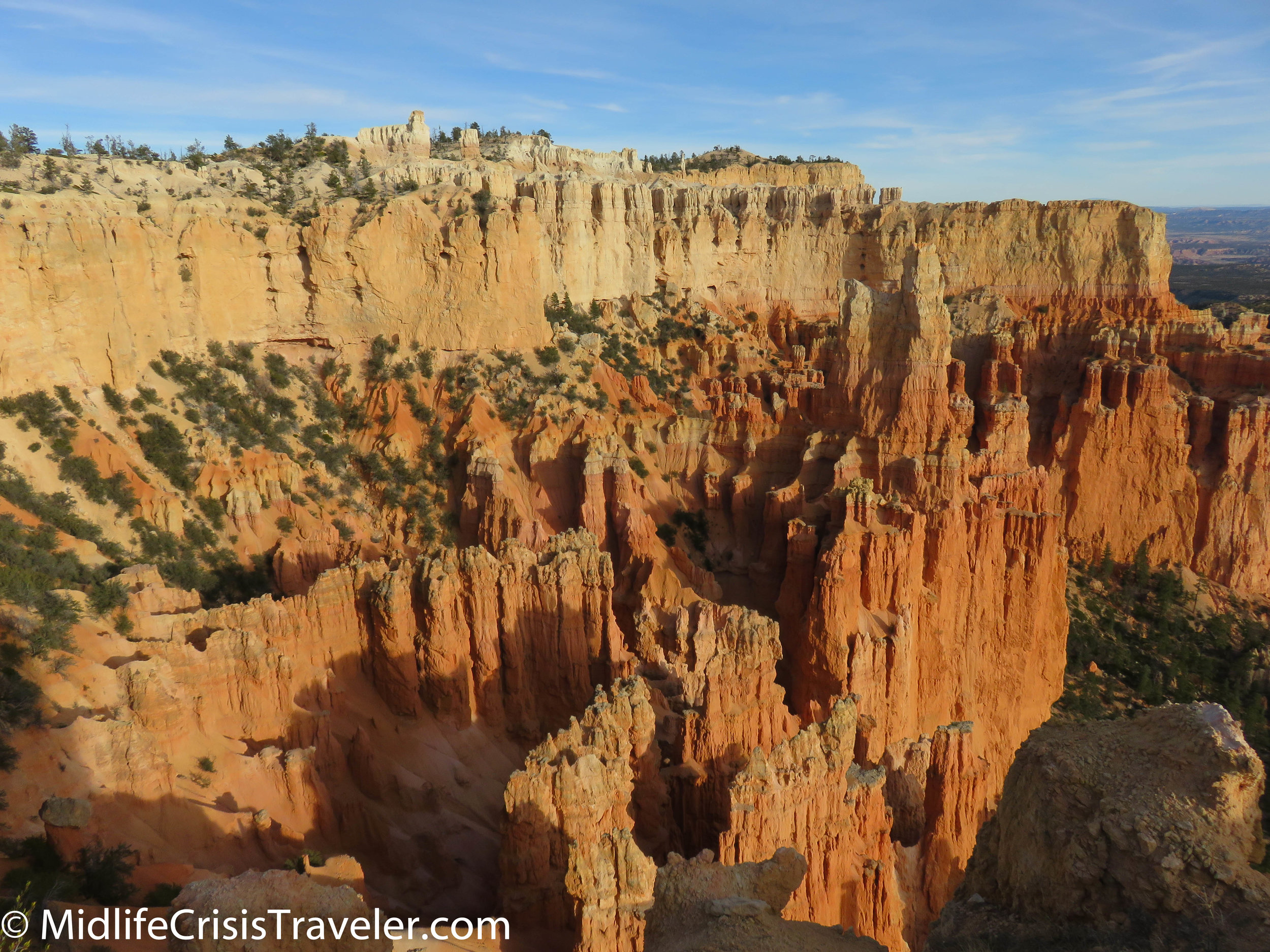
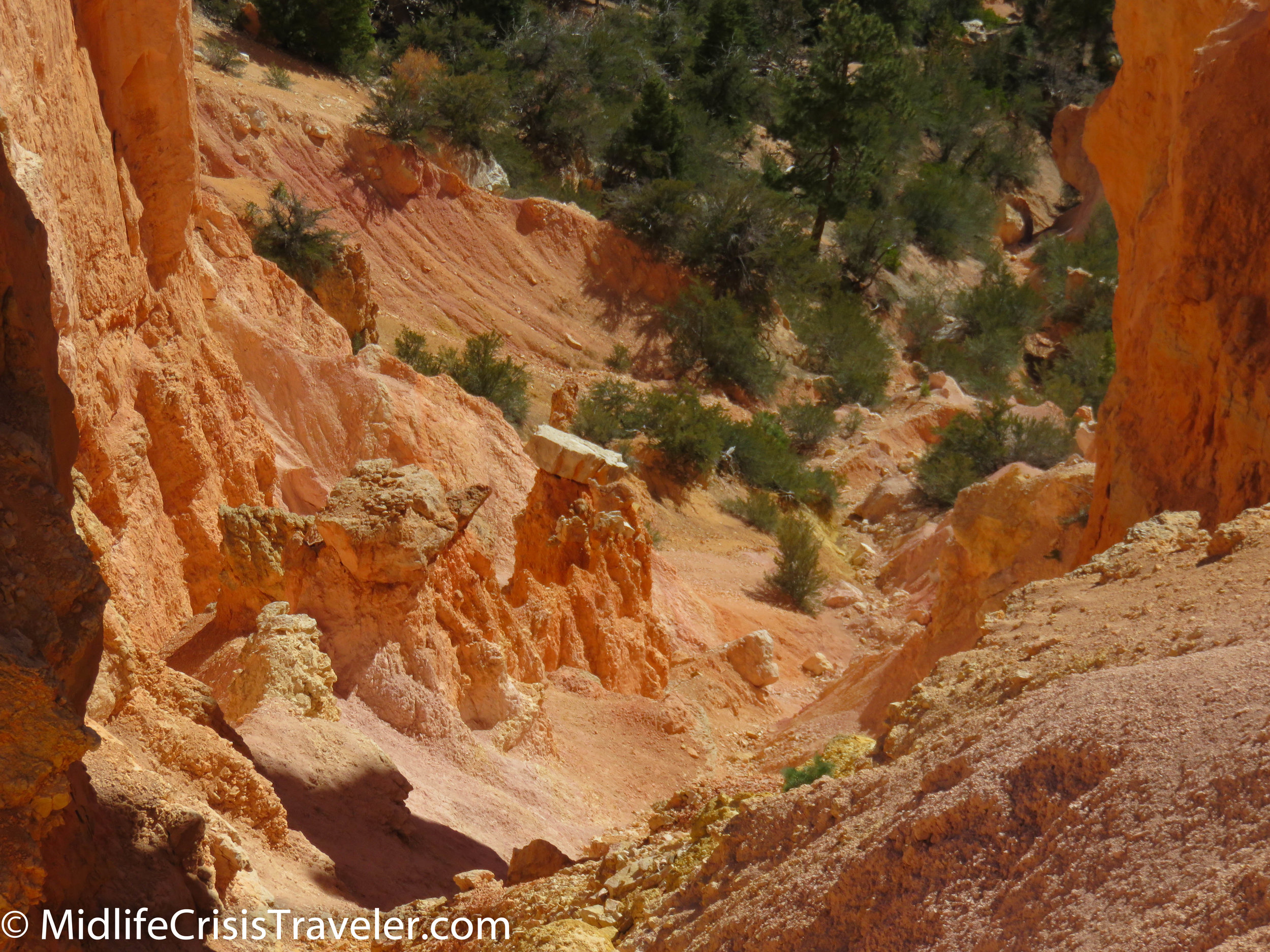
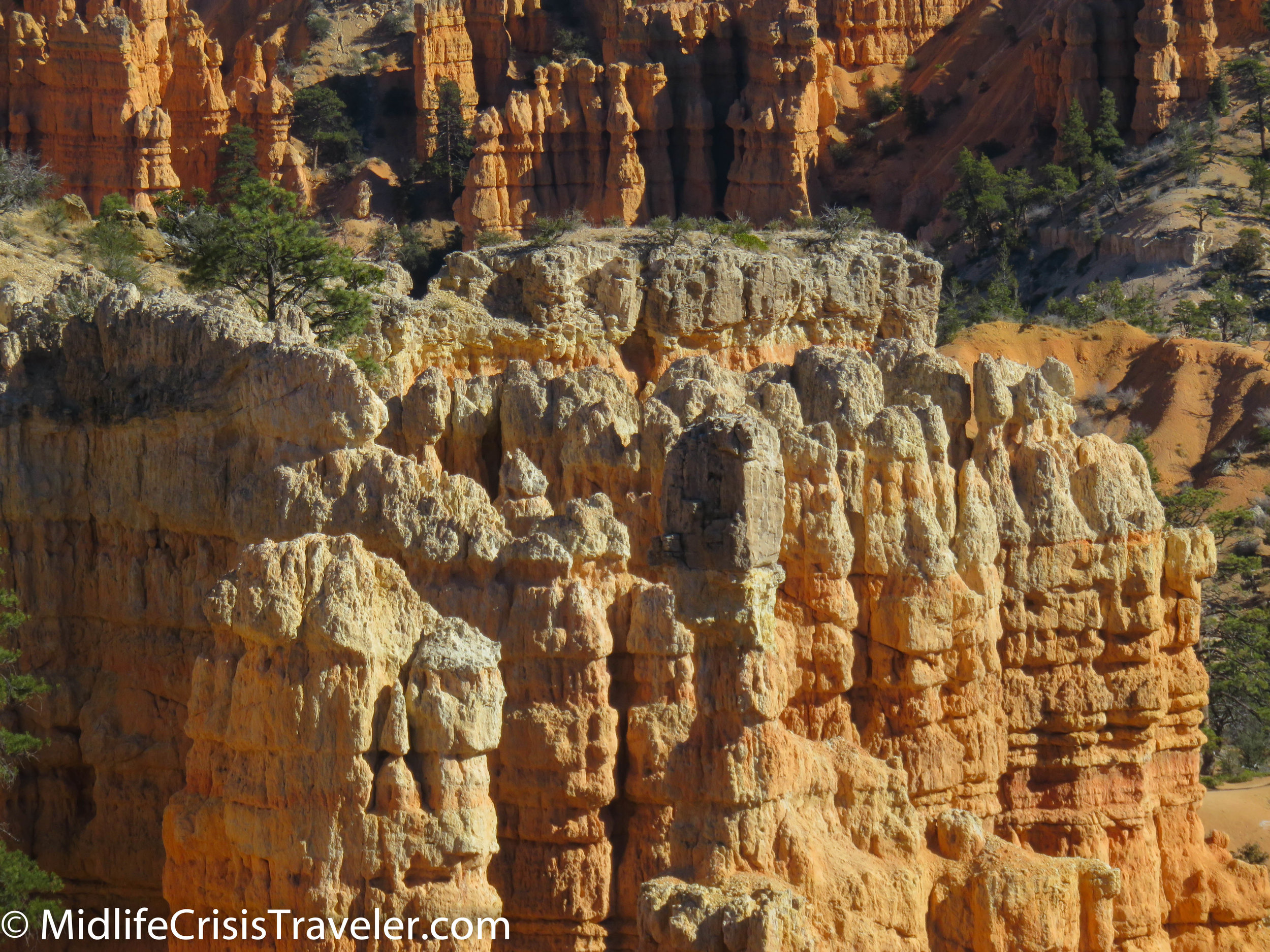
Bearing to your right, the trail will allow you to stroll next to Hoodoos via a series of switchbacks down to the bottom.  The trail is flat and well-maintained but the decline of this trail measures 550 feet so it is not necessarily easy if you aren’t used to walking at 8000-foot elevation.  It is important that you are careful when traversing the switchbacks.  Although they are a smooth surface, there are no railings or barriers to prevent you from falling over the edge. 

Bryce Canyon NP Navajo Loop-15.jpg
Bryce Canyon NP Navajo Loop-17.jpg
Bryce Canyon NP Navajo Loop-19.jpg
Bryce Canyon NP Navajo Loop-20.jpg
Bryce Canyon NP Navajo Loop-24.jpg
Bryce Canyon NP Navajo Loop-31.jpg
Bryce Canyon NP Navajo Loop-35.jpg
Bryce Canyon NP Navajo Loop-36.jpg

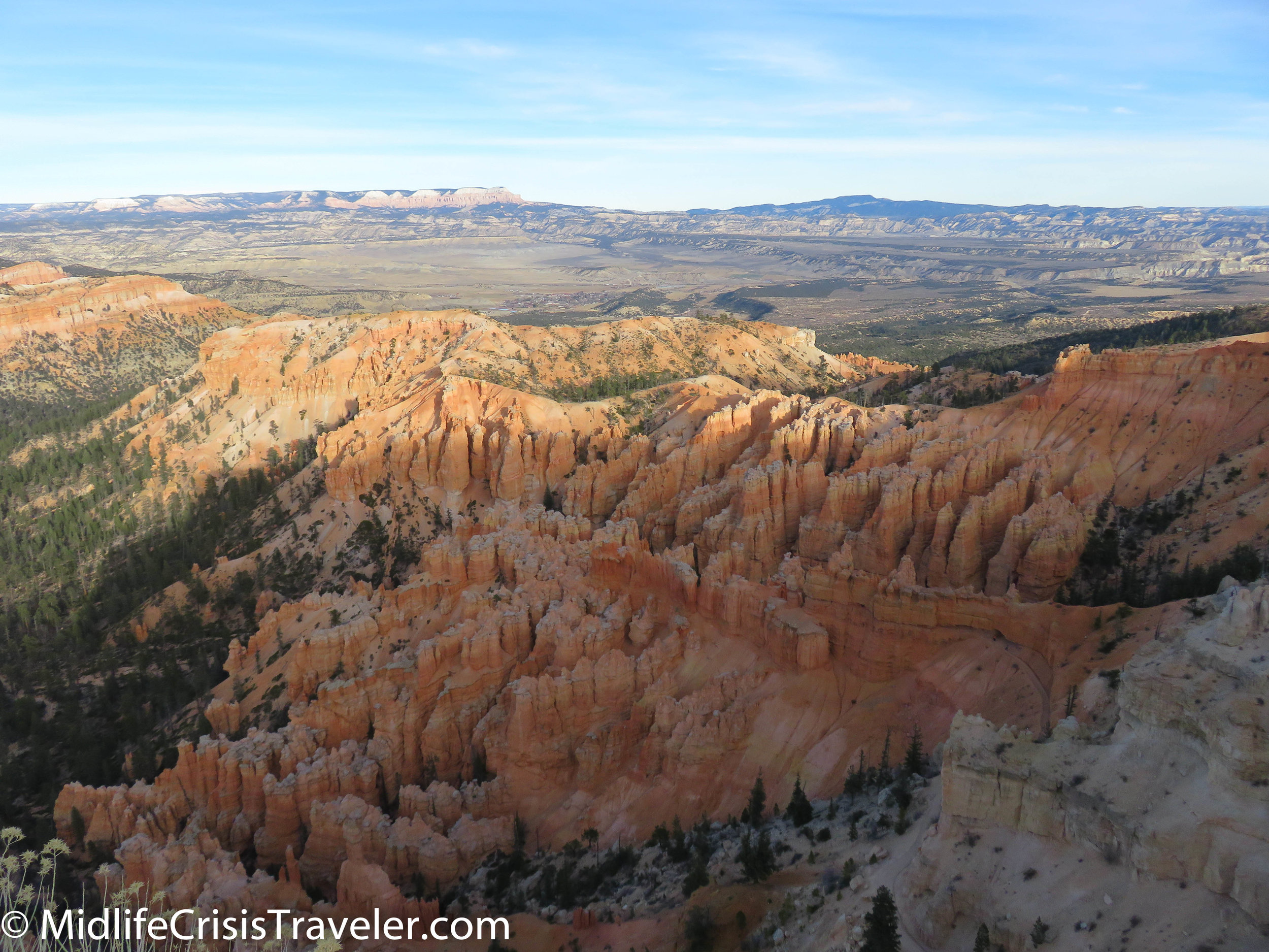
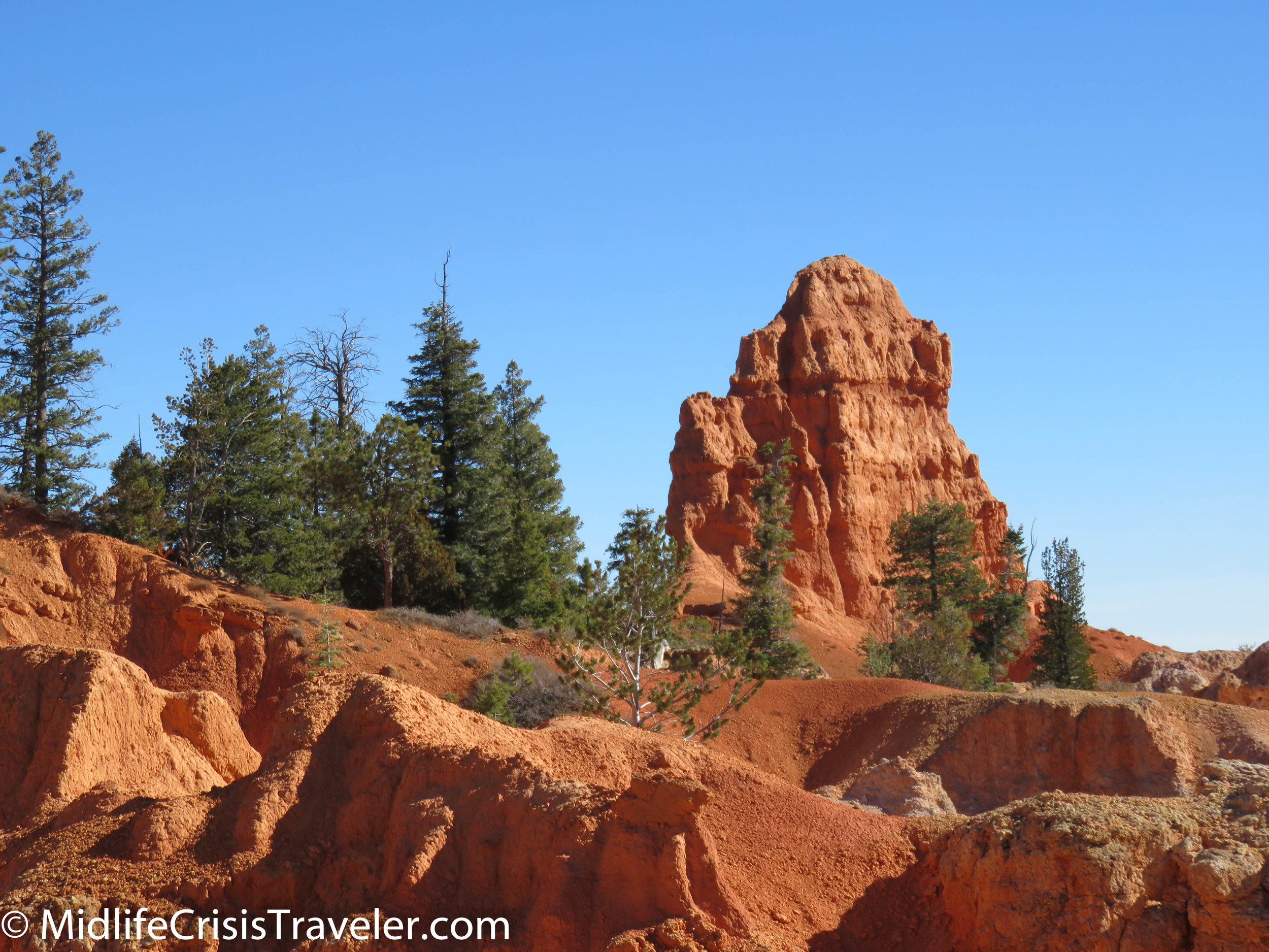
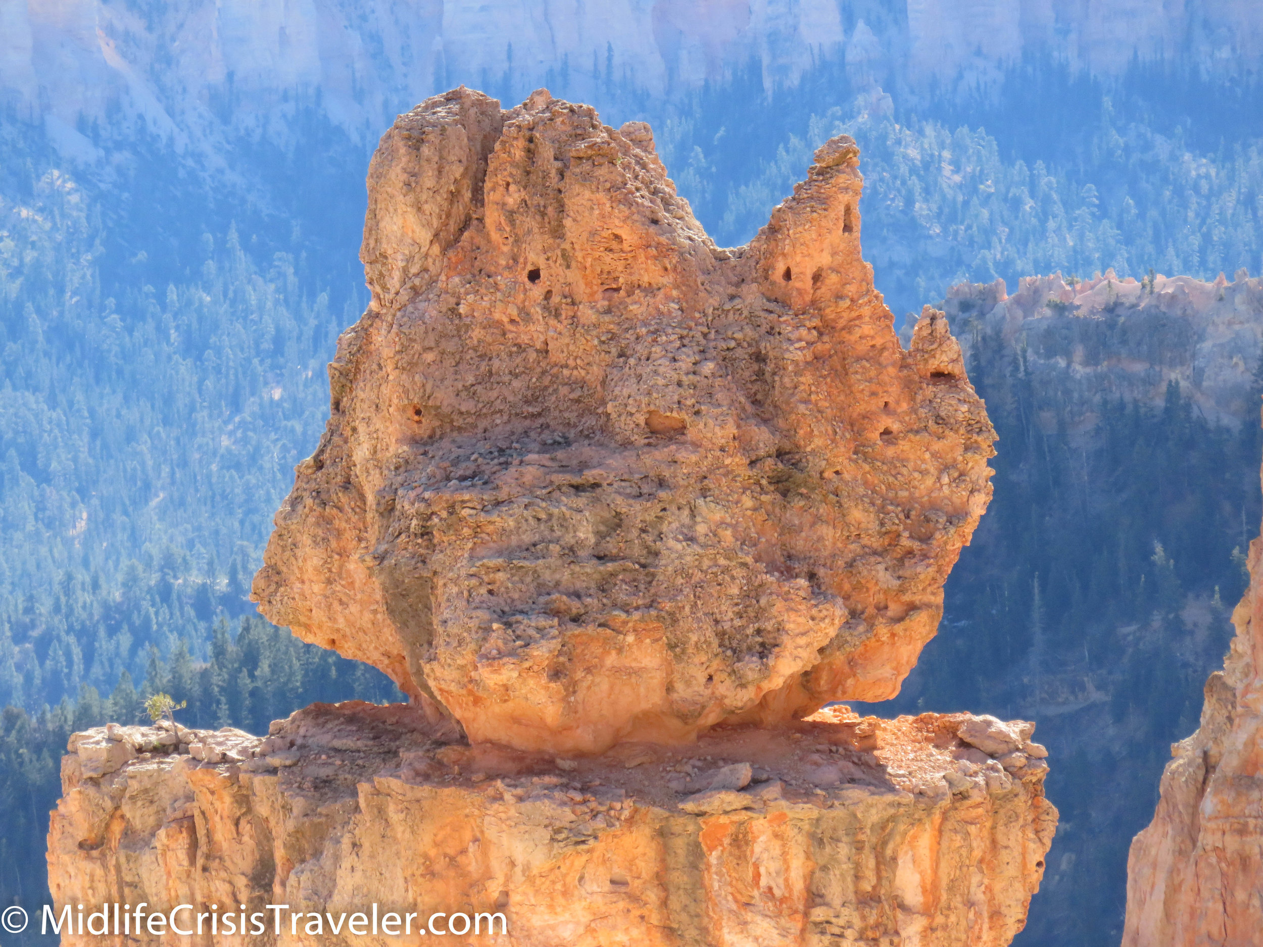
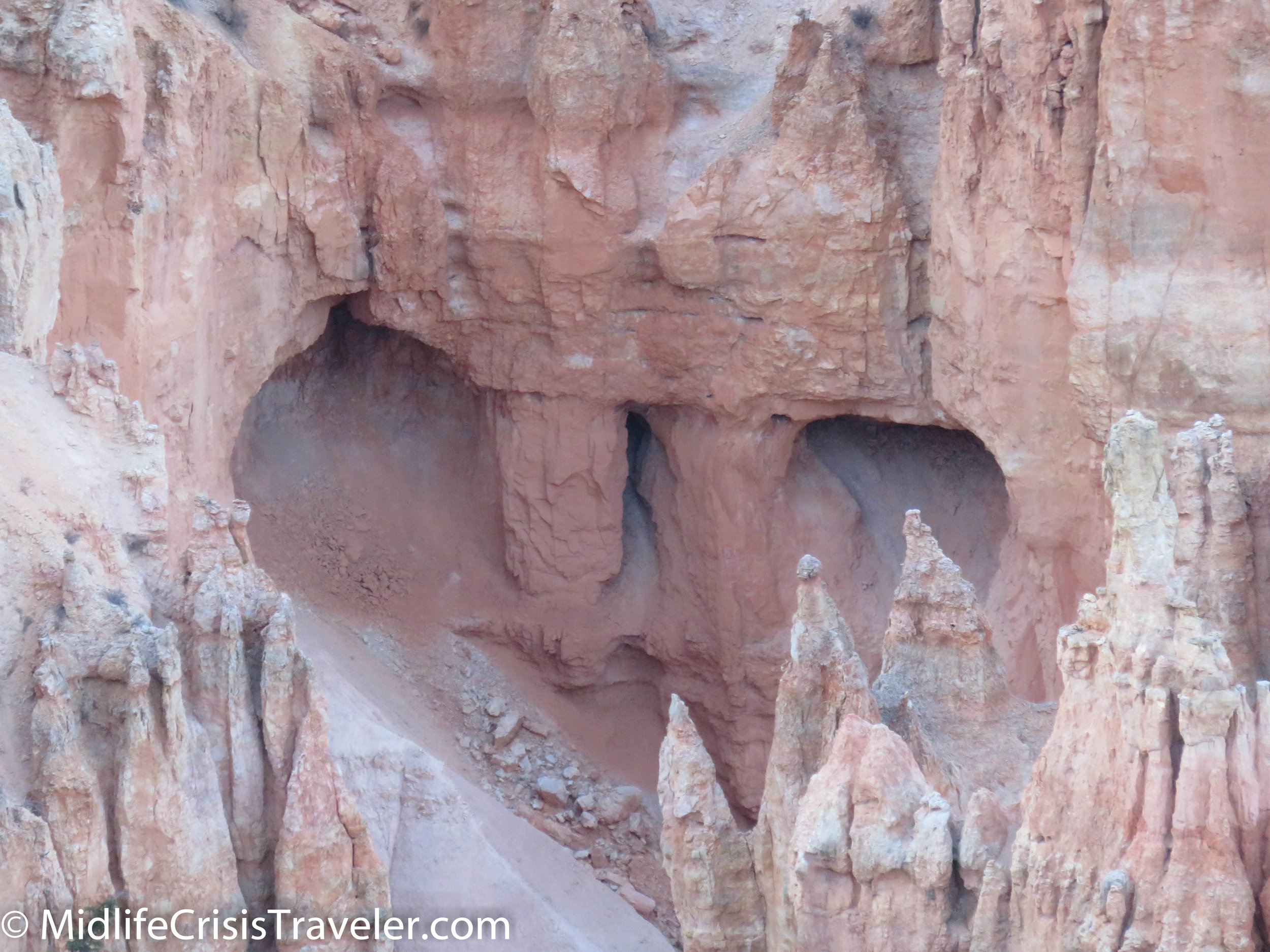
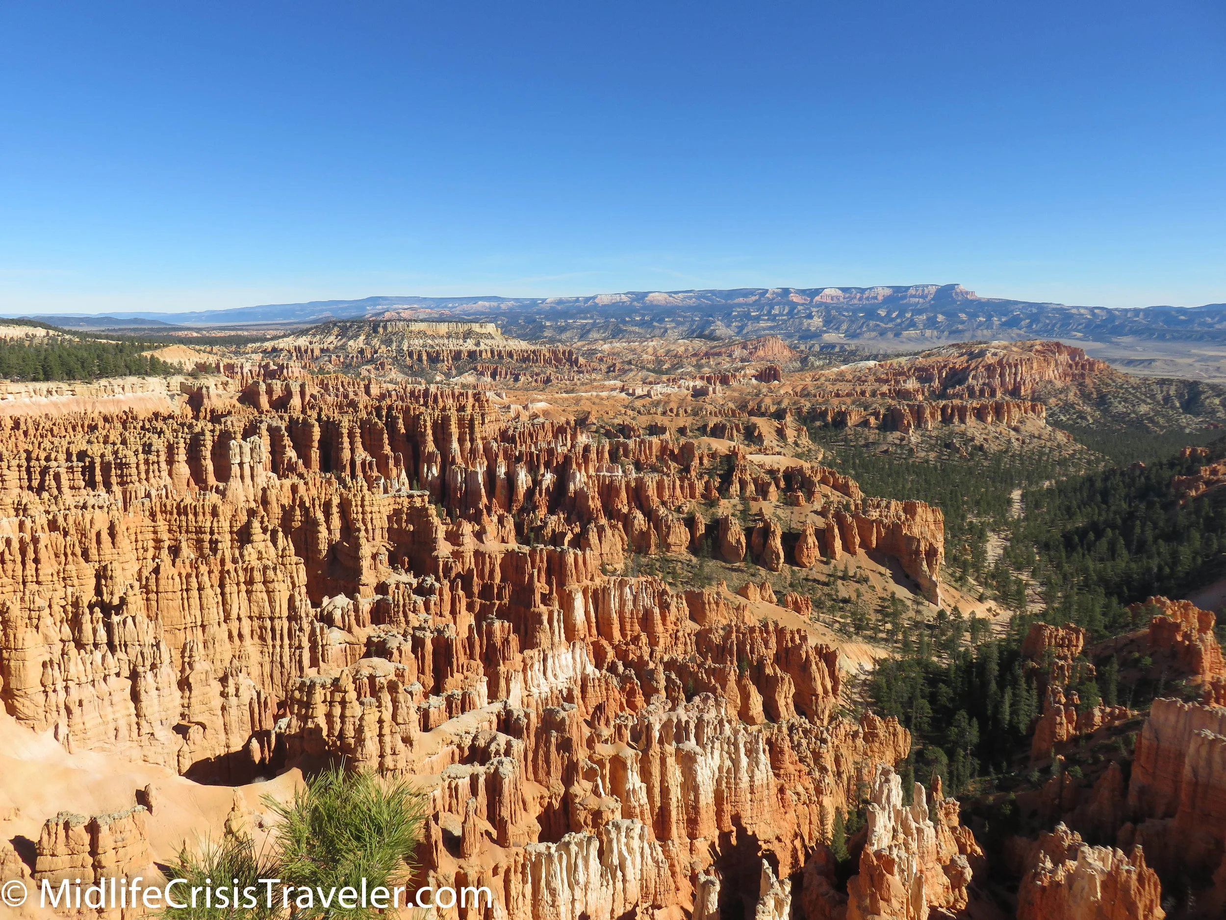
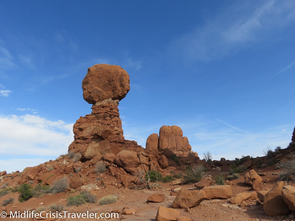
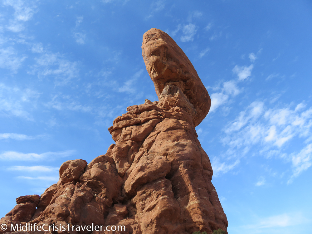
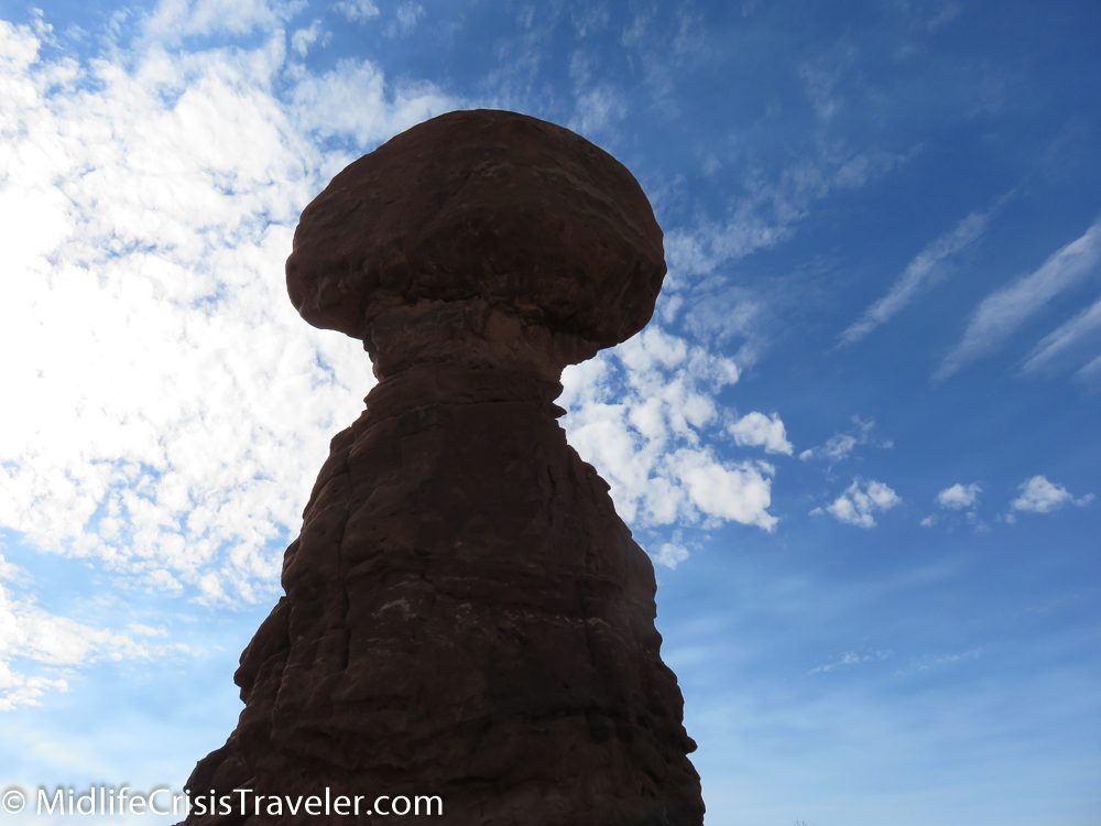
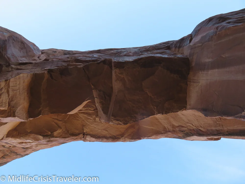
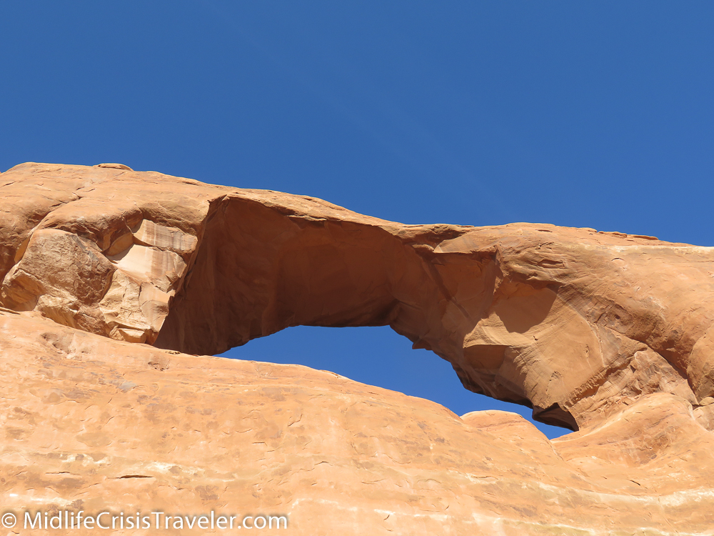
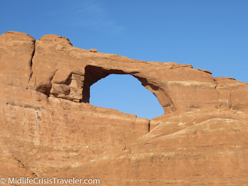
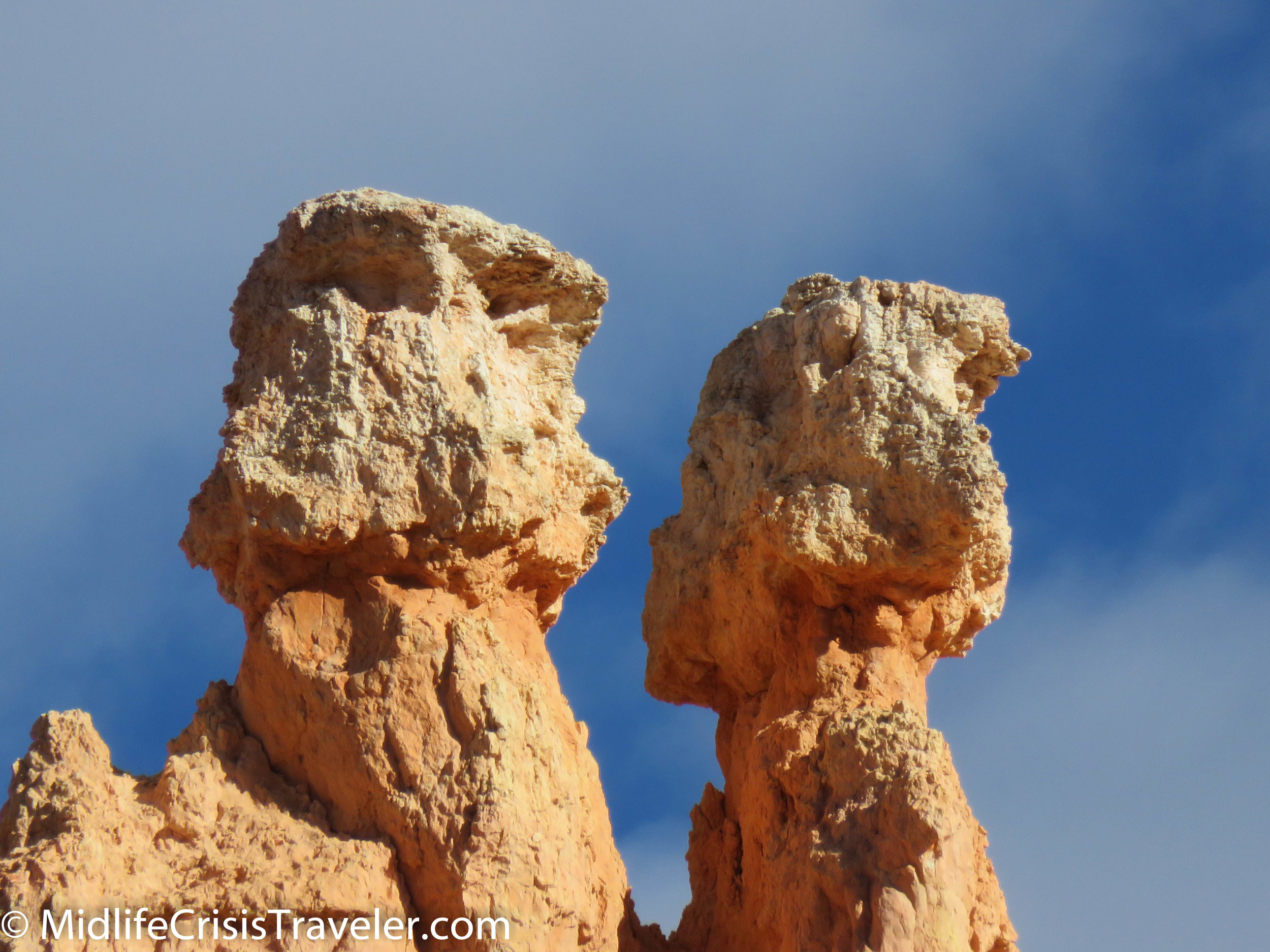
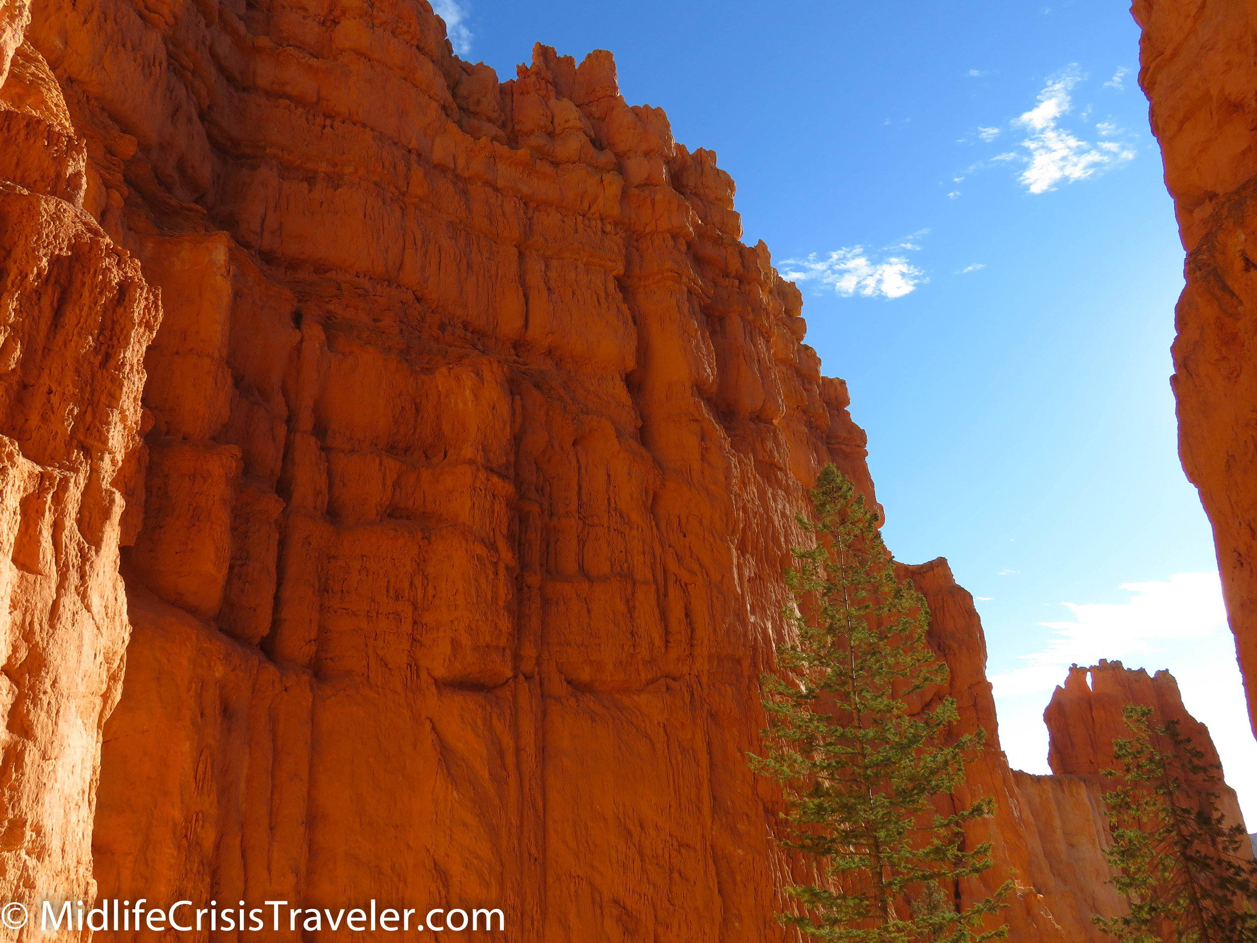
The trail is 1.3 miles and offers an upward view of the landscape. Being below these structures and seeing the orange flavor of the sandstone against the blue sky and puffy white clouds offers a completely different perspective.  They are rightly perched on pedestals for us to pay homage.  The trail features boulders perched on high, trees growing in less than perfect locations and curious rock formations that have defied erosion. 

Bryce Canyon NP Navajo Loop-37.jpg
Bryce Canyon NP Navajo Loop-38.jpg
Bryce Canyon NP Navajo Loop-40.jpg
Bryce Canyon NP Navajo Loop-42.jpg
Bryce Canyon NP Navajo Loop-43.jpg
Bryce Canyon NP Navajo Loop-45.jpg
Bryce Canyon NP Navajo Loop-49.jpg
Bryce Canyon NP Navajo Loop-51.jpg
Bryce Canyon NP Navajo Loop-53.jpg
Bryce Canyon NP Navajo Loop-54.jpg
Bryce Canyon NP Navajo Loop-59.jpg
Bryce Canyon NP Navajo Loop-60.jpg
Bryce Canyon NP Navajo Loop-61.jpg
Bryce Canyon NP Navajo Loop-64.jpg
Bryce Canyon NP Navajo Loop-65.jpg

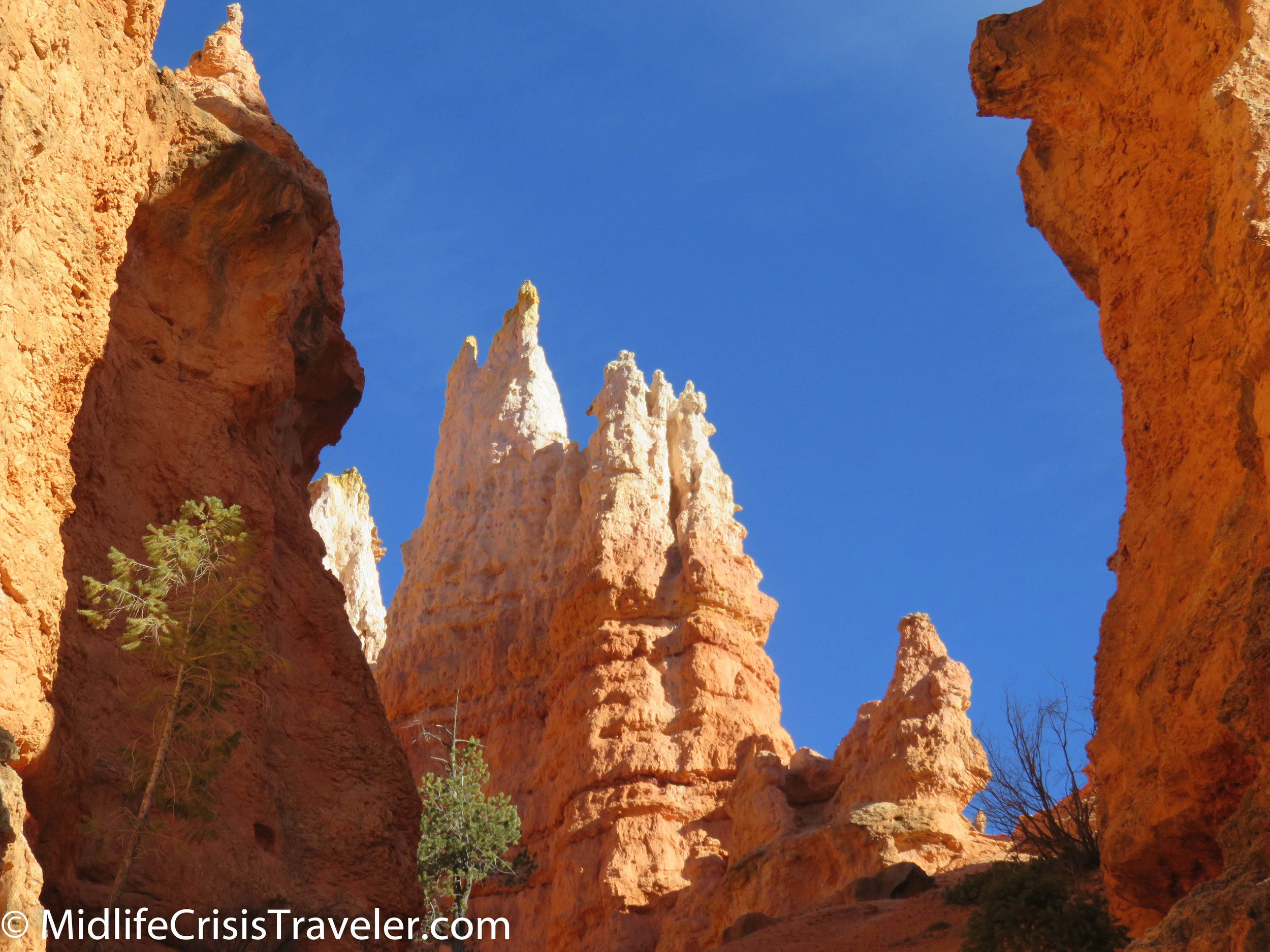
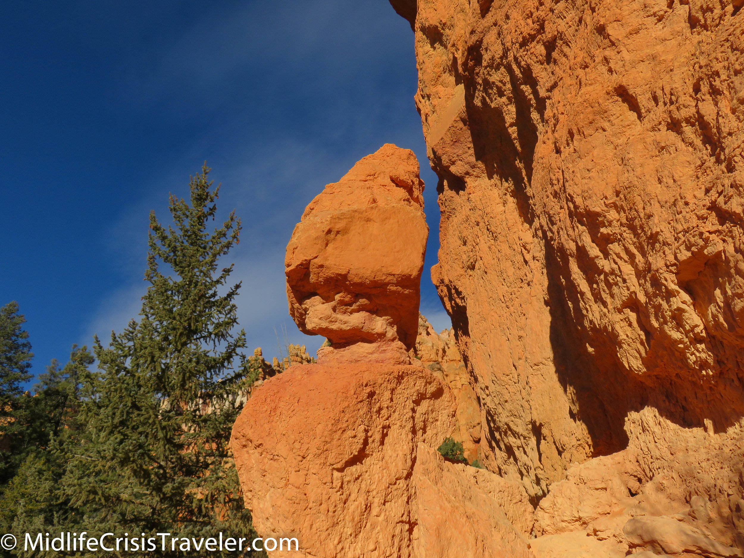
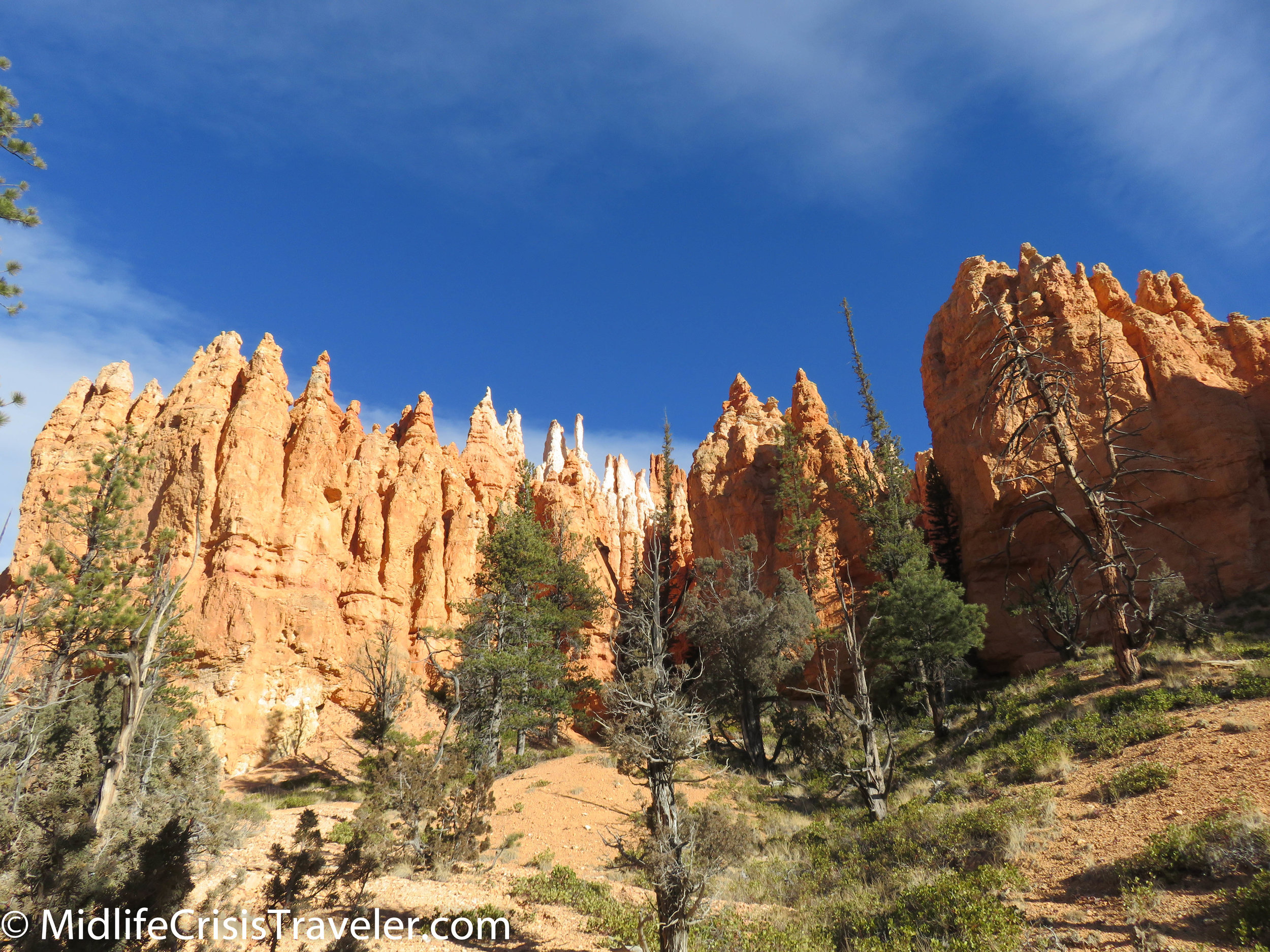
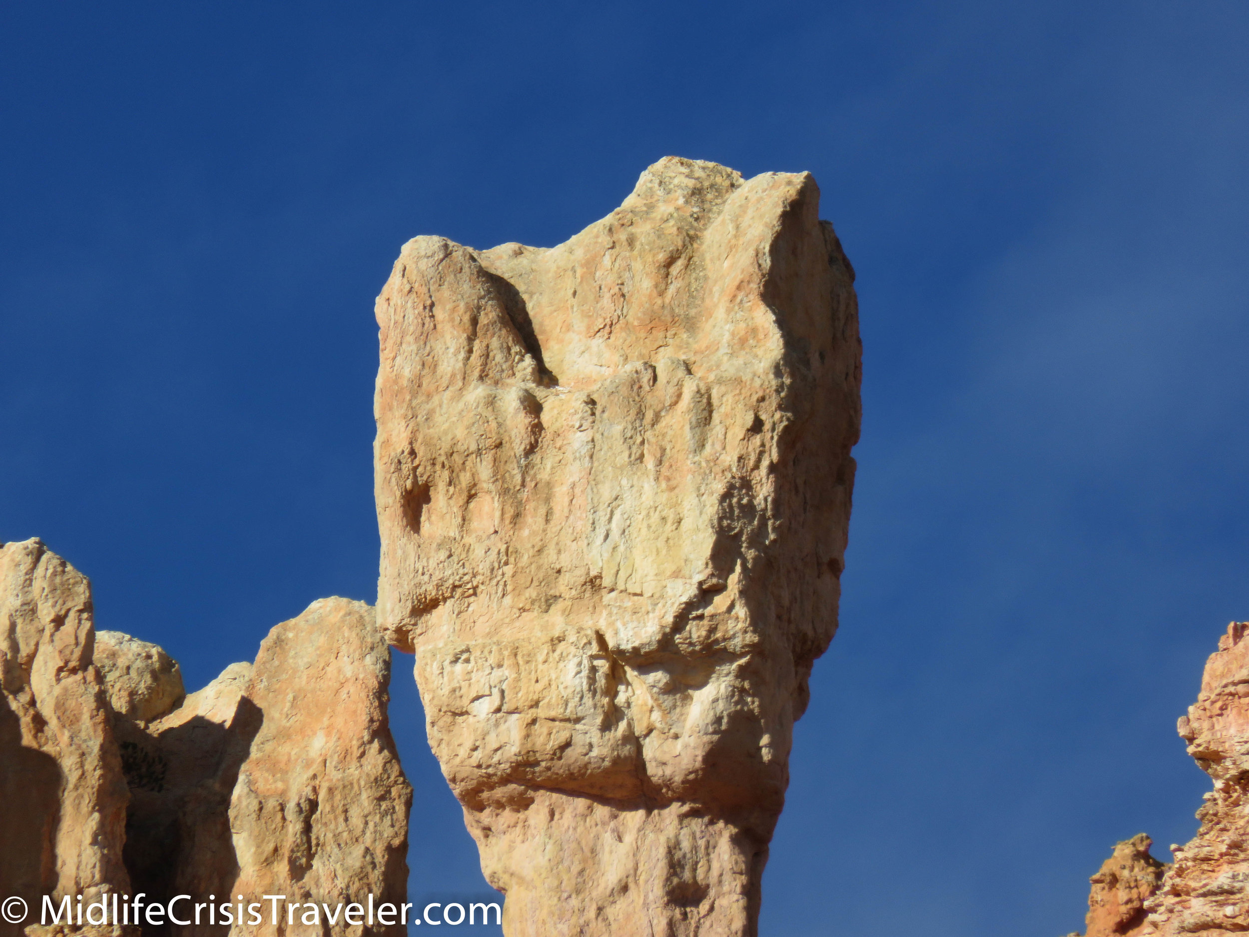
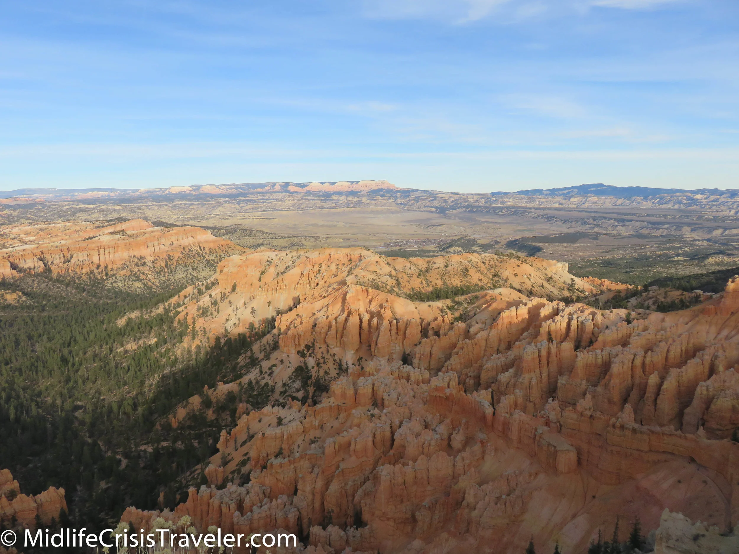
At the bottom, you are awed by the majesty and sheer will of these formations which have withstood the test of The Big 3: climate, weather and time.  They stand proudly as a reminder of the past and a stubbornness towards the future.  They are defying The Big 3 as long as possible.  Someday, they will all have crumbled and humans will have nothing but memories and pictures of their grandeur. 

Bryce Canyon NP Navajo Loop-67.jpg
Bryce Canyon NP Navajo Loop-68.jpg
Bryce Canyon NP Navajo Loop-69.jpg
Bryce Canyon NP Navajo Loop-74.jpg
Bryce Canyon NP Navajo Loop-77.jpg
Bryce Canyon NP Navajo Loop-79.jpg
Bryce Canyon NP Navajo Loop-82.jpg
Bryce Canyon NP Navajo Loop-86.jpg
Bryce Canyon NP Navajo Loop-88.jpg
Bryce Canyon NP Navajo Loop-91.jpg
Bryce Canyon NP Navajo Loop-93.jpg

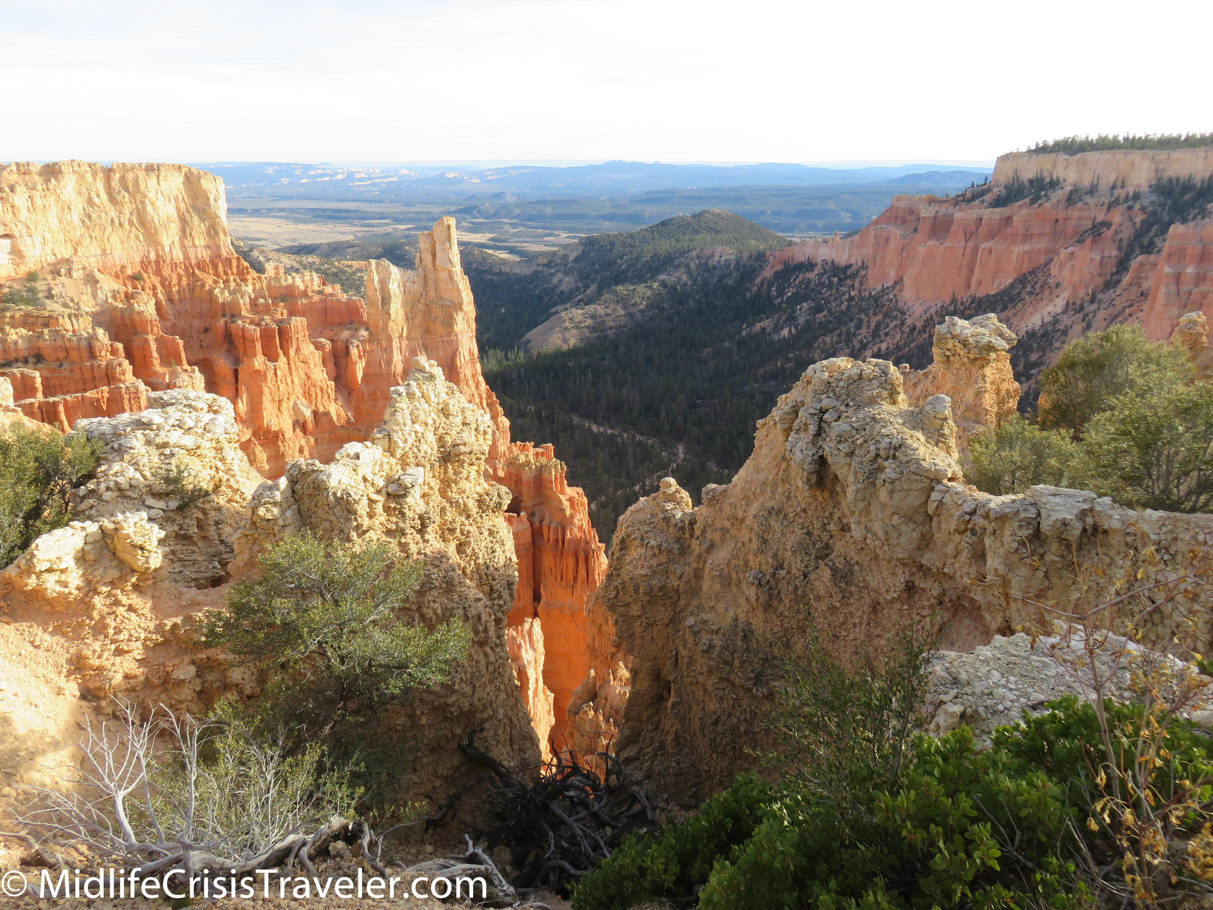
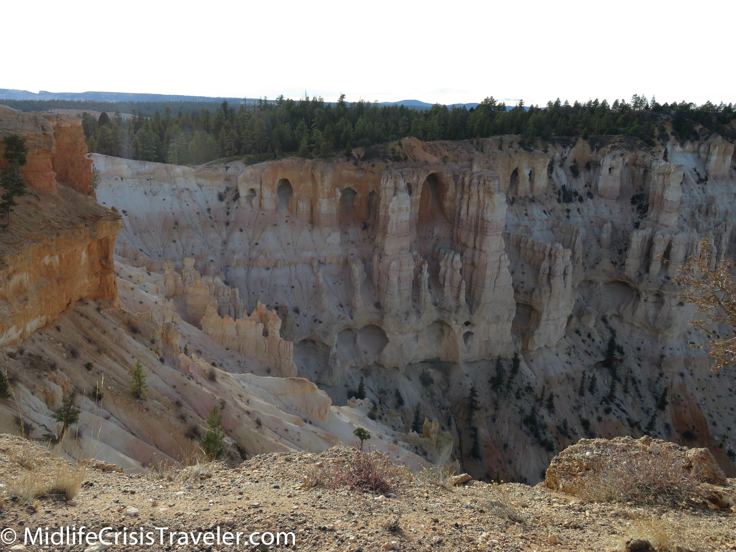
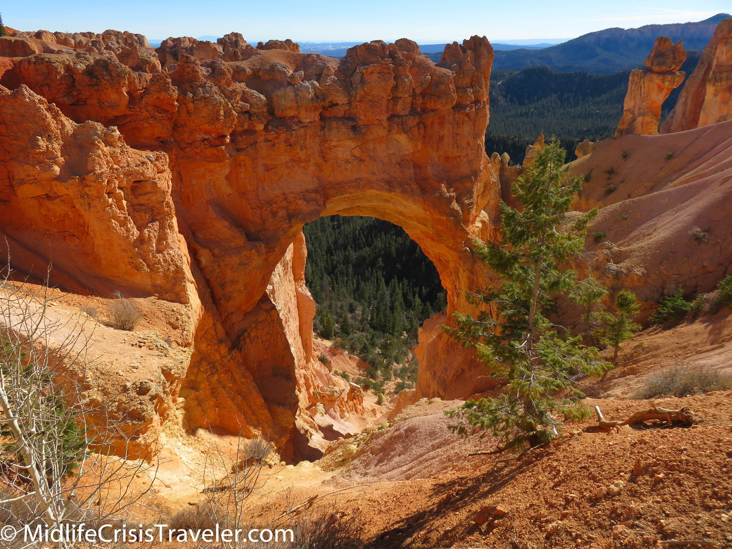
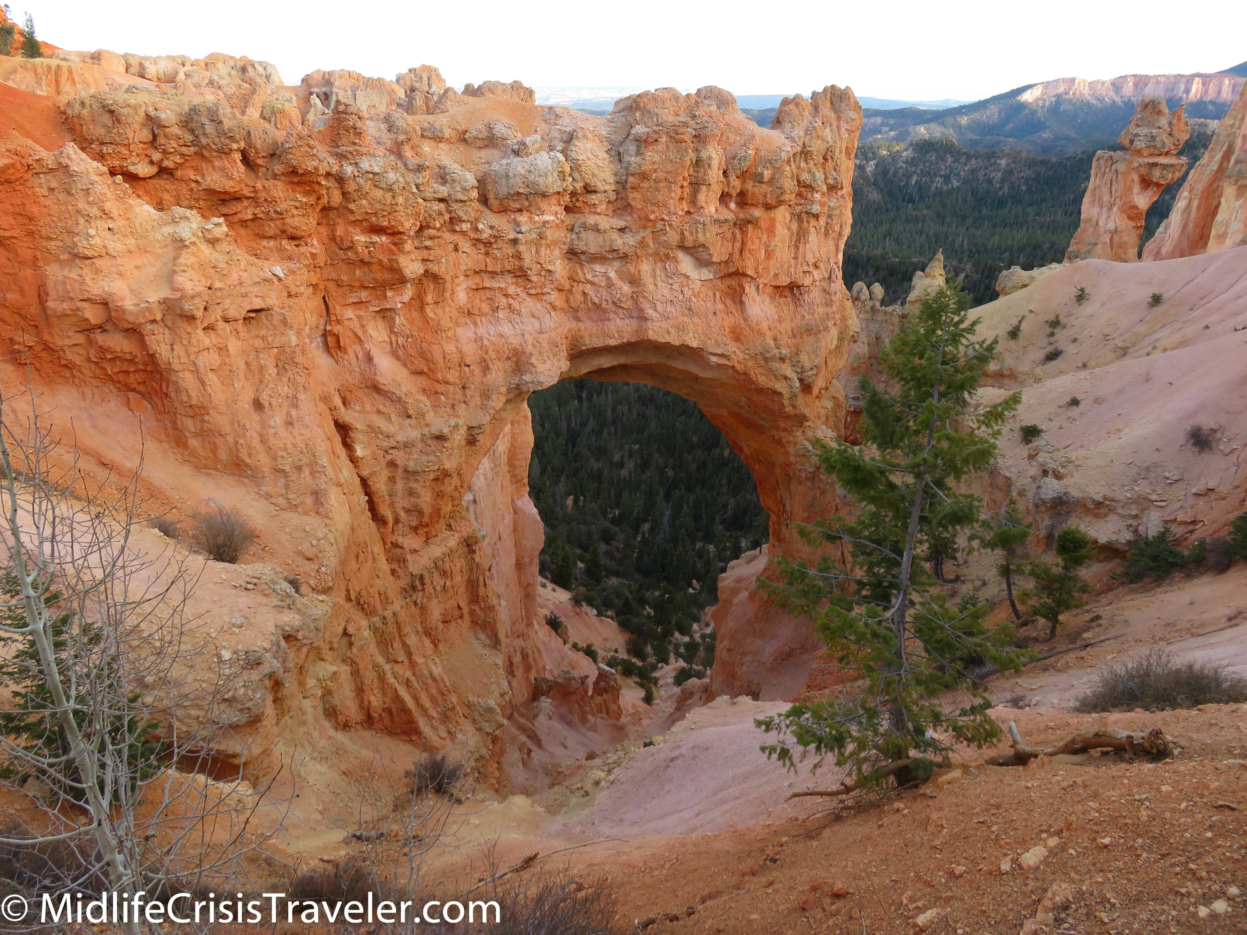
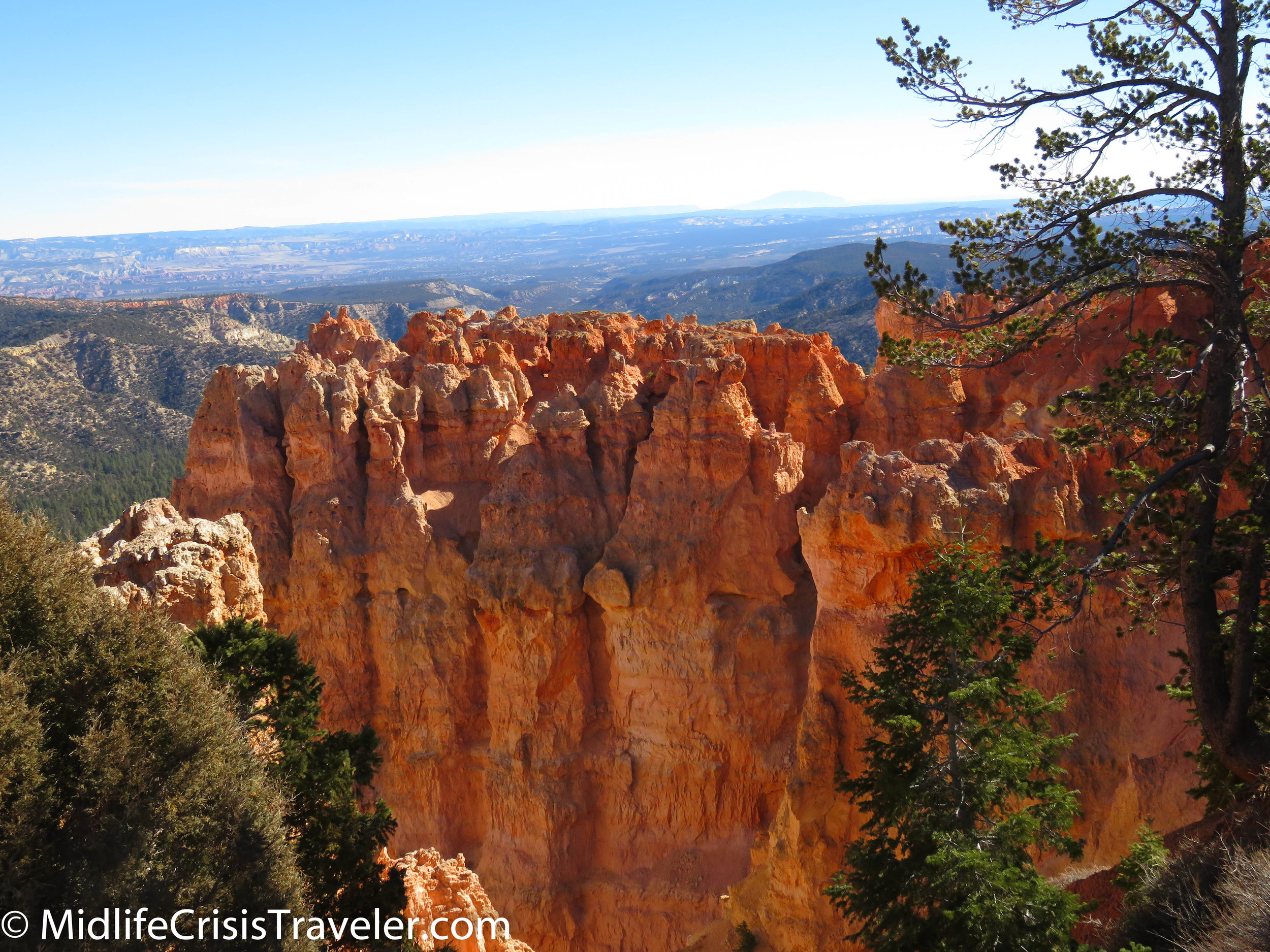
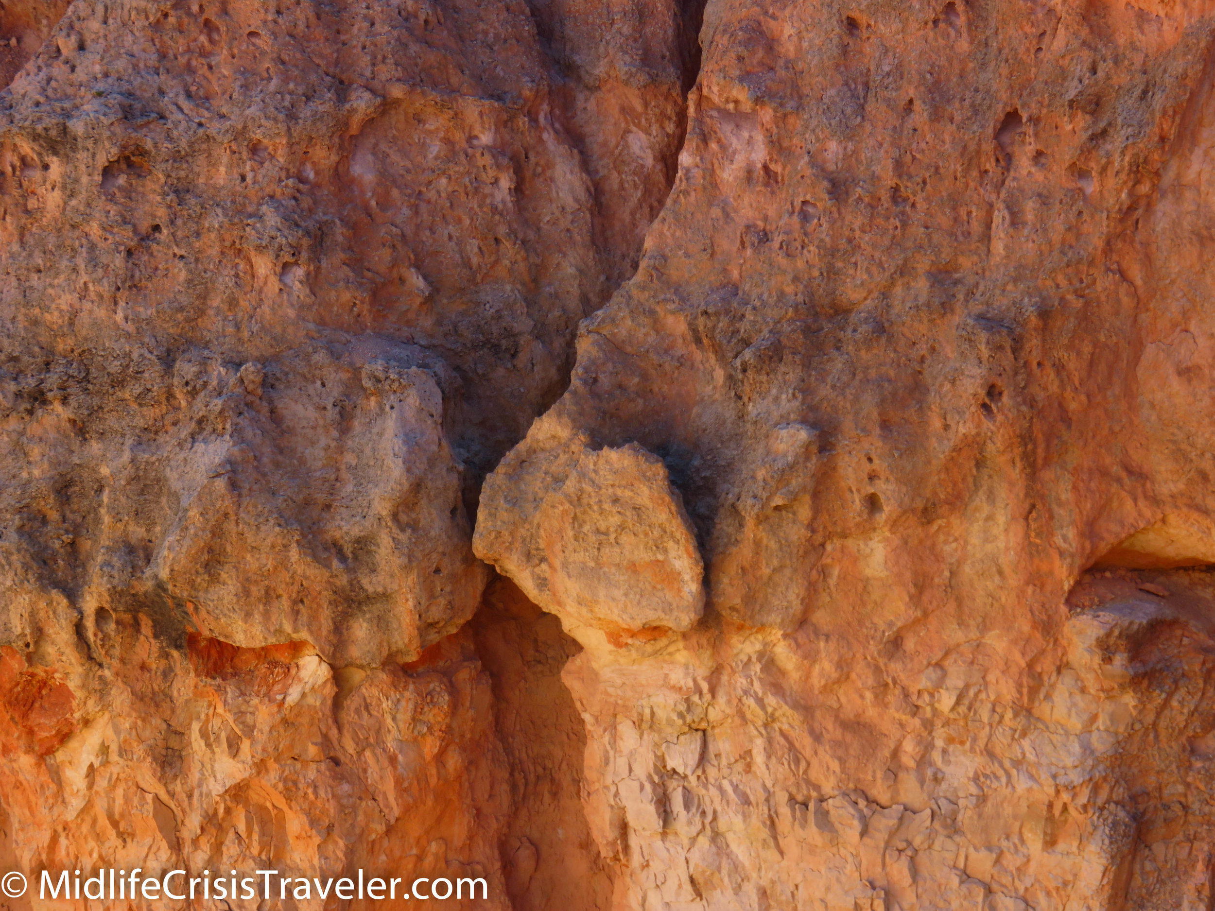
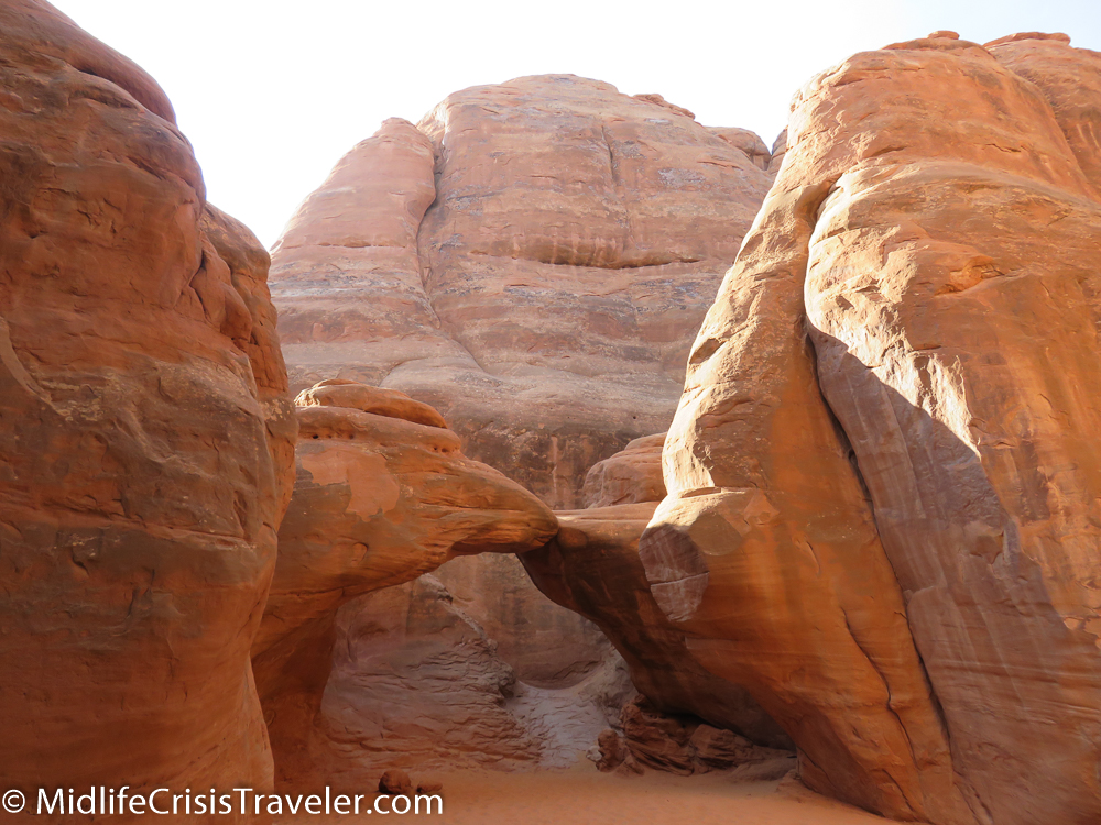
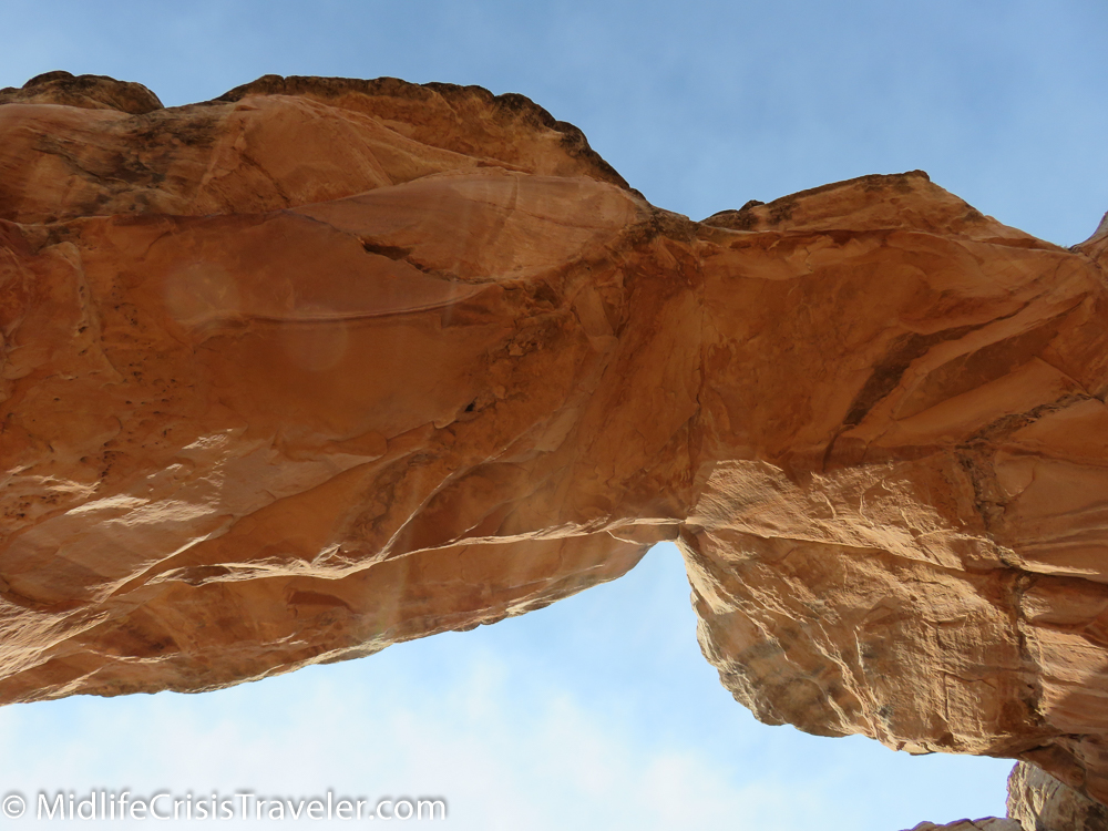
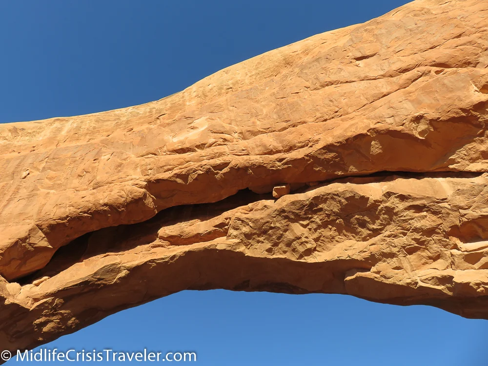
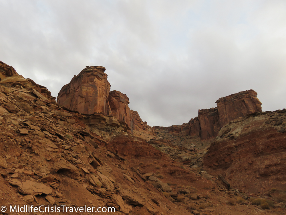
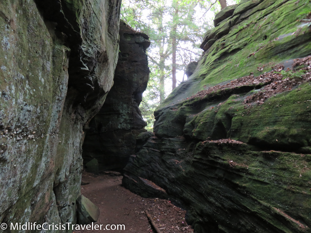
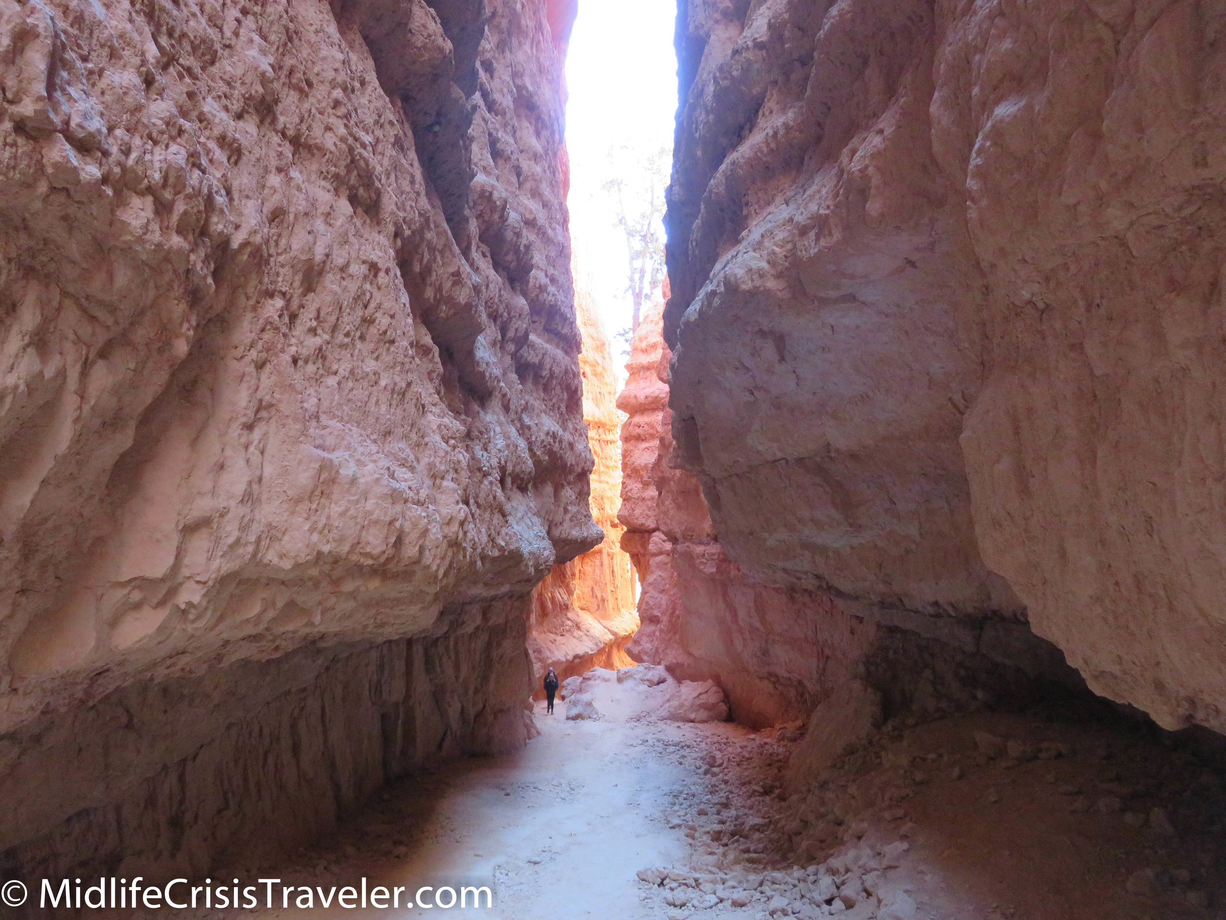
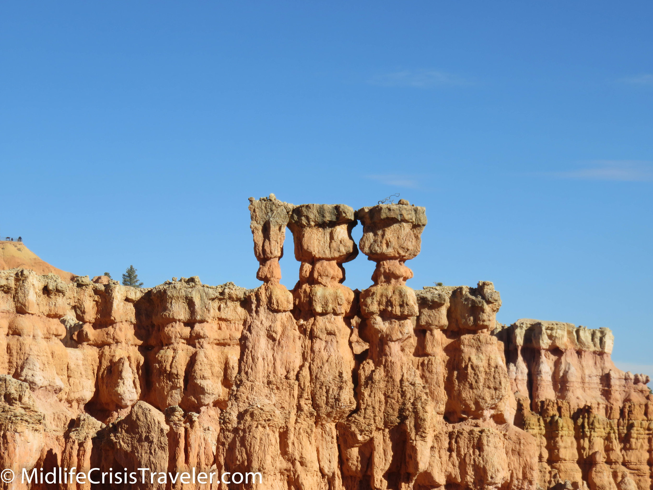
The picture above has two stone structures that look like bridges, hence the name Two Bridges.  Can you see both of them linking the two walls of the trail?

Bryce Canyon NP Navajo Loop-94.jpg
Bryce Canyon NP Navajo Loop-99.jpg
Bryce Canyon NP Navajo Loop-101.jpg
Bryce Canyon NP Navajo Loop-106.jpg
Bryce Canyon NP Navajo Loop-109.jpg
Bryce Canyon NP Navajo Loop-111.jpg
Bryce Canyon NP Navajo Loop-112.jpg
Bryce Canyon NP Navajo Loop-115.jpg
Bryce Canyon NP Navajo Loop-118.jpg

When you visit Bryce Canyon, I encourage you to walk this trail.  Take your time and enjoy the unique views and characteristics of this park.  Be safe and feel the impressiveness of the history of this land.  Imagine if you were the first person to see it this way.  How would you feel?  What thoughts would you have?  

Bryce Canyon NP Navajo Loop-119.jpg
Bryce Canyon NP Navajo Loop-120.jpg
Bryce Canyon NP Navajo Loop-123.jpg
Bryce Canyon NP Navajo Loop-124.jpg
Bryce Canyon NP Navajo Loop-125.jpg
Bryce Canyon NP Navajo Loop-126.jpg
Bryce Canyon NP Navajo Loop-128.jpg
Bryce Canyon NP Navajo Loop-130.jpg
Bryce Canyon NP Navajo Loop-132.jpg
Bryce Canyon NP Navajo Loop-135.jpg
Bryce Canyon NP Navajo Loop-137.jpg

Have you visited Bryce Canyon National Park?  What was your experience like?  Please share your thoughts with us.

For more information about Bryce Canyon NP, click the link below.

Bryce Canyon National Park (U.S. National Park Service) (nps.gov)

Bryce Canyon National Park: Woohoo for Hoodoos

Mossy Cave

Before we get deep into the heart of Bryce Canyon National Park, there is a small area down the road from Bryce Canyon proper called Mossy Cave.  If you drive about 3 miles east from the intersection of Routes 12 and 63, you will happen upon a small parking lot on the right.  Don’t skip past this quaint corner of Bryce Canyon.  This slice of the canyon is an easy way to get up close and personal with the Hoodoos that capture everyone’s fascination.  Hoodoos, pine trees and a small waterfall await your arrival.  This is an appetizer of what is to come. 

Bryce Canyon NP-1.jpg
Bryce Canyon NP-4.jpg
Bryce Canyon NP-2.jpg
Bryce Canyon NP-3.jpg
Bryce Canyon NP-5.jpg
Bryce Canyon NP-6.jpg
Bryce Canyon NP-7.jpg
Bryce Canyon NP-8.jpg
Bryce Canyon NP-9.jpg
Bryce Canyon NP-10.jpg

The next two pictures are of the surrounding area.

Bryce Canyon NP-11.jpg
Bryce Canyon NP-12.jpg

What is a Hoodoo?

Here is part of the description from the National Parks website:

https://www.nps.gov/brca/learn/nature/hoodoos.htm

General Description:

Hoodoos are tall skinny spires of rock that protrude from the bottom of arid basins and "broken" lands.  At Bryce Canyon, hoodoos range in size from that of an average human to heights exceeding a 10-story building. Formed in sedimentary rock, hoodoo shapes are affected by the erosional patterns of alternating hard and softer rock layers. The name given to the rock layer that forms hoodoos at Bryce Canyon is the Claron Formation. This layer has several rock types including siltstones and mudstones but is predominantly limestone. Thirty to 40 million years ago this rock was "born" in an ancient lake that covered much of Western Utah. Minerals deposited within different rock types cause hoodoos to have different colors throughout their height.

Bryce Canyon NP-14.jpg
Bryce Canyon NP-13.jpg
Bryce Canyon NP-16.jpg
Bryce Canyon NP-17.jpg
Bryce Canyon NP-18.jpg
Bryce Canyon NP-19.jpg
Bryce Canyon NP-20.jpg
Bryce Canyon NP-21.jpg
Bryce Canyon NP-22.jpg
Bryce Canyon NP-23.jpg
Bryce Canyon NP-24.jpg
Bryce Canyon NP-25.jpg
Bryce Canyon NP-26.jpg
Bryce Canyon NP-27.jpg
Bryce Canyon NP-28.jpg
Bryce Canyon NP-30.jpg
Bryce Canyon NP-31.jpg
Bryce Canyon NP-32.jpg
Bryce Canyon NP-33.jpg
Bryce Canyon NP-34.jpg
Bryce Canyon NP-35.jpg
Bryce Canyon NP-36.jpg
Bryce Canyon NP-37.jpg
Bryce Canyon NP-38.jpg
Bryce Canyon NP-39.jpg
Bryce Canyon NP-40.jpg
Bryce Canyon NP-41.jpg
Bryce Canyon NP-42.jpg
Bryce Canyon NP-43.jpg
Bryce Canyon NP-44.jpg
Bryce Canyon NP-45.jpg
Bryce Canyon NP-46.jpg
Bryce Canyon NP-105.jpg
Bryce Canyon NP-99.jpg
Bryce Canyon NP-107.jpg
Bryce Canyon NP-108.jpg
Bryce Canyon NP-50.jpg
Bryce Canyon NP-100.jpg
Bryce Canyon NP-101.jpg
Bryce Canyon NP-102.jpg

Formational Process:

Hoodoos are formed by two weathering processes that continuously work together in eroding the edges of the Paunsaugunt Plateau. The primary weathering force at Bryce Canyon is frost wedging. Here we experience over 200 freeze/thaw cycles each year. In the winter, melting snow, in the form of water, seeps into the cracks and freezes at night. When water freezes it expands by almost 10%, bit by bit prying open cracks, making them ever wider in the same way a pothole forms in a paved road.

Rain is also the chief source of erosion (the actual removal of the debris). In the summer, monsoon type rainstorms travel through the Bryce Canyon region bringing short duration high intensity rain.

Bryce Canyon NP-51.jpg
Bryce Canyon NP-55.jpg
Bryce Canyon NP-56.jpg
Bryce Canyon NP-57.jpg
Bryce Canyon NP-58.jpg
Bryce Canyon NP-59.jpg
Bryce Canyon NP-60.jpg
Bryce Canyon NP-61.jpg
Bryce Canyon NP-62.jpg
Bryce Canyon NP-63.jpg
Bryce Canyon NP-64.jpg
Bryce Canyon NP-65.jpg
Bryce Canyon NP-66.jpg
Bryce Canyon NP-67.jpg
Bryce Canyon NP-68.jpg
Bryce Canyon NP-83.jpg
Bryce Canyon NP-84.jpg
Bryce Canyon NP-85.jpg
Bryce Canyon NP-86.jpg
Bryce Canyon NP-87.jpg
Bryce Canyon NP-88.jpg
Bryce Canyon NP-89.jpg
Bryce Canyon NP-90.jpg
Bryce Canyon NP-91.jpg
Bryce Canyon NP-92.jpg
Bryce Canyon NP-94.jpg
Bryce Canyon NP-95.jpg
Bryce Canyon NP-96.jpg
Bryce Canyon NP-97.jpg
Bryce Canyon NP-98.jpg
Bryce Canyon NP-109.jpg
Bryce Canyon NP-110.jpg

Preservation Message:

Unfortunately, hoodoos don't last very long. The same processes that create hoodoos are equally aggressive and intent on their destruction. The average rate of erosion is calculated at 2-4 feet (.6-1.3 m) every 100 years. So, it is that Bryce Canyon, as we know it, will not always be here. As the canyon continues to erode to the west it will eventually capture (perhaps 3 million years from now) the watershed of the East Fork of the Sevier River. Once this river flows through the Bryce Amphitheater it will dominate the erosional pattern, replacing hoodoos with a "V" shaped canyon and steep cliff walls typical of the weathering and erosional patterns created by flowing water. Indeed, a foreshadowing of this fate can be observed in Water Canyon while hiking the Mossy Cave Trail. For over 100 years a diversion canal has been taking a portion of the East Fork of the Sevier River through this section of the park and already it's easy to see the changes the flowing water has created.

Hoodoo colors are more vibrant after a rainstorm. Viewing hoodoos in the winter is especially rewarding. Not only does melting snow enrich the colors but the blanket of white adds another dimension to the beauty under the crisp blue sky.

Bryce Canyon NP-112.jpg
Bryce Canyon NP-113.jpg

The elevation of Bryce Canyon ranges from around 7,000 to 9,000 feet. Taking a hike into the canyons can mean a drop of several hundred feet.  Well constructed paths make the hikes relatively easy but you must take your time if you are not used to walking or hiking at high elevations.  

Bryce Canyon NP-142.jpg
Bryce Canyon NP-111.jpg
Bryce Canyon NP-114.jpg
Bryce Canyon NP-122.jpg
Bryce Canyon NP-54.jpg
Bryce Canyon NP-116.jpg
Bryce Canyon NP-117.jpg
Bryce Canyon NP-115.jpg
Bryce Canyon NP-118.jpg
Bryce Canyon NP-119.jpg
Bryce Canyon NP-120.jpg
Bryce Canyon NP-121.jpg
Bryce Canyon NP-123.jpg
Bryce Canyon NP-124.jpg
Bryce Canyon NP-125.jpg
Bryce Canyon NP-126.jpg
Bryce Canyon NP-127.jpg
Bryce Canyon NP-128.jpg
Bryce Canyon NP-129.jpg
Bryce Canyon NP-130.jpg
Bryce Canyon NP-131.jpg
Bryce Canyon NP-132.jpg
Bryce Canyon NP-133.jpg
Bryce Canyon NP-134.jpg
Bryce Canyon NP-135.jpg
Bryce Canyon NP-136.jpg
Bryce Canyon NP-137.jpg
Bryce Canyon NP-138.jpg
Bryce Canyon NP-140.jpg
Bryce Canyon NP-141.jpg

I highly recommend Ruby's Inn for lodging and food.  During summer and fall months, they offer a buffet that will fill your belly for hours and give you plenty of fuel for those hikes through the Hoodoos.  Performances run Wednesday through Saturday at 7pm from late May through mid-August.  

Bryce Canyon NP-145.jpg
Bryce Canyon NP-143.jpg
Bryce Canyon NP-184.jpg

I visited Bryce Canyon multiple times in the fall and winter.  There wasn't enough snow to make a huge difference in the view but I have seen other pictures which make the park seem magical in winter.

Bryce Canyon NP-189.jpg
Bryce Canyon NP-190.jpg
Bryce Canyon NP-192.jpg
Bryce Canyon NP-195.jpg
Bryce Canyon NP-202.jpg
Bryce Canyon NP-369.jpg
Bryce Canyon NP-376.jpg
Bryce Canyon NP-380.jpg
Bryce Canyon NP-382.jpg
Bryce Canyon NP-240.jpg
Bryce Canyon NP-216.jpg
Bryce Canyon NP-219.jpg
Bryce Canyon NP-220.jpg
Bryce Canyon NP-205.jpg
Bryce Canyon NP-208.jpg
Bryce Canyon NP-211.jpg
Bryce Canyon NP-222.jpg
Bryce Canyon NP-213.jpg
Bryce Canyon NP-224.jpg
Bryce Canyon NP-230.jpg
Bryce Canyon NP-228.jpg
Bryce Canyon NP-234.jpg
Bryce Canyon NP-237.jpg
Bryce Canyon NP-238.jpg
Bryce Canyon NP-239.jpg

Have you been to Bryce Canyon NP?  What was your experience like?  What advice would you give to people who are planning to visit the park?  For more information about Bryce Canyon National Park, click the link below.

https://www.nps.gov/brca/index.htm

Big Bend National Park: Boquillas Canyon and Santa Elena Canyon

Boquillas Canyon and Santa Elena Canyon are almost at opposite ends of Big Bend National Park.  Boquillas is a dead end on the eastern arm of the park whereas Santa Elena is a dead end near the western tip of Big Bend.  Both are very remote areas that share the Rio Grande River as their southern border.  The surrounding landscape is equally as beautiful. 

There are a dozen tributaries that feed the old Rio Grande.  Generations have navigated its flow and used its water to farm the land.  You can see the lush vegetation that thrives in the river basin.  It is a shallow river that is lazy at times and swift at others. 

Boquillas Canyon-2.jpg
Boquillas Canyon-3.jpg
Boquillas Canyon-4.jpg
Boquillas Canyon-5.jpg
Boquillas Canyon-6.jpg
Boquillas Canyon-7.jpg

Boquillas Canyon’s jagged walls have been carved by the water.  You can either walk about 1.4 miles roundtrip on the trail along the river or take a 2-4 day rafting trip that will float you 33 miles down the canyon.  Whichever adventure you choose, be sure to wear sunglasses as the steep limestone walls of the canyon reflect the bright sunlight like a mirror. 

Boquillas Canyon-8.jpg
Boquillas Canyon-9.jpg
Boquillas Canyon-10.jpg
Boquillas Canyon-12.jpg
Boquillas Canyon-11.jpg
Boquillas Canyon-13.jpg
Boquillas Canyon-16.jpg
Boquillas Canyon-14.jpg
Boquillas Canyon-18.jpg
Boquillas Canyon-17.jpg

Rock formations on the road through Castolon have been shaped by volcanic eruptions occurring over millions of years.  The volcanic remnants protrude through grass, cactus and desert shrubbery.  The land is calm now, awaiting the next volcanic episode. 

Santa Elena Castolon-27.jpg
Santa Elena Castolon-25.jpg
Santa Elena Castolon-24.jpg
Santa Elena Castolon-23.jpg
Santa Elena Castolon-22.jpg
Santa Elena Castolon-21.jpg
Santa Elena Castolon-20.jpg
Santa Elena Castolon-19.jpg
Santa Elena Castolon-18.jpg
Santa Elena Castolon-14.jpg
Santa Elena Castolon-15.jpg
Santa Elena Castolon-13.jpg
Santa Elena Castolon-12.jpg
Santa Elena Castolon-11.jpg
Santa Elena Castolon-9.jpg

Santa Elena Canyon is a grand presentation of how water always wins.  The miniscule waves of the Rio Grande seem to be laughing at the massive rock that has been cut in half by millions of years of water assault.  The river no longer thrashes the limestone walls of the gorge, it is much more peaceful now.  Crossing the 80 feet or so of the Rio Grande is a federal crime as the grasslands at the foot of the cliff is Mexican land.  (Please no comments about immigration). 

Santa Elena Castolon-1.jpg
Santa Elena Castolon-4.jpg
Santa Elena Castolon-3.jpg
Santa Elena Castolon-5.jpg
Santa Elena Castolon-6.jpg
Santa Elena Castolon-7.jpg
Santa Elena Castolon-8.jpg

Have you visited Big Bend National Park?  What was your experience like? 

https://www.nps.gov/bibe/index.htm

Canyonlands National Park: The Southern Trails

Canyonlands is a park with borders.  There’s the Northern portion of Canyonlands which is mostly encapsulated by the White Rim Trail, a 100 mile route that is only fit for 4 wheel drive vehicles.  Then there is the Southern Canyonlands Park which is separated from the north by the confluence of the Green and Colorado Rivers and features the Needles.  

Canyonlands South-5.jpg
Canyonlands South-6.jpg
Canyonlands South-7.jpg

Ironically, both regions unfold stunning landscapes just outside their borders.  Rock formations that are no less spectacular than what can be found inside the park are not included within the park’s borders.  The Mineral Road is north of Canyonlands and was featured in this article.

https://www.midlifecrisistraveler.com/national-parks-blog-1/2017/12/30/canyonlands-national-park-mineral-bottom-a-treacherous-trail

This article focuses on the southern area of the park which can be reached via Route 211.  Route 191 starts at Interstate 70 in central Utah and runs south to within a mile of the Mexican border.  Moab is the largest outpost in Utah on 191.  Driving south features the La Sal Mountains on the left and the Abajo Mountains on the right.  Route 211 appears to be your everyday run of the mill access road until around mile 6 when it reveals huge rock formations and glorious valleys bathed in sunlight.  Any 1950’s western could have been filmed here, it is that picturesque.  

Canyonlands South-77.jpg
Canyonlands South-79.jpg
Canyonlands South-80.jpg
Canyonlands South-81.jpg
Canyonlands South-83.jpg
Canyonlands South-84.jpg
Canyonlands South-86.jpg
Canyonlands South-88.jpg
Canyonlands South-89.jpg
Canyonlands South-90.jpg
Canyonlands South-91.jpg
Canyonlands South-92.jpg
Canyonlands South-93.jpg
Canyonlands South-94.jpg
Canyonlands South-95.jpg
Canyonlands South-96.jpg
Canyonlands South-101.jpg
Canyonlands South-103.jpg
Canyonlands South-107.jpg
Canyonlands South-108.jpg
Canyonlands South-110.jpg
Canyonlands South-111.jpg
Canyonlands South-120.jpg
Canyonlands South-185.jpg

This land was formed 300 million years ago.  Twenty-nine different times this area was flooded with sea water. But each time the water  drained back to the ocean, leaving a legacy of beauty and history.   

Canyonlands South-45.jpg
Canyonlands South-46.jpg
Canyonlands South-47.jpg
Canyonlands South-48.jpg
Canyonlands South-49.jpg
Canyonlands South-50.jpg
Canyonlands South-74.jpg
Canyonlands South-75.jpg
Canyonlands South-76.jpg
Canyonlands South-32.jpg
Canyonlands South-33.jpg
Canyonlands South-36.jpg
Canyonlands South-38.jpg
Canyonlands South-39.jpg
Canyonlands South-40.jpg
Canyonlands South-41.jpg
Canyonlands South-42.jpg
Canyonlands South-43.jpg
Canyonlands South-34.jpg
Canyonlands South-32.jpg
Canyonlands South-33.jpg


The interior of the park is a collection of scenic views, camping sites and hiking trails.  Beware, some of the ravens can be aggressive.  I saw a couple of them sitting on people’s cars while they were hiking.  There are a few roads but much of the land is only accessible via four wheel drive or hiking.  The Needles is the prominent area of this section of the park.  Many boulders can be seen sitting atop rock formations exposed by millions of years of erosion.

Canyonlands South-51.jpg
Canyonlands South-52.jpg
Canyonlands South-53.jpg
Canyonlands South-54.jpg
Canyonlands South-55.jpg
Canyonlands South-56.jpg
Canyonlands South-57.jpg
Canyonlands South-59.jpg
Canyonlands South-60.jpg
Canyonlands South-61.jpg
Canyonlands South-63.jpg
Canyonlands South-65.jpg
Canyonlands South-67.jpg
Canyonlands South-68.jpg
Canyonlands South-70.jpg
Canyonlands South-71.jpg
Canyonlands South-72.jpg

The southern portion of Canyonlands National Park is beautiful, but the grandiosity that exists just outside the park is the highlight of this journey.  I hope you will enjoy both areas.

Canyonlands South-30.jpg
Canyonlands South-29.jpg
Canyonlands South-28.jpg
Canyonlands South-27.jpg
Canyonlands South-26.jpg
Canyonlands South-24.jpg
Canyonlands South-22.jpg
Canyonlands South-20.jpg

Have you visited Canyonlands National Park?  What was your experience like?

For more information about Canyonlands National Park, click the link below.

https://www.nps.gov/cany/index.htm

Canyonlands National Park: Island in the Sky

Hope is like a road in the country; there was never a road, but when many people walk on it, the road comes into existence.
— Lin Yutang
Canyonlands North-1.JPG

On an overcast and extremely windy autumn day, Grand View Point Road is a lonely, winding trail curving left and right through the desert.  There is no indication of the dramatic wonderland that is simply a few hundred yards to the left or right.

Canyonlands North-3.jpg
Canyonlands North-4.jpg
Canyonlands North-5.jpg
Canyonlands North-7.jpg
Canyonlands North-2.jpg

Reaching the end at Grandview Point reveals only 3 other vehicles with visitors exploring the trails.  The weather has intimidated the tourist crowd today with 40-50 mile per hour wind gusts.  Who in their right mind would step near the edge of a thousand-foot ledge when the wind is that strong?  Of course I would. 

Canyonlands North-9.jpg
Canyonlands North-10.jpg
Canyonlands North-11.jpg
Canyonlands North-12.jpg
Canyonlands North-13.jpg
Canyonlands North-14.jpg
Canyonlands North-15.jpg

Canyonlands not only reveals one drop in depth but multiple drops.  It’s a canyon within a canyon.  Visitors are given the choice to peer over the edge from vantage points along Grand View Point Road down at the canyons or drive around the park on the White Rim Road which requires a four-wheel drive vehicle.  The White Rim Road is 100 miles long and the park service recommends that you take two days to complete it.   

Canyonlands North-16.jpg
Canyonlands North-17.jpg
Canyonlands North-18.jpg
Canyonlands North-19.jpg

The canyon reveals levels of erosion from the last 320 million years or so.  Multiple colors and structure of rock have been carved from water and wind.  The Colorado and Green rivers both cut through this park and meet further south of Grand View Point. 

Canyonlands North-21.jpg
Canyonlands North-22.jpg
Canyonlands North-24.jpg
Canyonlands North-25.jpg
Canyonlands North-26.jpg
Canyonlands North-27.jpg
Canyonlands North-28.jpg
Canyonlands North-30.jpg
Canyonlands North-31.jpg
Canyonlands North-32.jpg

Mesa Arch is one of the most famous places to photograph the sunrise.  Alas, the clouds have spoiled this luxury today.  The arch still holds its value as a scenic wonder.  Its precarious perch defies gravity for now.  Sometime in the next billion years it may face its ultimate demise. 

Canyonlands North-35.jpg
Canyonlands North-36.jpg
Canyonlands North-37.jpg
Canyonlands North-38.jpg
Canyonlands North-40.jpg
Canyonlands North-41.jpg
Canyonlands North-44.jpg
Canyonlands North-45.jpg
Canyonlands North-54.jpg
Canyonlands North-47.jpg
Canyonlands North-48.jpg
Canyonlands North-52.jpg
Canyonlands North-51.jpg
Canyonlands North-53.jpg

Climbing near-vertical mountains isn’t easy so a series of switchbacks allows vehicles to slowly inch their way to the top safely.  It is imperative to maintain attention to the road as guardrails and barriers are nowhere to be found.  This is the wild where only the strong and smart survive. 

Canyonlands North-58.jpg
Canyonlands North-59.jpg
Canyonlands North-61.jpg
Canyonlands North-62.jpg
Canyonlands North-63.jpg
Canyonlands North-68.jpg
Canyonlands North-66.jpg
Canyonlands North-65.jpg

For more information about Canyonlands National Park, click the link below.

https://www.nps.gov/cany/index.htm

Have you visited Canyonlands National Park?  What was your experience like? 

Great Smoky Mountains National Park: Fire and Waterfalls

Fire

One cannot visit the Great Smoky Mountains and ignore the reality of what took place between late November and mid-December 2016.  Forest fires started and spread throughout the area of the park and Gatlinburg as well as some other towns several miles north.  Fourteen people died and 134 people were injured.  Here are some pictures of the areas that were burned.  Many of these areas have already started to recover.  You can see that the fire came dangerously close to a good number of hotels on the edge of the park. 

Great Smoky Mountains-133.jpg
Great Smoky Mountains-135.jpg
Great Smoky Mountains-137.jpg
Great Smoky Mountains-140.jpg
Great Smoky Mountains-141.jpg
Great Smoky Mountains-142.jpg
Great Smoky Mountains-143.jpg
Great Smoky Mountains-144.jpg
Great Smoky Mountains-145.jpg

Waterfalls

There are various waterfalls throughout the park.  These two falls: Juney Whank and Tom Branch Falls are in an area southwest of Route 441.  Upon leaving the park on Route 441, take Route 19 South until you reach Bryson City.  Drive north past the Smoky Mountain Campground and you are within walking distance of three waterfalls.  Due to the late time of the day, I was only able to capture two of the falls in pictures and video.  This is a very secluded area.  I only saw two people while I spent an hour or so there.  The Juney Whank Falls are up a rather steep hill whereas the Tom Branch Falls are a short, flat walk from the parking lot.  If you want to get away from the hustle and bustle of Gatlinburg or Clingman’s Dome, this is the place.  Enjoy.

Great Smoky Mountains-146.jpg
Great Smoky Mountains-147.jpg
Great Smoky Mountains-148.jpg

Tom Branch Falls

Great Smoky Mountains-154.jpg
Great Smoky Mountains-151.jpg
Great Smoky Mountains-152.jpg
Great Smoky Mountains-150.jpg
Great Smoky Mountains-155.jpg
Great Smoky Mountains-156.jpg

Have you visited Great Smoky Mountains National Park?  What was your experience like?  Which waterfall is your favorite?  You can read more about this National Park by clicking the link below.

https://www.nps.gov/grsm/index.htm

Great Smoky Mountains National Park: The Heart and Soul of the Park

Please be patient, it may take a minute for all of the pictures and video to load.

East and Southeast

Great Smoky Mountains-6.jpg
Great Smoky Mountains-7.jpg
Great Smoky Mountains-8.jpg
Great Smoky Mountains-11.jpg
Great Smoky Mountains-12.jpg

Interstate 40 is the eastern border for Great Smoky Mountains National Park.  It doesn’t afford a lot of scenic views so you might want to get off the highway and take either Route 339 or Route 32 for some picture taking opportunities.  The east side of the park is not as developed as the central area of the park.  There are many old residences on the back roads here and sometimes you might just end up on someone’s driveway.  I don’t recommend spending much time in this area of the park because of the limited scenic overlooks that have been established.  The Cataloochee area in the southeastern block of the park has herds of elk that you might be able to see but be careful, they are very large animals and could attack if you get too close.

Great Smoky Mountains-14.jpg
Great Smoky Mountains-16.jpg
Great Smoky Mountains-15.jpg
Great Smoky Mountains-17.jpg
Great Smoky Mountains-23.jpg
Great Smoky Mountains-24.jpg
Great Smoky Mountains-26.jpg
Great Smoky Mountains-27.jpg
Great Smoky Mountains-28.jpg
Great Smoky Mountains-32.jpg
Great Smoky Mountains-33.jpg
Great Smoky Mountains-34.jpg

Central

Route 441 literally cuts the park in half.  This is the heart and soul of the park.  There are many scenic overlooks and hiking trails where you can enjoy the environment and make memories with your camera.  This is also how you can reach Clingman’s Dome (you can read more about Clingman’s here ( https://www.midlifecrisistraveler.com/national-parks-blog-1/2017/12/12/great-smoky-mountains-national-park-clingmans-dome ) and the Fontana Lake area. 

Great Smoky Mountains-38.jpg
Great Smoky Mountains-39.jpg
Great Smoky Mountains-40.jpg
Great Smoky Mountains-44.jpg
Great Smoky Mountains-45.jpg
Great Smoky Mountains-58.jpg
Great Smoky Mountains-61.jpg
Great Smoky Mountains-63.jpg
Great Smoky Mountains-42.jpg
Great Smoky Mountains-92.jpg
Great Smoky Mountains-93.jpg
Great Smoky Mountains-67.jpg
Great Smoky Mountains-94.jpg
Great Smoky Mountains-95.jpg

Other Facts

When I was driving to Great Smoky Mountains National Park, I came upon an area that I didn’t know existed.  What I mean is that I had no idea that this area of Route 66 between Interstate 40 and Gatlinburg was so built up.  It is a 30 mile drive filled with hotels, restaurants, amusement parks, tourist trap entertainment and shopping.  I tend to like National Parks where there is less of the commercial world and more nature-focused.  If I had to recommend a National Park that is more nature-focused, I would recommend Shenandoah NP over Smoky Mountains.  I would recommend that you visit both and see which one you like better but, for my choice, I would take Shenandoah as my top selection.   

Great Smoky Mountains-96.jpg
Great Smoky Mountains-97.jpg
Great Smoky Mountains-100.jpg
Great Smoky Mountains-101.jpg
Great Smoky Mountains-103.jpg
Great Smoky Mountains-131.jpg
Great Smoky Mountains-159.jpg
Great Smoky Mountains-163.jpg
Great Smoky Mountains-162.jpg

Have you visited Great Smoky Mountains National Park?  What did you like about it?  What is your favorite area?  For more information about this National Park, click on the link below.

https://www.nps.gov/grsm/index.htm


Great Smoky Mountains National Park: Clingman's Dome

The Smoky Mountains, rays of sunlight piercing the clouds and a fog bank overwhelming a ridge like you would see in San Francisco, that’s what a visit to Clingman’s Dome is like.  Clingman’s is: the third highest point east of the Mississippi; the tallest mountain in the Smoky Mountain Range; and peers down paternally on the rest of the Smokies.  It can’t be ignored or avoided, it is too impressive for that. 

Great Smoky Mountains-75.jpg
Great Smoky Mountains-83.jpg
Great Smoky Mountains-81.jpg
Great Smoky Mountains-86.jpg

The parking lot provides a carnival-like atmosphere.  There are families taking pictures, elderly waiting for the bathroom and hikers challenging themselves to take a brisk walk to the observation tower without stopping to catch their breath.  This mountain is over 6,600 feet above sea level and the walk from the parking area to the tower, although not far, is very steep which is challenging for those who live at much lower elevations. 

Great Smoky Mountains-87.jpg
Great Smoky Mountains-88.jpg
Great Smoky Mountains-72.jpg
Great Smoky Mountains-77.jpg

Unfortunately, the observation tower is currently closed due to renovations.  It is expected to open again in the spring of 2018.  Seven and a half miles of the Appalachian Trail crosses the mountain just north of the observation tower.  There are also many other trails of varying grades that can satisfy the appetite of any avid hiker. 

Great Smoky Mountains-85.jpg
Great Smoky Mountains-71.jpg
Great Smoky Mountains-74.jpg

It was overcast during my visit but I definitely recommend spending some time here.  The observation tower is scheduled to re-open in April 2018.  I would schedule a visit after that date so you can enjoy the 360 degree view from the top of the mountain. 

Great Smoky Mountains-84.jpg

Have you been to Clingman’s Dome?  What was your experience like there? 

For more information about the Clingman’s Dome area, click on the link.

https://www.nps.gov/grsm/planyourvisit/clingmansdome.htm

Hot Springs National Park: The Natural Spa

Spending several hours in a car driving hundreds of miles day after day after day is more strenuous than most people realize.  Even the most comfortable vehicle can elicit a snap, crackle and pop from one’s joints after sitting in the same position for hours at a time.  Hot Springs National Park is perfectly situated if you are making a cross-country journey. 

Hot Springs-7.jpg
Hot Springs-9.jpg

Hot Springs, Arkansas is located between Routes 30 and 40 just southwest of Little Rock.  It is a small park that packs a wallop.  It offers beautiful views, quiet surroundings and rejuvenating water that would make Ponce De Leon’s head spin.  Visitors take in the surroundings by picnicking, hiking, camping or taking a bath.  That’s right, I said taking a bath. 

Hot Springs-118.jpg

A friend of mine recommended the Buckstaff Bathhouse for its soothing treatment.  She is a physician so I must say that it was just what the doctor ordered.  The Buckstaff does not take reservations so it is best to walk in on a weekday when they are not quite as busy.  I went with the $71 package which included: 30 minutes or so in a hot mineral bath (the jets loosen you up); 15 minutes in a Sitz bath (an inferno where you are surrounded by hot steam); 15 minutes wrapped in hot towels (targeting tight muscles wherever you have them); and a 20 minute Swedish massage (Steven was excellent).  This prepared me for my drive to Austin TX that day which meant that I would be in the car for about seven hours.  I was extremely relaxed and it helped me complete my trip safely. 

Hot Springs-119.jpg

The Buckstaff is located on Central Avenue (just outside the park) which is also known as Bathhouse Row.  Tours are available or you can just go through the process of having a bath as I did.  There is free parking a block away at the municipal garage. 

Hot Springs-120.jpg
Hot Springs-40.jpg
Hot Springs-41.jpg

I met some friends when I first arrived at the park.  They did not offer me part of their afternoon snack. 

The deer were less than 100 yards away from the famous Hot Springs National Park Mountain Tower.  Here is some video from the observation deck.

Hot Springs-27.jpg
Hot Springs-28.jpg
Hot Springs-29.jpg

Hot Springs is a city but still has a small-town persona.  The view from the Mountain Tower reveals the city.  The roads and trails surrounding it provide the intimate small-town atmosphere.  If you’re looking for a quiet getaway with that small-town feel, Hot Springs is your kind of place. 

Hot Springs-1.jpg
Hot Springs-2.jpg
Hot Springs-42.jpg

Have you visited Hot Springs National Park?  What were your impressions?  Would you recommend this park to other people?

For more information about Hot Springs National Park, click the link below.

https://www.nps.gov/hosp/index.htm

Shenandoah National Park: The Gem of the East Coast

Last night I was watching a repeat of a Seinfeld episode that I’ve probably seen at least a half dozen times.  Despite my familiarity with that particular episode it still brings a smile to my face whenever I watch it.  Driving along Skyline Drive in Shenandoah National Park is a similar experience.  You see view after view of the great expanse below and it never gets old. (These first five pictures are from just one overlook)

Shenandoah-118.jpg
Shenandoah-119.jpg
Shenandoah-120.jpg
Shenandoah-121.jpg
Shenandoah-122.jpg

The word “WOW” is uttered by nearly everyone who exits their car at one of the dozens of scenic overlooks.  The Appalachian Mountains roll along in an unending wave of trees and leaves.  The slopes of green are peppered with rays of sunlight that poke through the clouds.  The contours of each ridge stand proud like contestants at a beauty contest. 

Shenandoah-4.jpg
Shenandoah-5.jpg

Skyline Drive meanders 105 miles from Front Royal, Virginia to Route 64 where it turns into The Blue Ridge Parkway.  Within the park, there are 75 designated areas where you can stop and enjoy its beauty.  Most of those turnoffs provide views like these. 

Shenandoah-43.jpg
Shenandoah-42.jpg
Shenandoah-45.jpg
Shenandoah-46.jpg

You can’t see forever from here but you can come really close.  The views from atop the mountain ridges are breathtaking.  Visitors spend their time sightseeing, camping, hiking, horseback riding and cycling.  These mountains are perfect if you want to have the Tour De France experience in America. 

Shenandoah-88.jpg
Shenandoah-89.jpg
Shenandoah-81.jpg
Shenandoah-83.jpg
Shenandoah-85.jpg
Shenandoah-82.jpg

There are over 500 miles of trails to hike.  Be aware that you need to have proper walking/hiking shoes and clothing.  I went on a hike to photograph a waterfall.  The mountains are steeply sloped which provides you with the great views of the valleys but they make for strenuous hikes.  Here is my report……..

The busiest time of the year is from summer through the end of October when the leaves change their colors.  There are three choices for lodging in the park with several campgrounds also available.  If you choose to stay outside the park, expect a 20-40 minute drive to one of the surrounding towns. 

Shenandoah-33.jpg
Shenandoah-97.jpg
Shenandoah-2.jpg
Shenandoah-26.jpg
Shenandoah-27.jpg
Shenandoah-30.jpg

Shenandoah National Park is a hidden gem of the east coast.  When I mention it to people they either get a quizzical look on their face or they say, “Oh yeah, we went there years and years ago when I was a kid.  Beautiful place.”  It certainly doesn’t get the recognition it deserves so I encourage everyone to make the trip. 

Shenandoah-68.jpg
Shenandoah-58.jpg
Shenandoah-57.jpg
Shenandoah-79.jpg

Have you visited Shenandoah NP?  What was your experience like?  What did you do there?

For more information about Shanadoah National Park, click the link below.

https://www.nps.gov/shen/index.htm

Cuyahoga Valley National Park

Cuyahoga Valley National Park is a charming park which features waterfalls, bridges, wildlife, massive rock formations and a historic canal.  Cuyahoga is different from many other parks in that it was named a national park in 2000, therefore human intrusion left its imprint on the park prior to the designation. 

Cuyahoga Valley-2.jpg

Brandywine Falls is one of the most popular waterfalls in the park.  These pictures show a decent flow but it can be a much heavier flow at different times of the year or after significant rainfall. 

Cuyahoga Valley-100.jpg
Cuyahoga Valley-103.jpg
Cuyahoga Valley-112.jpg
Cuyahoga Valley-105.jpg
Cuyahoga Valley-107.jpg
Cuyahoga Valley-104.jpg

The area between Cleveland and Akron was very rural in the early 1800’s when the Ohio and Erie Canal was established.  This canal spurred economic development and trade that transformed one of the poorest areas of Ohio into one of the wealthiest areas of the state.

Cuyahoga Valley-3.jpg
Cuyahoga Valley-4.jpg
Cuyahoga Valley-19.jpg
Cuyahoga Valley-20.jpg
Cuyahoga Valley-22.jpg
Cuyahoga Valley-23.jpg
Cuyahoga Valley-24.jpg
Cuyahoga Valley-25.jpg

The Great Falls is located at Viaduct Park in the northeast corner of the park.  As you can see from the pictures, the trip to this area is definitely worth it. The journey starts above the falls and flows to the tunnel where the water disappears. 

Cuyahoga Valley-120.jpg
Cuyahoga Valley-124.jpg
Cuyahoga Valley-127.jpg
Cuyahoga Valley-136.jpg
Cuyahoga Valley-137.jpg
Cuyahoga Valley-147.jpg
Cuyahoga Valley-148.jpg
Cuyahoga Valley-149.jpg
Cuyahoga Valley-150.jpg
Cuyahoga Valley-151.jpg
Cuyahoga Valley-152.jpg
Cuyahoga Valley-153.jpg

Cuyahoga is a desirable destination during the fall when the leaves are changing colors.  The forest not only allows just the right amount of sunlight to warm the earth, but it also shrouds many roads with limbs that reach across the pavement. 

Cuyahoga Valley-203.jpg
Cuyahoga Valley-204.jpg
Cuyahoga Valley-206.jpg
Cuyahoga Valley-207.jpg
Cuyahoga Valley-179.jpg
Cuyahoga Valley-178.jpg
Cuyahoga Valley-177.jpg

The Ledges area is a zoo for enormous rock formations.  Many of these rocks are larger than houses and weigh hundreds of tons. 

Cuyahoga Valley-183.jpg
Cuyahoga Valley-186.jpg
Cuyahoga Valley-187.jpg
Cuyahoga Valley-189.jpg
Cuyahoga Valley-190.jpg
Cuyahoga Valley-192.jpg
Cuyahoga Valley-195.jpg
Cuyahoga Valley-196.jpg

This tree had one root that traveled along the rock and ended in the dirt.  This is what I call survival mode.

Cuyahoga Valley-200.jpg
Cuyahoga Valley-201.jpg
Cuyahoga Valley-202.jpg

Our last stop is at the Everett Covered Bridge.  This is a bridge that was rebuilt in 1986 to reflect what the original bridge might have looked like in the 1800's. 

Cuyahoga Valley-212.jpg
Cuyahoga Valley-213.jpg
Cuyahoga Valley-214.jpg
Cuyahoga Valley-222.jpg
Cuyahoga Valley-223.jpg
Cuyahoga Valley-224.jpg
Cuyahoga Valley-226.jpg
Cuyahoga Valley-227.jpg
Cuyahoga Valley-228.jpg
Cuyahoga Valley-229.jpg


Cuyahoga Valley National Park is a very nice park.  It would not make my top 10 list of best national parks due to some issues.  First, two major highways run through the middle of the park (I-271 and I-80).  Secondly, there is an active rail line running through the park.  There are also many residential roads that cut through the park.  In addition, there are private residences within the borders of the park.  Maybe I am being too nitpicky but I believe that a National Park should have that eye-popping WOW effect.  I didn’t get that feeling at CVNP.  It felt more like a state park or National Forest.  I’m not saying that you shouldn’t go or it’s not worthwhile, but I wouldn’t prioritize it over many other parks in the NP system. 

Have you been to Cuyahoga Valley National Park?  How would you compare it to other parks in the national park system?

For more information about Cuyahoga Valley National Park, click the link below.

https://www.nps.gov/cuva/index.htm

Congaree National Park: Silence is Golden

Hello darkness, my old friend,

I've come to talk with you again.

Because a vision softly creeping,

Left its seeds while I was sleeping.

And the vision that was planted in my brain,

Still remains,

Within the sound of silence.


The Sound of Silence—Simon and Garfunkel

Congaree-34.jpg
Congaree-36.jpg
Congaree-6.jpg

Wandering through Congaree National Park will not elicit feelings of angst or depression that the lyrics of The Sound of Silence might evoke but the overwhelming feeling that you are experiencing a sacred ritual is prevalent.  Although you’ve walked thousands of times through all different types of terrain (cities, suburbs, stores, beaches, etc), one element of this experience has been lacking—silence.  Congaree is amazingly silent and even encountering other hikers means that a courteous hello will be met with hushed tones.  Congaree commands respect without ever uttering a word.

Congaree-3.jpg

A small park (only 26,000 acres) it boasts 25 miles of hiking trails, camping, fishing, canoeing and kayaking.  I hiked approximately 3 miles between the Boardwalk and Sims Trails, spending time at Weston Lake and Wise Lake. 

Congaree-11.jpg
A turtle (directly below the 4 x 4 post) makes his way towards the shore in Lake Weston.

A turtle (directly below the 4 x 4 post) makes his way towards the shore in Lake Weston.

Congaree-13.jpg
Congaree-23.jpg
Congaree-25.jpg

The mud between these trails can measure eight feet thick in spots and helps to cleanse the environment of pollution and toxins that would threaten the ecosystem.  My advice is to stay on the trails as much as possible because there are some huge spiders to be found between limbs, leaves, stumps and trees. 

The thick mud seen here helps to maintain a healthy balance in this special forest.

The thick mud seen here helps to maintain a healthy balance in this special forest.

If you look closely just above the center of this picture, you can see a rather large spider resting in its web.

If you look closely just above the center of this picture, you can see a rather large spider resting in its web.

Congaree-18.jpg
Congaree-38.jpg

Congaree is (according to the National Park website) home to “the largest intact expanse of old growth bottomland hardwood forest remaining in the southeastern United States.”

Congaree-30.jpg
Congaree-31.jpg
Congaree-26.jpg
Congaree-27.jpg

Congaree, located about 20 miles southeast of Columbia, SC, is unique in that it is open to the public 24 hours/day, does not charge a fee for entry or use of the park and has a Boardwalk trail that allows disabled visitors (especially in wheelchairs) to enjoy the surroundings.  If you want a secluded place where peace and quiet is your goal (and your phone will be inoperable) Congaree is a destination that you will want to experience. 

A colorful black butterfly travels along the brush.

A colorful black butterfly travels along the brush.

Congaree-37.jpg
The roots of the many trees in the forest intertwine like a web of wood.

The roots of the many trees in the forest intertwine like a web of wood.

Congaree-29.jpg
Congaree-1.jpg
Congaree-10.jpg

Have you explored Congaree National Park?  If so, what are your thoughts about this park? 

For more information about Congaree National Park, click the link below.

https://www.nps.gov/cong/index.htm

Kings Canyon National Park: The Kings River

Please be patient, it may take a minute for the videos to load.

No:

Swimming

Wading

Boating

Rafting

or Fishing.

In essence, stay out of the water.  It is too rough.  Too fast.  Too violent.  It’s not this dangerous on the whole river, but in many parts of Kings Canyon National Park, it is.

Kings Canyon-13.jpg
Kings Canyon-17.jpg
Kings Canyon-16.jpg
Kings Canyon-15.jpg

I am convinced that if you fell into the Kings River in most areas of Kings Canyon National Park, you would be dead within minutes.  There are too many boulders that you would strike and the water is too fast that you could never stand up or drag yourself to safety.

Kings Canyon-18.jpg
Kings Canyon-20.jpg
Kings Canyon-41.jpg
Kings Canyon-45.jpg

Don’t get me wrong, it is a gorgeous flow of water to see in contrast with the mountains and valleys.  But in this case, Mother Nature is not to be tested.

Kings Canyon-47.jpg
Kings Canyon-49.jpg
Kings Canyon-50.jpg
Kings Canyon-51.jpg
Kings Canyon-66.jpg

The Kings River provides irrigation to over a million acres of farmland in California's central valley.  The river also provides fresh drinking water to central valley residents.  In some areas, white water rafting is permitted.  It is a level 3 river.

Kings Canyon-82.jpg
Kings Canyon-89.jpg

I made acrylic prints of this waterfall.  They are as breathtaking as the waterfall is itself.

Kings Canyon-73.jpg
Kings Canyon-74.jpg
Kings Canyon-76.jpg


Have you seen the Kings River in person?  What were your impressions?

For more information about Kings Canyon National Park, click the link below.

https://www.nps.gov/seki/index.htm