Burney Falls and Mount Shasta: Two Jewels in the Crown of Northern California

Burney Falls, CA 2023 Trip

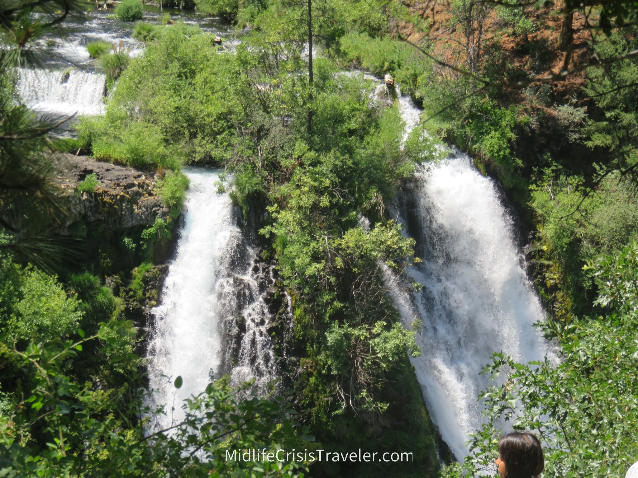
Burney Falls is located 63 miles northeast of Redding, CA. It is a scenic drive through the hills of northern CA.  I arrived on July 4th and it was 90+ degrees in the parking lot.  The beauty of the falls is unique and breathtaking.  It’s like an oasis, in that, as you walk to the bottom of the falls, the temperature drops about 20 degrees. To give you some perspective, Burney Falls is 130 feet from top to bottom whereas Niagara Falls is 167 feet.  Parking can be difficult as this park gets a lot of traffic.  Patience is the key because as soon as it seems like you will never get a spot, there will be 5-10 openings 30 minutes later.  The falls were especially strong this year due to record snowfall in northern CA.  Check out the videos to see how fast the water runs.

Someone left their fanny pack and water bottle on the rocks near the falls and a squirrel was doing his best to find some snacks. 

2019 Trip

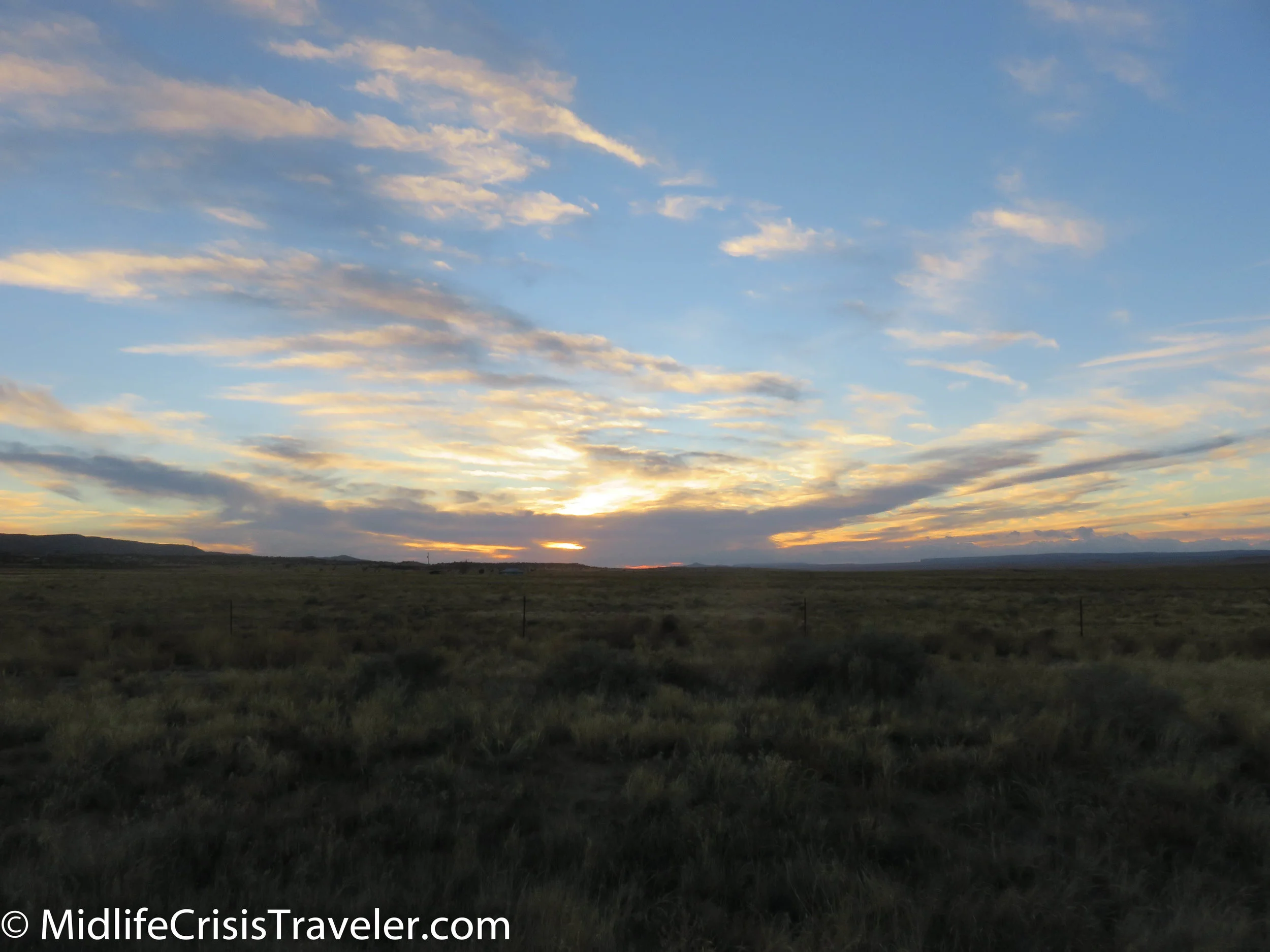
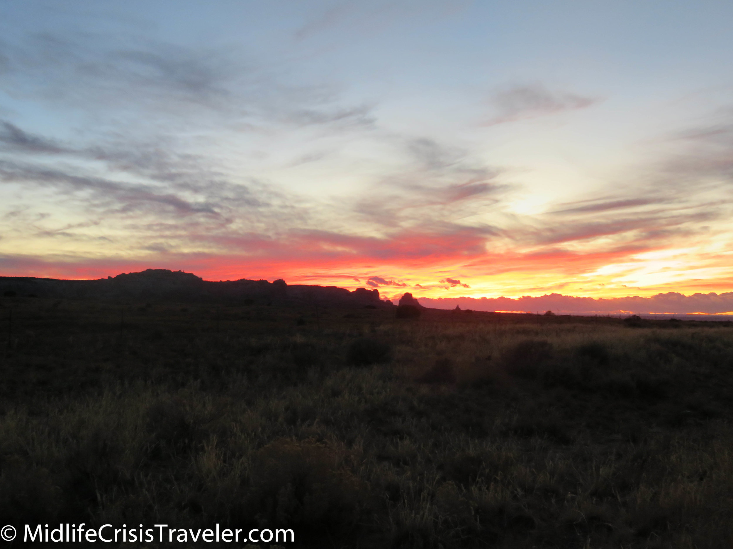
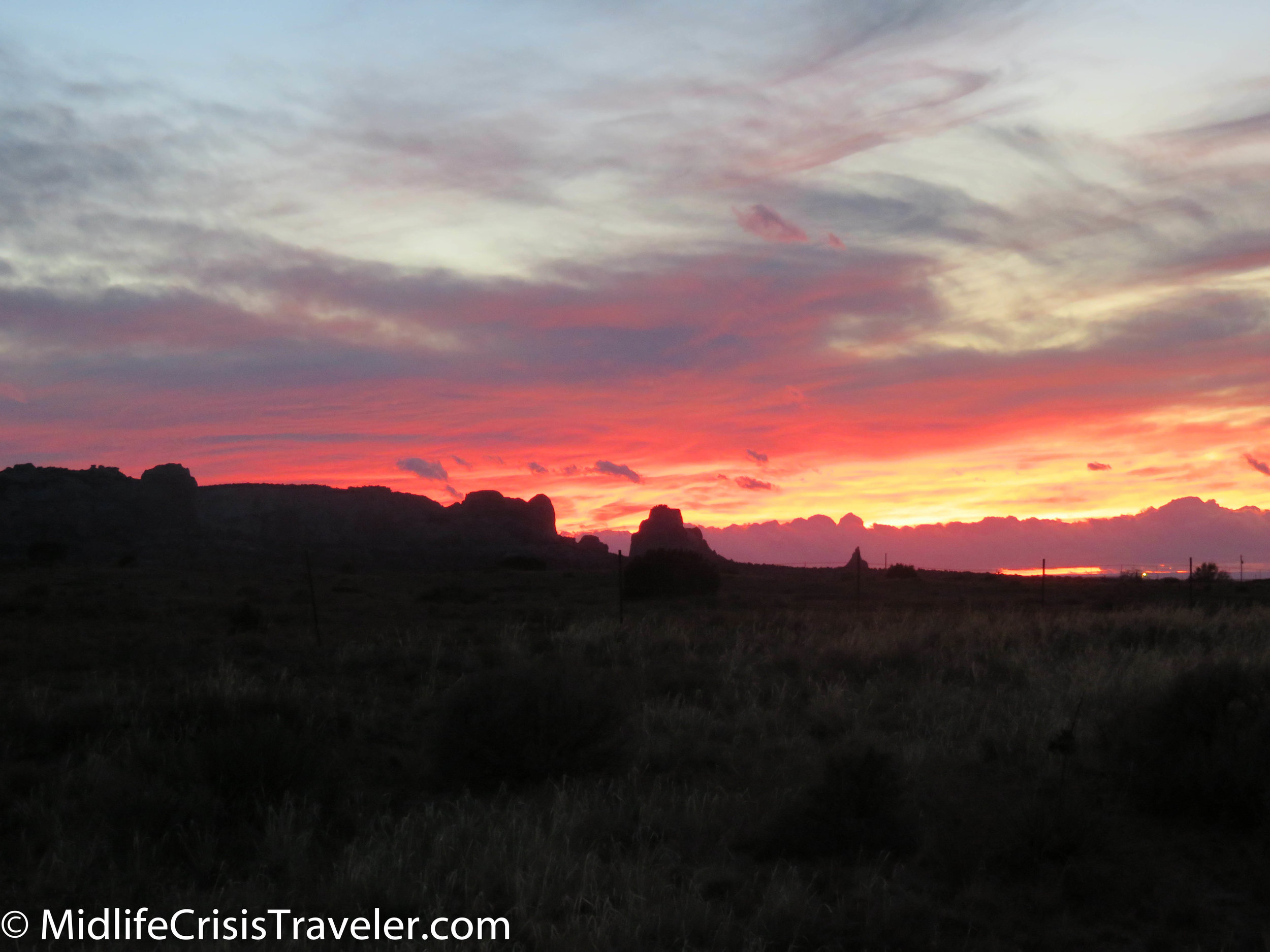
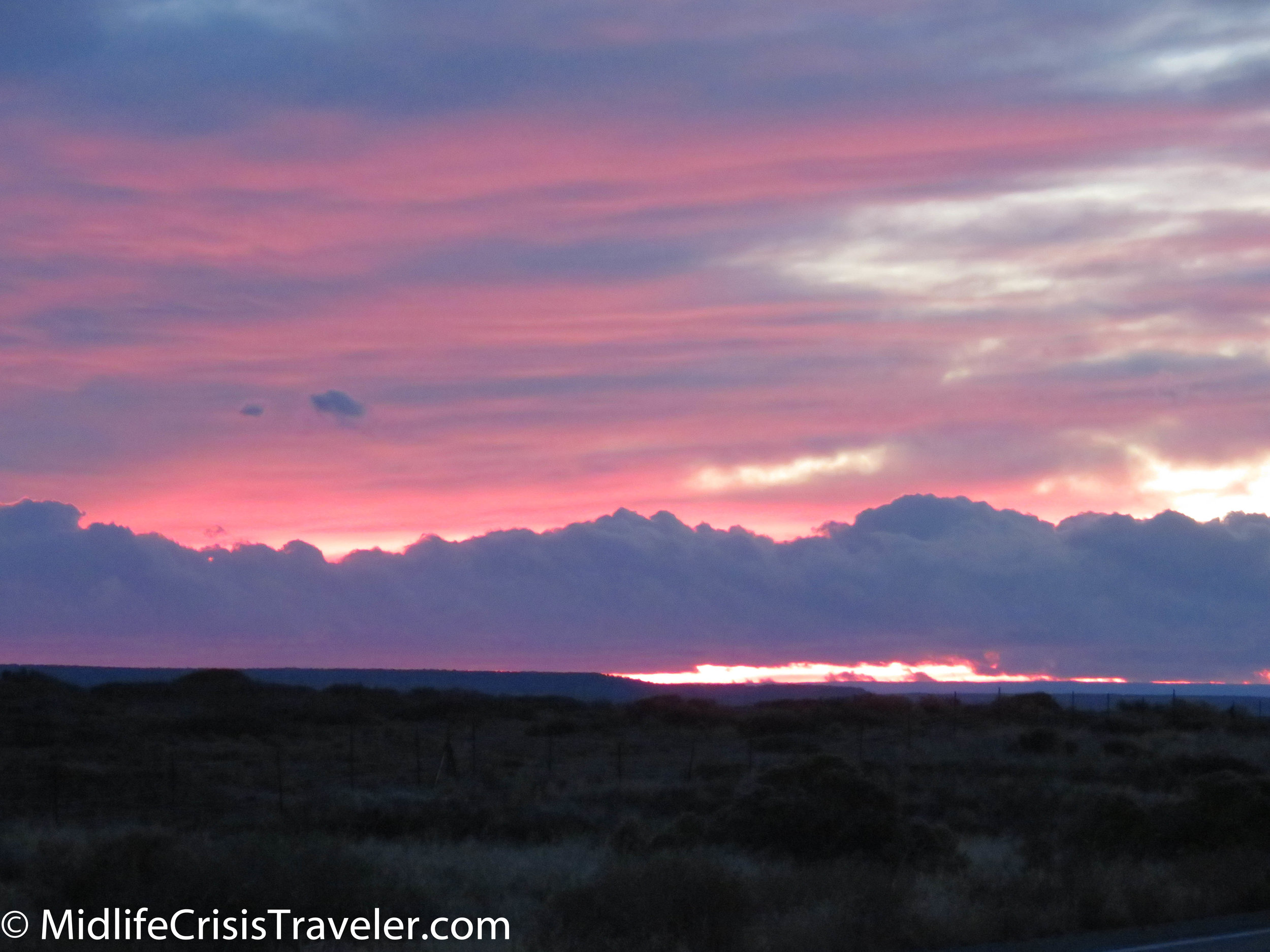
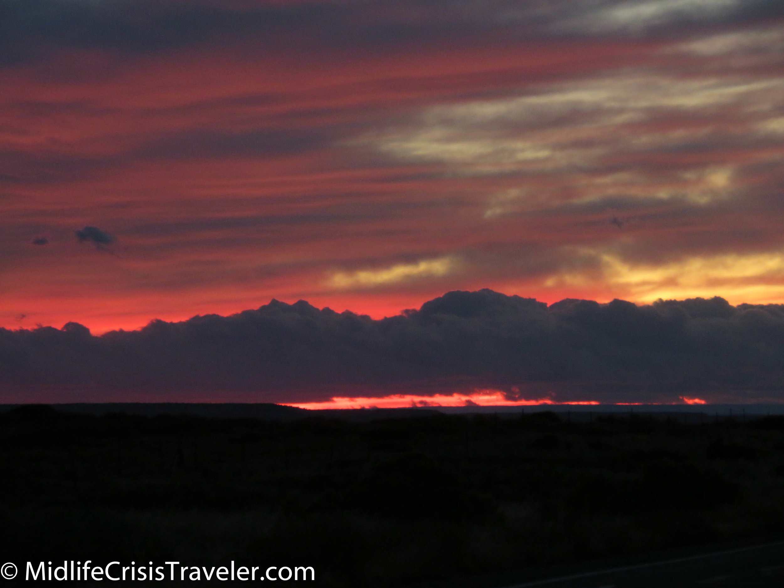
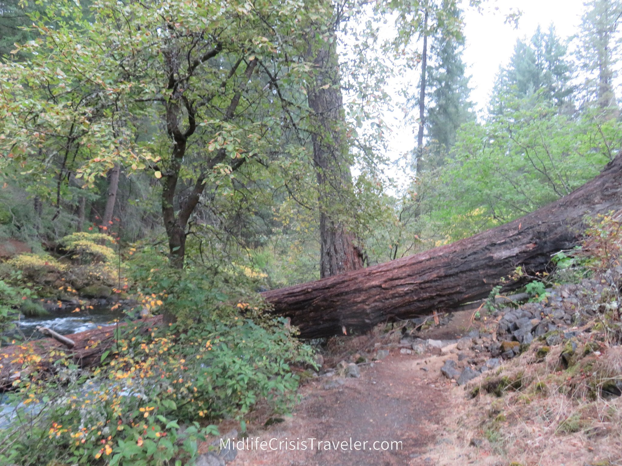
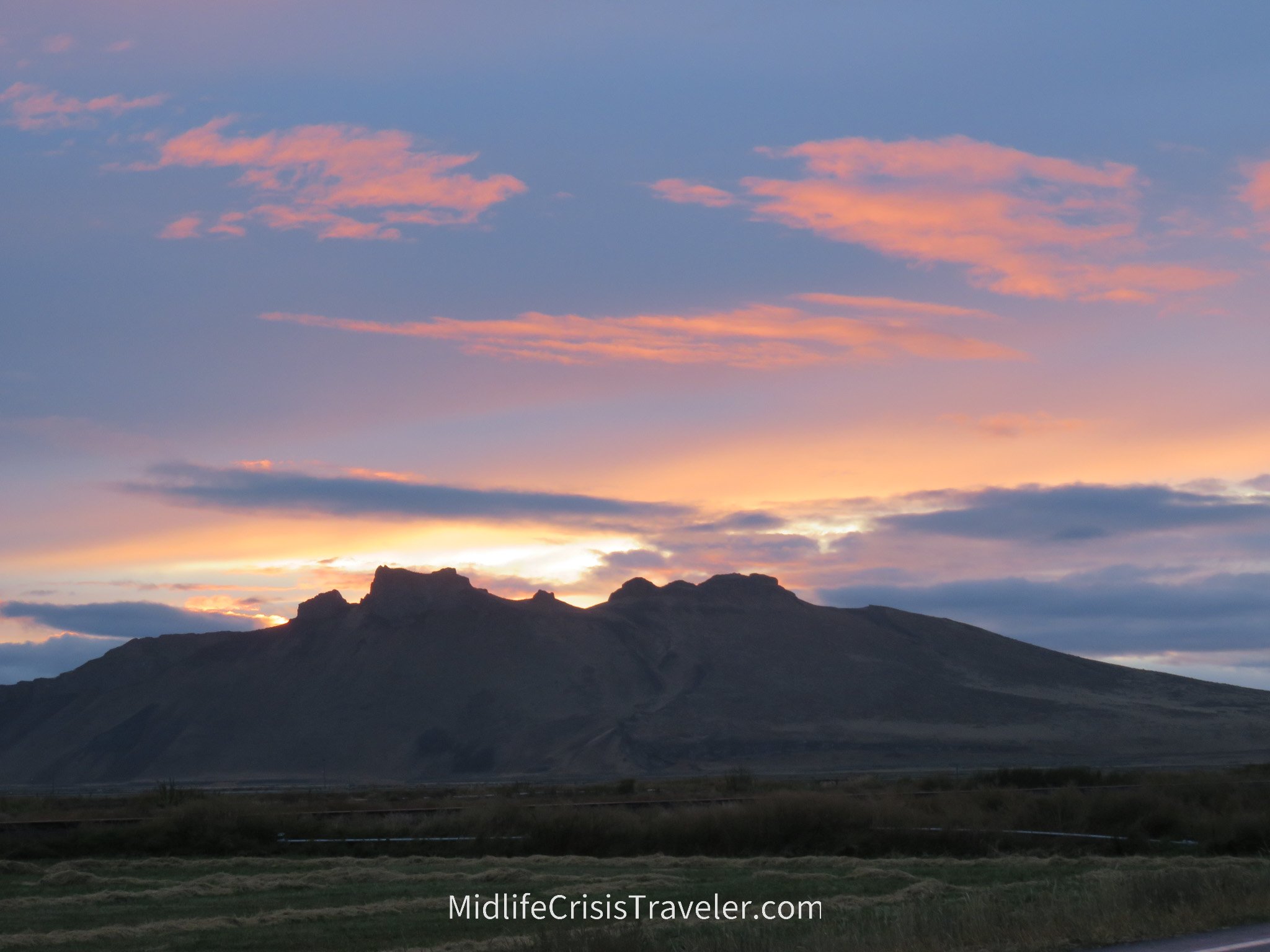
I visited Burney in 2019 but it was raining heavily that day but the hike through the woods and the sunset a few miles down the road were very satisfying. 

The sunset down the road from Burney was amazing.

Mt Shasta, CA

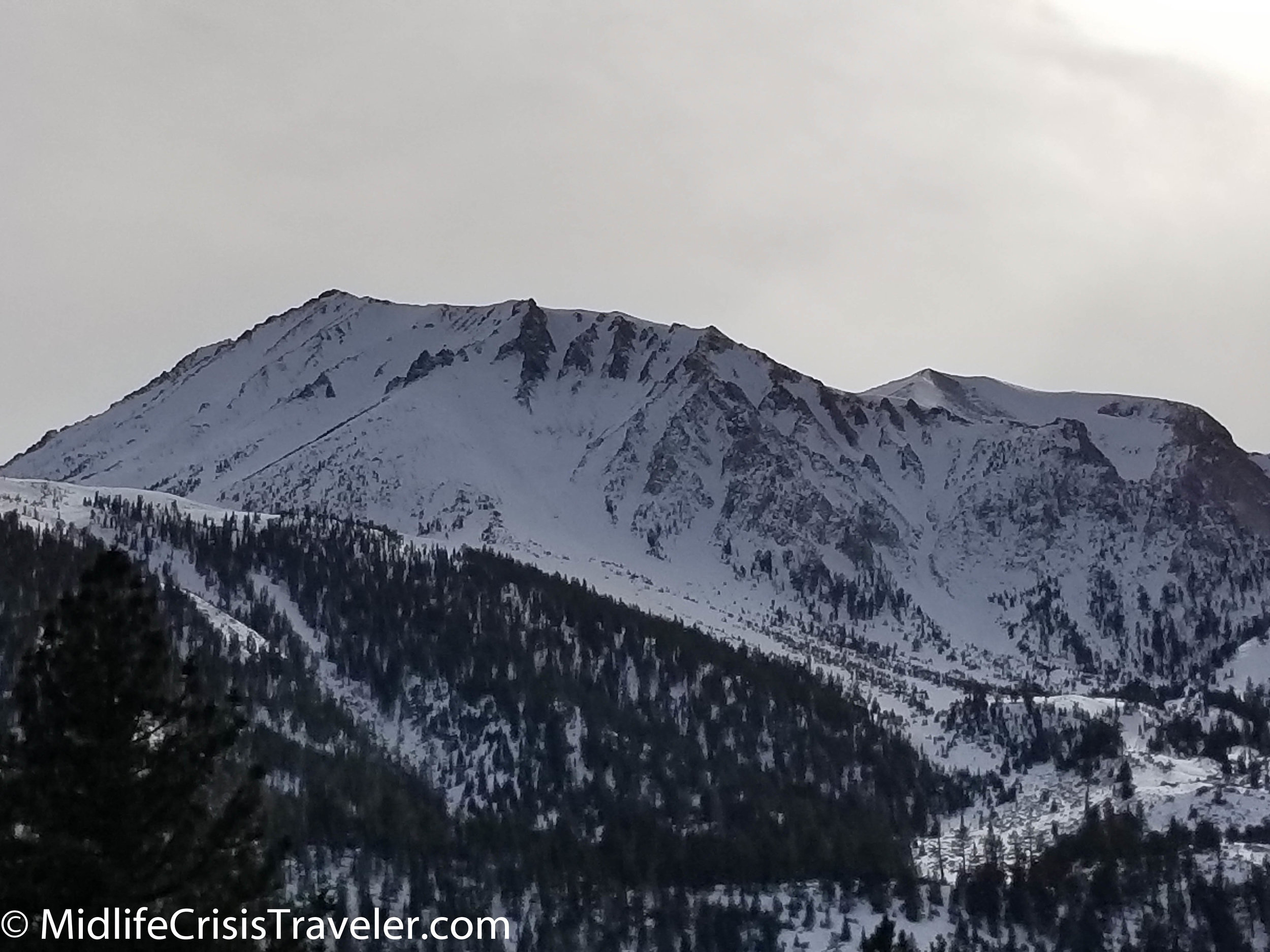
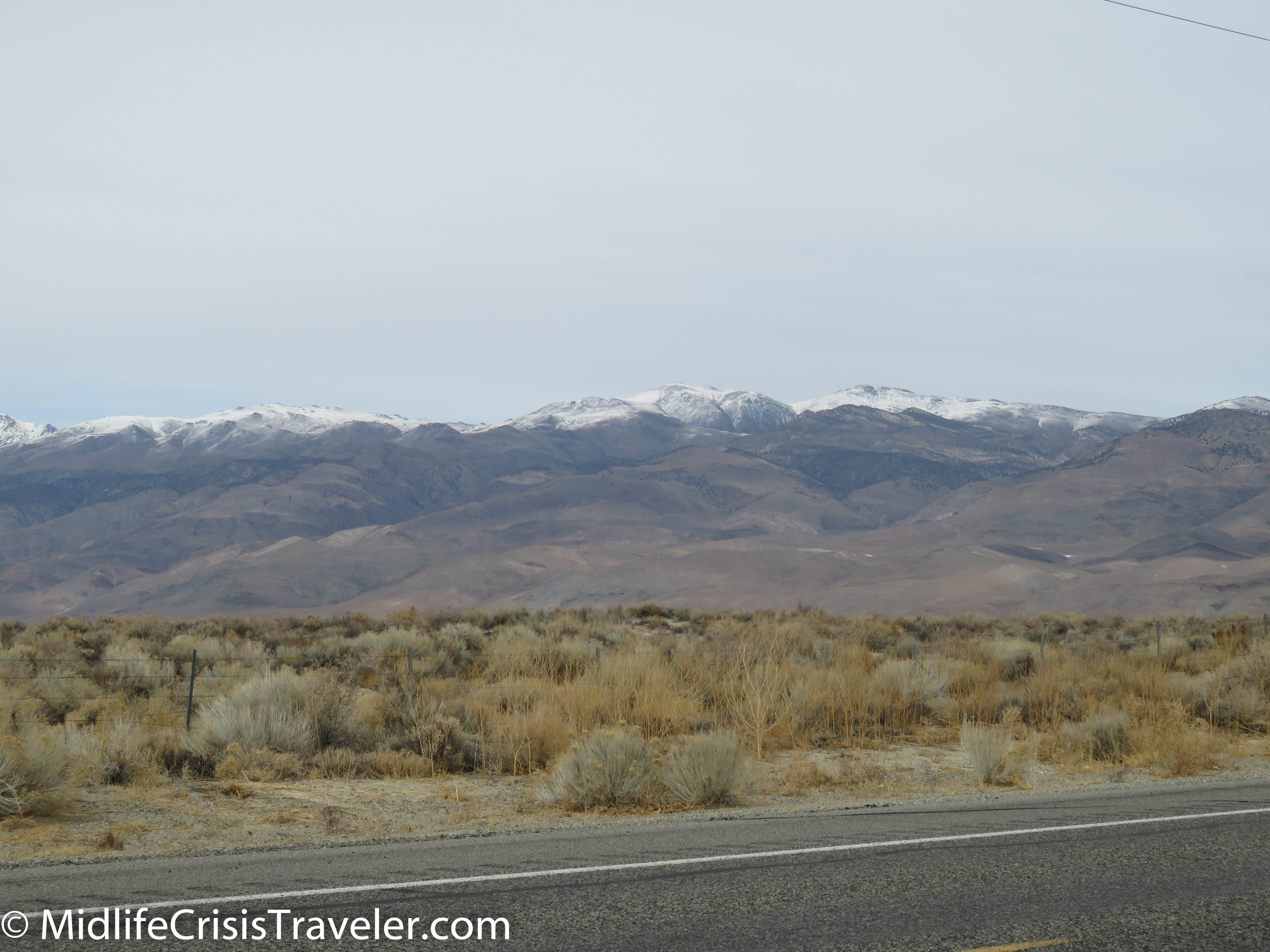
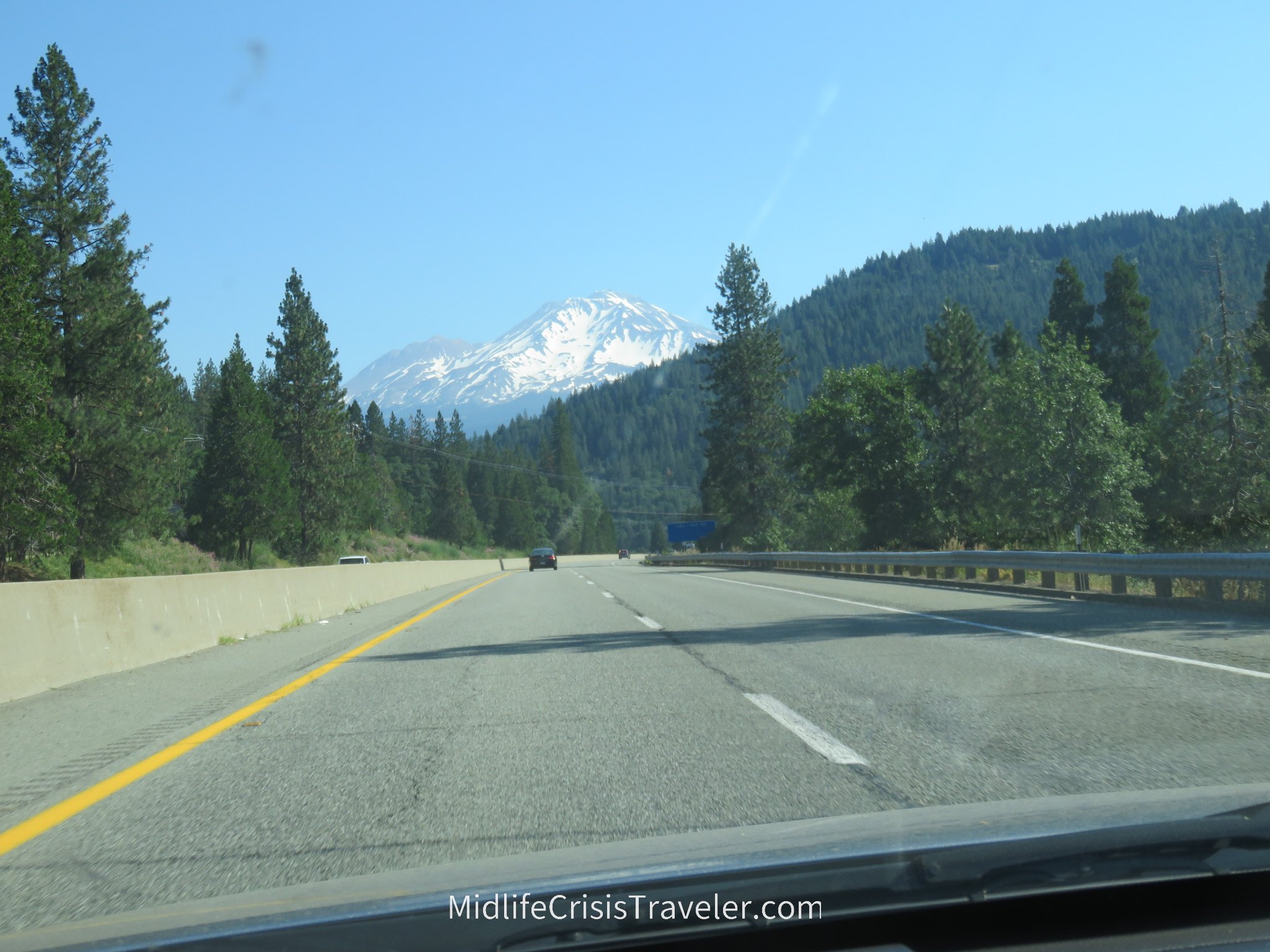
Mt Shasta is 61 miles north of Redding, CA just east of Route 5.  You literally can’t miss the mountain because it dwarfs everything around it.  It frequently has a snow cap, even through the summer.  I was there at the beginning of July and you can clearly see there is no shortage of snow.  The peak is at 14,179 feet and it is part of the Cascade Range.

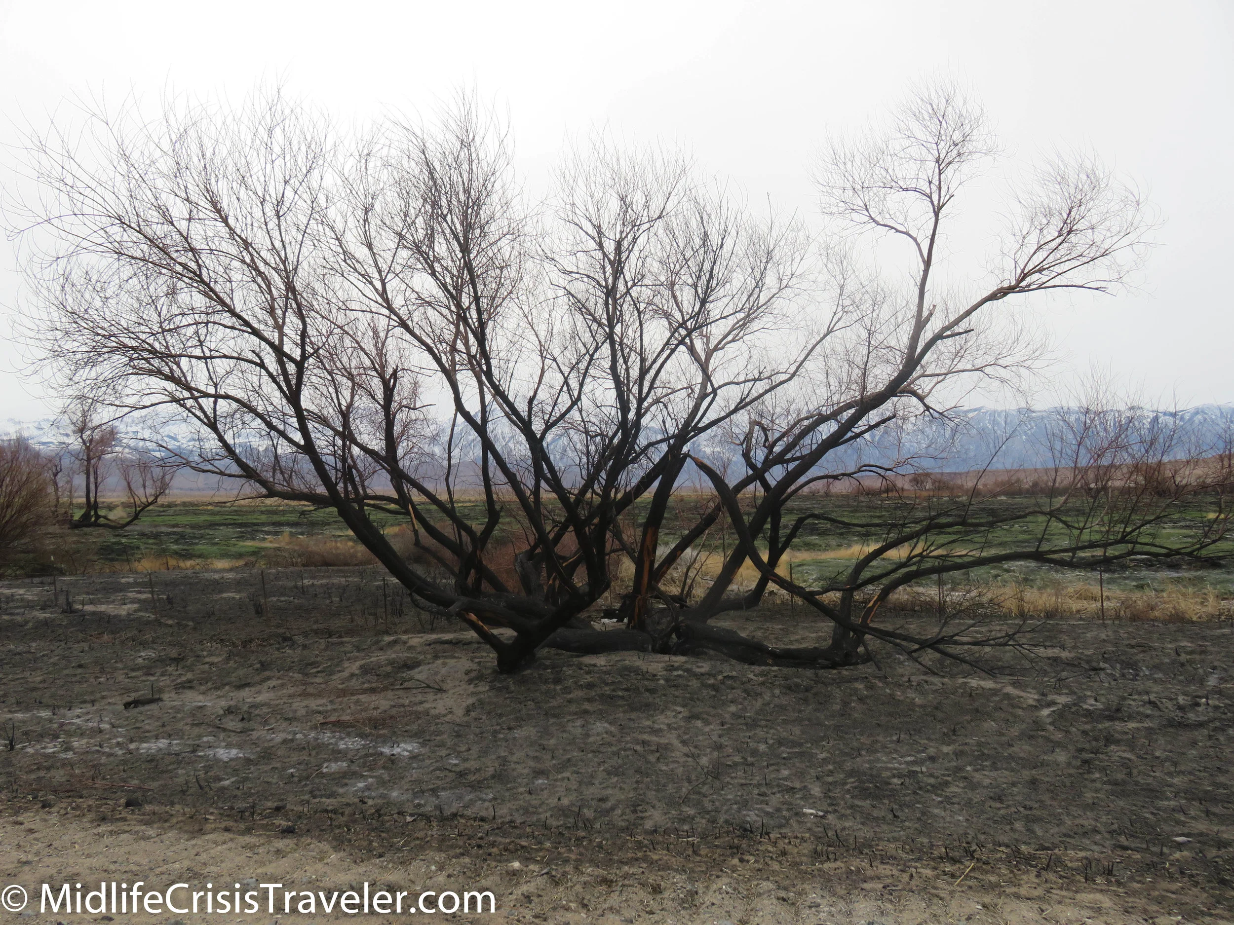
There are areas around Mt Shasta that were burned extensively by the 2021 Dixie Fire. The area is recovering and you can see plenty of green areas overtaking the burnt remains.

Click the links below for more information about Burney Falls an Mt Shasta:

Burney Falls Link

Mt Shasta Link

Have you visited these landmarks? What were your thoughts when you were there?

Antelope Valley Poppy Reserve State Park

THE SUPER BLOOM

Shortly after turning off the highway, the orange and yellow mounds appear approximately 10 miles on the horizon.  Undulations covered in color, a contrast from the green fields and solar panels on the way.  Halfway there, the fields are overrun with orange, yellow and purple flowers.  The hills are now easily seen.  They are vibrantly alive with an almost fluorescent color.  A wet January and February have spawned the super bloom. 

From the Poppy Reserve Website:

The Park

Each spring, the Antelope Valley California Poppy Reserve comes alive with the seasonal surprises of the Mojave Desert Grassland habitat.  The duration and intensity of colors and scents vary from year to year.  The wildflower season generally lasts from as early as mid-February through May, with a variety of wildflowers creating a mosaic of color that changes daily.

Eight miles of trails through the gentle rolling hills, including a paved section for wheelchair access, make the park a wonderful place to hike and explore any season.  Get away from the city and relax in the quietude of the countryside, with the birds singing and hawks gliding silently overhead.  Benches located along the trails make good places to sit quietly and watch for wildlife, such as meadow larks, lizards, and gopher snakes.  If you're lucky, you may spot a coyote or bobcat.  Numerous burrows around the trails may shelter mice, gophers, kangaroo rats, beetles, scorpions, or others. 

For more information, click the link below.

http://www.parks.ca.gov/?page_id=627

THE OUTSKIRTS

2019 Super Bloom-1.jpg
2019 Super Bloom-2.jpg
2019 Super Bloom-3.jpg
2019 Super Bloom-4.jpg
2019 Super Bloom-6.jpg
2019 Super Bloom-7.jpg
2019 Super Bloom-8.jpg
2019 Super Bloom-9.jpg
2019 Super Bloom-10.jpg
2019 Super Bloom-11.jpg
2019 Super Bloom-12.jpg
2019 Super Bloom-13.jpg
2019 Super Bloom-14.jpg
2019 Super Bloom-15.jpg
2019 Super Bloom-16.jpg
2019 Super Bloom-17.jpg
2019 Super Bloom-18.jpg
2019 Super Bloom-19.jpg
2019 Super Bloom-20.jpg
2019 Super Bloom-21.jpg
2019 Super Bloom-22.jpg
2019 Super Bloom-5.jpg
2019 Super Bloom-23.jpg
2019 Super Bloom-24.jpg
2019 Super Bloom-25.jpg
2019 Super Bloom-26.jpg
2019 Super Bloom-27.jpg
2019 Super Bloom-28.jpg
2019 Super Bloom-29.jpg
2019 Super Bloom-30.jpg
2019 Super Bloom-31.jpg
2019 Super Bloom-32.jpg
2019 Super Bloom-33.jpg
2019 Super Bloom-34.jpg
2019 Super Bloom-35.jpg

THE RESERVE

2019 Super Bloom-37.jpg
2019 Super Bloom-38.jpg
2019 Super Bloom-39.jpg
2019 Super Bloom-40.jpg
2019 Super Bloom-41.jpg
2019 Super Bloom-42.jpg
2019 Super Bloom-43.jpg
2019 Super Bloom-44.jpg
2019 Super Bloom-45.jpg
2019 Super Bloom-46.jpg
2019 Super Bloom-47.jpg
2019 Super Bloom-48.jpg
2019 Super Bloom-49.jpg
2019 Super Bloom-50.jpg
2019 Super Bloom-51.jpg
2019 Super Bloom-52.jpg
2019 Super Bloom-53.jpg
2019 Super Bloom-54.jpg
2019 Super Bloom-55.jpg
2019 Super Bloom-56.jpg
2019 Super Bloom-57.jpg
2019 Super Bloom-58.jpg
2019 Super Bloom-60.jpg

More from the Reserve Website

The Antelope Valley is located in the western Mojave Desert at an elevation ranging from 2600--3000 feet, making it a high desert environment. 

This State Natural Reserve is located on California's most consistent poppy-bearing land. Other wildflowers: owl's clover, lupine, goldfield, cream cups, and coreopsis, to name a few, share the desert grassland to produce a mosaic of color and fragrance each spring. As unpredictable as nature - the intensity and duration of the wildflower bloom varies yearly.  California State Parks does not water or use any other means to stimulate the flowers; the land is preserved to only be influenced by the natural forces that had once influenced all of our surroundings.  The broad views of this landscape provide eyefuls of brilliant wildflower colors and fragrance. Whether you most enjoy expansive fields or the close-up study of a single flower, this is the place to visit.

2019 Super Bloom-63.jpg
2019 Super Bloom-65.jpg
2019 Super Bloom-64.jpg
2019 Super Bloom-66.jpg
2019 Super Bloom-67.jpg
2019 Super Bloom-68.jpg
2019 Super Bloom-70.jpg
2019 Super Bloom-71.jpg
2019 Super Bloom-72.jpg
2019 Super Bloom-74.jpg
2019 Super Bloom-36.jpg
2019 Super Bloom-75.jpg
2019 Super Bloom-76.jpg
2019 Super Bloom-77.jpg
2019 Super Bloom-78.jpg
2019 Super Bloom-79.jpg
2019 Super Bloom-81.jpg
2019 Super Bloom-82.jpg
2019 Super Bloom-84.jpg
2019 Super Bloom-86.jpg
2019 Super Bloom-87.jpg
2019 Super Bloom-89.jpg
2019 Super Bloom-91.jpg
2019 Super Bloom-92.jpg
2019 Super Bloom-94.jpg
2019 Super Bloom-95.jpg
2019 Super Bloom-96.jpg
2019 Super Bloom-97.jpg
2019 Super Bloom-98.jpg
2019 Super Bloom-99.jpg
2019 Super Bloom-100.jpg
2019 Super Bloom-101.jpg
2019 Super Bloom-102.jpg
2019 Super Bloom-88.jpg
2019 Super Bloom-103.jpg
2019 Super Bloom-104.jpg
2019 Super Bloom-105.jpg
2019 Super Bloom-106.jpg
2019 Super Bloom-107.jpg
2019 Super Bloom-108.jpg
2019 Super Bloom-110.jpg
2019 Super Bloom-111.jpg
2019 Super Bloom-112.jpg
2019 Super Bloom-113.jpg
2019 Super Bloom-114.jpg
2019 Super Bloom-115.jpg
2019 Super Bloom-116.jpg
2019 Super Bloom-118.jpg
2019 Super Bloom-119.jpg
2019 Super Bloom-123.jpg
2019 Super Bloom-124.jpg
2019 Super Bloom-125.jpg
2019 Super Bloom-127.jpg
2019 Super Bloom-128.jpg
2019 Super Bloom-130.jpg

Have you visited the Poppy Reserve? What was your experience like? Have you visited other areas that have seen a super bloom this year?

Whale Watching

In the heart of Newport Beach (where there is very little parking), you can take a 2-hour tour (said in the Gilligan’s Island narrative voice) a few miles off the coast and see various types of whales.  The time of year will dictate what types of whales you might see in this area.  I went on this excursion on Saturday January 19th.  It was a beautiful 75-degree day with barely a cloud in the sky. 

Whale Watching-1.jpg
Whale Watching-2.jpg
Whale Watching-3.jpg
Whale Watching-4.jpg
Whale Watching-5.jpg
Whale Watching-6.jpg
Whale Watching-7.jpg
Whale Watching-8.jpg
Whale Watching-9.jpg
Whale Watching-10.jpg
Whale Watching-11.jpg
Whale Watching-12.jpg
Whale Watching-13.jpg

A nice day to paddle your way around the shoreline.

Whale Watching-14.jpg
Whale Watching-15.jpg
Whale Watching-20.jpg
Whale Watching-18.jpg
Whale Watching-21.jpg
Whale Watching-23.jpg

Pretty cool to see snow-capped mountains while cruising on the ocean.

Whale Watching-16.jpg
Whale Watching-17.jpg
Whale Watching-24.jpg
Whale Watching-26.jpg
Whale Watching-27.jpg

We were told by the boat’s captain that there were a few Gray Whales in the area and we should have a reasonable chance to see them.  These whales migrate at a top speed of 3 miles per hour from Alaska to Baja Mexico.  He also mentioned that the whales lose a considerable amount of weight because they do not feed while migrating.  We met up with two smaller boats that were staking out an area.  Approximately 10 minutes after we arrived, we saw some water spouts so we knew they were near the surface.  Shortly thereafter, we were able to see one of the whales breach the water and two tails flip over.  And that, folks, was the extent of our experience.  LOL.  After about 20 minutes, the captain told us that whales can go under water and hold their breath for 20 minutes.  We waited a while longer but did not see them again.  The captain then took us to some other locations but we were not able to see more whales.  We did to see some sea lions who were laying on each other on a buoy.  We then made our journey back to the dock.  I took many pictures so I hope you enjoy them. 

Whale Watching-29.jpg
Whale Watching-30.jpg
Whale Watching-32.jpg

I like the following sequence of photos. Check out the changing ripples of water with various shades of light hitting them as the sun begins to set.

Whale Watching-35.jpg
Whale Watching-36.jpg
Whale Watching-37.jpg
Whale Watching-38.jpg
Whale Watching-39.jpg
Whale Watching-40.jpg
Whale Watching-41.jpg
Whale Watching-42.jpg
Whale Watching-43.jpg
Whale Watching-44.jpg
Whale Watching-49.jpg
Whale Watching-50.jpg
Whale Watching-51.jpg
Whale Watching-52.jpg
Whale Watching-53.jpg

Same situation here. This is a closeup of the waves and foam from the ship’s engine.

Whale Watching-54.jpg
Whale Watching-55.jpg
Whale Watching-56.jpg
Whale Watching-57.jpg
Whale Watching-58.jpg
Whale Watching-59.jpg
Whale Watching-60.jpg
Whale Watching-45.jpg
Whale Watching-47.jpg
Whale Watching-61.jpg

Check out the color and shading of the sun on the water on the next couple of pictures. The water looks like it is on fire.

Whale Watching-67.jpg
Whale Watching-68.jpg
Whale Watching-62.jpg
Whale Watching-63.jpg
Whale Watching-64.jpg
Whale Watching-65.jpg
Whale Watching-66.jpg
Whale Watching-69.jpg
Whale Watching-70.jpg
Whale Watching-71.jpg
Whale Watching-72.jpg
Whale Watching-73.jpg
Whale Watching-74.jpg
Whale Watching-75.jpg

I’m not sure who this guy is but he is extremely tall. Either he or the woman or both were flown in on the helicopter and joined the party on-board.

Whale Watching-76.jpg
Whale Watching-77.jpg
Whale Watching-78.jpg
Whale Watching-79.jpg
Whale Watching-80.jpg
Whale Watching-81.jpg
Whale Watching-82.jpg
Whale Watching-83.jpg
Whale Watching-84.jpg
Whale Watching-85.jpg
Whale Watching-86.jpg
Whale Watching-88.jpg
Whale Watching-89.jpg
Whale Watching-93.jpg
Whale Watching-94.jpg
Whale Watching-95.jpg
Whale Watching-100.jpg
Whale Watching-104.jpg
Whale Watching-106.jpg
Whale Watching-90.jpg
Whale Watching-91.jpg
Whale Watching-96.jpg
Whale Watching-97.jpg
Whale Watching-98.jpg
Whale Watching-99.jpg
Whale Watching-102.jpg
Whale Watching-103.jpg
Whale Watching-105.jpg

For more information about Gray Whales, click the link below.

https://www.nationalgeographic.com/animals/mammals/g/gray-whale/

Red Canyon: Dixie National Forest, Utah

Just 14 miles west of Bryce Canyon National Park on Route 12, Red Canyon in the Dixie National Forest gives a glimpse of what is to come at the grand national park down the road.  It is like a little brother that lives in the shadow of his big brother who gets all the accolades.  Red Canyon is perfect for sunsets and moon rises.  The orange sandstone and the green pine trees glow in the setting sun.  The moon ascends from behind the park and functions as the icing on the cake. 

Bryce Canyon NP-147.jpg
Bryce Canyon NP-155.jpg
Bryce Canyon NP-160.jpg
Bryce Canyon NP-163.jpg
Bryce Canyon NP-161.jpg
Bryce Canyon NP-166.jpg
Bryce Canyon NP-167.jpg
Bryce Canyon NP-169.jpg
Bryce Canyon NP-172.jpg
Bryce Canyon NP-175.jpg
Bryce Canyon NP-177.jpg
Bryce Canyon NP-178.jpg
Bryce Canyon NP-183.jpg
Red Canyon State Park UT-2.jpg
Red Canyon State Park UT-3.jpg
Red Canyon State Park UT-4.jpg
Red Canyon State Park UT-5.jpg
Red Canyon State Park UT-6.jpg
Red Canyon State Park UT-1.jpg
Red Canyon State Park UT-8.jpg
Red Canyon State Park UT-7.jpg
Red Canyon State Park UT-9.jpg
Red Canyon State Park UT-10.jpg
Red Canyon State Park UT-11.jpg
Red Canyon State Park UT-12.jpg
Red Canyon State Park UT-13.jpg
Red Canyon State Park UT-14.jpg

There are trails to hike and a campground if you prefer to stay the night.  When covered in snow, the trails can be navigated with snowshoes or cross-country skis.  One of the more photographed areas of the park are the tunnels.  The tunnels are currently undergoing construction so be careful when driving through the area.  Oh, and watch for passing vehicles if you insist on taking pictures of them while standing on or at the side of the road. 

Red Canyon State Park UT-18.jpg
Red Canyon State Park UT-20.jpg
Red Canyon State Park UT-21.jpg
Red Canyon State Park UT-25.jpg
Red Canyon State Park UT-26.jpg
Red Canyon State Park UT-27.jpg

Framed by the blue sky, wispy clouds or none at all, this smaller version of Bryce Canyon is never ignored, but is less crowded than its larger brother to the east.  If you visit Bryce Canyon, take the leisurely drive to Red Canyon.  It’s only another 10 miles to the small town of Panguitch or an hour to the gorgeous Zion National Park. 

For more information on Red Canyon click on the link below.

https://www.fs.usda.gov/recarea/dixie/recarea/?recid=24942


Route 395: Manzanar

Manzanar was a World War II Japanese Internment Camp located on Route 395 between Lone Pine and Independence California.  I had the opportunity to spend some time in the visitor’s center and took many pictures.  I also watched the video that I posted below.  Please watch the video as it tells many stories of these poor people who had everything taken from them just because of their ancestry.  Although this is a beautiful area, the climate can be difficult.  The living quarters were hastily slapped together and did not always shield the inhabitants from the harsh elements.  Over 11,000 Japanese Americans were processed through Manzanar. 

Manzanar-130.jpg
Manzanar-127.jpg
Manzanar-129.jpg
Manzanar-3.jpg
Manzanar-2.jpg
Manzanar-4.jpg
Manzanar-5.jpg
Manzanar-6.jpg
Manzanar-7.jpg
Manzanar-8.jpg
Manzanar-9.jpg
Manzanar-10.jpg
Manzanar-11.jpg
Manzanar-12.jpg
Manzanar-13.jpg
Manzanar-14.jpg
Manzanar-15.jpg
Manzanar-16.jpg
Manzanar-17.jpg
Manzanar-18.jpg
Manzanar-19.jpg
This is a model of what the camp used to look like.  Only a few buildings remain.

This is a model of what the camp used to look like.  Only a few buildings remain.

Manzanar-21.jpg
Manzanar-22.jpg
Manzanar-23.jpg
Manzanar-24.jpg
Manzanar-25.jpg
Manzanar-26.jpg
Manzanar-27.jpg
Manzanar-28.jpg
Manzanar-29.jpg
Manzanar-30.jpg
Manzanar-31.jpg
Manzanar-32.jpg
Manzanar-33.jpg
Manzanar-34.jpg
Manzanar-35.jpg
Manzanar-36.jpg
Manzanar-37.jpg
Manzanar-38.jpg
Manzanar-39.jpg
Manzanar-40.jpg
Manzanar-41.jpg
Manzanar-42.jpg
Manzanar-43.jpg
Manzanar-44.jpg
Manzanar-45.jpg
Manzanar-46.jpg
Manzanar-47.jpg
Manzanar-48.jpg
Manzanar-49.jpg
Manzanar-50.jpg
Manzanar-51.jpg
Manzanar-52.jpg
Manzanar-53.jpg
Manzanar-54.jpg
Manzanar-55.jpg
Manzanar-56.jpg
Manzanar-57.jpg
Manzanar-58.jpg
This is a list of all the people who lived at Manzanar.

This is a list of all the people who lived at Manzanar.

Manzanar-60.jpg
Manzanar-61.jpg
Manzanar-62.jpg
Manzanar-63.jpg
Manzanar-64.jpg
Manzanar-65.jpg
Manzanar-66.jpg
Manzanar-67.jpg
Manzanar-68.jpg
Manzanar-69.jpg
Manzanar-70.jpg
Manzanar-71.jpg
Manzanar-72.jpg
Manzanar-73.jpg
Manzanar-74.jpg
Manzanar-75.jpg
Manzanar-76.jpg
Manzanar-77.jpg
Manzanar-78.jpg
Manzanar-79.jpg
Manzanar-80.jpg
Manzanar-81.jpg
Manzanar-82.jpg
Manzanar-83.jpg
Manzanar-84.jpg
Manzanar-85.jpg
Manzanar-86.jpg
Manzanar-87.jpg
Manzanar-89.jpg
Manzanar-90.jpg
Manzanar-91.jpg
Manzanar-92.jpg
Manzanar-93.jpg
Manzanar-94.jpg
Manzanar-95.jpg
Manzanar-96.jpg
Manzanar-97.jpg
Manzanar-98.jpg
Manzanar-99.jpg
Manzanar-100.jpg
Manzanar-101.jpg
Manzanar-102.jpg
Manzanar-103.jpg
Eight people were assigned to each living area which measured 20x25 feet. 

Eight people were assigned to each living area which measured 20x25 feet. 

Manzanar-105.jpg
Manzanar-106.jpg
Manzanar-107.jpg
Manzanar-108.jpg
Manzanar-109.jpg
Manzanar-110.jpg
Manzanar-112.jpg
Manzanar-113.jpg
Manzanar-114.jpg
Manzanar-115.jpg
Manzanar-116.jpg
Manzanar-117.jpg
Manzanar-119.jpg
Manzanar-118.jpg
Manzanar-120.jpg
Manzanar-121.jpg
This is the Manzanar cemetery.  135 people died at Manzanar, 28 were buried in Manzanar's cemetery. 

This is the Manzanar cemetery.  135 people died at Manzanar, 28 were buried in Manzanar's cemetery. 

Manzanar-133.jpg
Manzanar-134.jpg
Manzanar-122.jpg
Manzanar-123.jpg
Manzanar-124.jpg
Manzanar-125.jpg
Manzanar-126.jpg
Manzanar-135.jpg
Manzanar-136.jpg
Manzanar-137.jpg
Manzanar-138.jpg
Manzanar-139.jpg
Manzanar-140.jpg
Manzanar-141.jpg

For more information about Manzanar, click the link below to visit their website.

https://www.nps.gov/manz/index.htm

Route 395: Lone Pine and Mount Whitney

Route 395 must suffer the fate of the middle child.  On one side, you have two of the most legendary sites in the US National Park system in Yosemite and Sequoia National Parks.  On the other, you have one of the largest parks in the National Park system that has the lowest point in North America.  Yosemite is quite possibly the most photographed location in the United States.  Tunnel view, Yosemite Valley and places like Hetch Hetchy, Tuolumne Meadow and Tenaya Lake on the Tioga Road are a photographer’s idea of heaven on earth.  Sequoia National Park boasts the largest trees on earth that can live over 3000 years. 

Death Valley National Park contains Badwater Basin which is the lowest point in North America at 282 feet below sea level.  It is the hottest, driest and lowest National Park.  The hottest temperature in world history, 134 degrees, was recorded at (fittingly named) Furnace Creek on July 10, 1913.  Death Valley NP is a massive 3.4 million acres and contains everything from mountains to sand dunes to caves and even snow in the winter. 

Lone Pine-6.jpg
Lone Pine-7.jpg
Lone Pine-8.jpg
Lone Pine-9.jpg
Lone Pine-10.jpg
Lone Pine-11.jpg
Lone Pine-12.jpg
Lone Pine-13.jpg
Lone Pine-14.jpg
Lone Pine-15.jpg
Lone Pine-16.jpg
Lone Pine-17.jpg
Lone Pine-18.jpg
Mt. Whitney is the tallest mountain in the lower 48 states.

Mt. Whitney is the tallest mountain in the lower 48 states.

Lone Pine-20.jpg
Lone Pine-21.jpg
Lone Pine-23.jpg
Lone Pine-24.jpg
Lone Pine-25.jpg
Lone Pine-26.jpg
Lone Pine-27.jpg
Lone Pine-28.jpg
Lone Pine-29.jpg
Lone Pine-30.jpg
Lone Pine-31.jpg

With these two areas containing such marvels, what is left for the Route 395 corridor?  The view.  The view from this valley is better than what you will see if you are in Yosemite and Sequoia NP’s.  The eastern side of the Sierra Nevada mountains is the best view for these scenic wonders.  There is a collection of lakes cradled in the nooks of these majestic mountains.  I’ve driven this road in the summer and winter.  I highly recommend a trip during the winter months through this area.  The snow and ice accentuate the crags in the mountains.  Millions of years of abuse by the wind, rain, snow and ice have left these mountains with scars of beauty.  Roads snake their way through the foothills and make an ascent to the top rather manageable.  Warning: if you want to climb Mount Whitney, which is the highest peak in the lower 48 states, you must get a permit. 

Lone Pine-34.jpg
Lone Pine-35.jpg
Lone Pine-36.jpg
Lone Pine-37.jpg
Lone Pine-38.jpg
Lone Pine-39.jpg
Lone Pine-40.jpg

There are dozens of campgrounds which are either at the base or located partially up the mountainsides.  If travelling during the winter and early spring months, be careful of rock slides and debris on the road.  As the snow and ice start to melt, it dislodges rocks and dirt which create rockslides which can cause damage to people, cars and the roads.  Many of the roads and campgrounds partially up the mountains are closed during the winter but you can still drive a considerable way before a gate will block the road.  Make sure that you don’t go too far off the beaten path.  Some roads might only consist of dirt and gravel.  There are few visitors to some of these areas during the winter so, if you get stuck, you could get yourself in deep trouble.  Always be safe out there. 

Lone Pine-41.jpg
Lone Pine-42.jpg
Lone Pine-43.jpg
Lone Pine-44.jpg
Lone Pine-45.jpg
Lone Pine-47.jpg
Lone Pine-48.jpg
Lone Pine-50.jpg

The Alabama Hills are at the foot of the Whitney Portal Road.  Collections of huge rocks have settled here and provide a unique scenery.  There are roads that twist and turn through the rock formations.  Shadows fall between the precarious round curves and sharp edges of the rocks.  They form a fascinating welcome mat to the gorgeous mountains that stare down at them.  I wonder what they say to each other when we are not around?

Lone Pine-49.jpg
Lone Pine-33.jpg
Lone Pine-51.jpg
Lone Pine-52.jpg
Lone Pine-53.jpg
Lone Pine-54.jpg
Lone Pine-55.jpg
Lone Pine-56.jpg
Lone Pine-57.jpg
Lone Pine-58.jpg
Lone Pine-59.jpg
Lone Pine-60.jpg
Lone Pine-61.jpg
Lone Pine-64.jpg
Lone Pine-65.jpg
Lone Pine-66.jpg
Lone Pine-67.jpg
Lone Pine-68.jpg
Lone Pine-69.jpg
Lone Pine-72.jpg
Lone Pine-73.jpg
Lone Pine-75.jpg
Lone Pine-74.jpg
Lone Pine-75.jpg
Lone Pine-76.jpg
Lone Pine-70.jpg
Lone Pine-62.jpg
Lone Pine-71.jpg
Lone Pine-63.jpg
Lone Pine-77.jpg
Lone Pine-78.jpg
Lone Pine-79.jpg
Lone Pine-80.jpg
Lone Pine-81.jpg
Lone Pine-82.jpg
Lone Pine-83.jpg
Lone Pine-84.jpg
Lone Pine-85.jpg
Lone Pine-86.jpg
Lone Pine-87.jpg
Lone Pine-88.jpg
Lone Pine-89.jpg
Lone Pine-90.jpg

Have you visited Mount Whitney?  What was your experience like?  Click the link below for more information about Mount Whitney.

https://www.nps.gov/seki/planyourvisit/whitney.htm

Route 395: Red Rock State Park to Lone Pine

A couple of years ago, I decided to drive through Yosemite National Park on the Tioga Road (which is only open during the summer) and drive south on Route 395.  Looking at the map to prepare for my trip made me think that this could be a very scenic drive.  On my right were the Sierra Nevada mountains which were seeing pockets of rain showers, clouds and fog covering various peaks.  It made for some breathtaking photos even though my Ipad was not the best camera to capture the moment.  I vowed to return in the winter to see if the snow and ice would showcase the jagged edges of the mountains more dramatically.  I was not disappointed. 

Red Rock to Lone Pine-10.jpg
Red Rock to Lone Pine-11.jpg
Red Rock to Lone Pine-1.jpg
Red Rock to Lone Pine-2.jpg
Red Rock to Lone Pine-7.jpg
Red Rock to Lone Pine-13.jpg
Red Rock to Lone Pine-8.jpg
Red Rock to Lone Pine-15.jpg
Red Rock to Lone Pine-12.jpg
Red Rock to Lone Pine-16.jpg
Red Rock to Lone Pine-3.jpg
Red Rock to Lone Pine-17.jpg
Red Rock to Lone Pine-18.jpg
Red Rock to Lone Pine-19.jpg
Red Rock to Lone Pine-20.jpg
Red Rock to Lone Pine-21.jpg
Red Rock to Lone Pine-22.jpg
Red Rock to Lone Pine-24.jpg

This time, I decided to start driving from the south.  My journey began with Red Rock Canyon State Park.  This is a small park which offers camping spots for tents and RV’s.  It is a beautiful location and has two main areas of interest with Route 14 splitting these areas in half.  Route 14 merges with Route 395 if you drive north about 20 miles.  At that intersection, you start to see the Sierra Nevada mountains on your left and the mountains of Death Valley National Park on your right.  Although the drive to Lone Pine shouldn’t take very long, your urge to stop and take hundreds of pictures of the various angles of the mountains will keep you moving at a snail’s pace.  It’s worth every second. 

Red Rock to Lone Pine-25.jpg
Red Rock to Lone Pine-26.jpg
Red Rock to Lone Pine-27.jpg
Red Rock to Lone Pine-28.jpg
Red Rock to Lone Pine-29.jpg
Red Rock to Lone Pine-30.jpg
Red Rock to Lone Pine-31.jpg
Red Rock to Lone Pine-32.jpg
Red Rock to Lone Pine-33.jpg
Red Rock to Lone Pine-34.jpg
Red Rock to Lone Pine-35.jpg
Red Rock to Lone Pine-36.jpg
Red Rock to Lone Pine-54.jpg
Red Rock to Lone Pine-37.jpg
Red Rock to Lone Pine-38.jpg
Red Rock to Lone Pine-39.jpg
Red Rock to Lone Pine-40.jpg
Red Rock to Lone Pine-41.jpg
Red Rock to Lone Pine-42.jpg
Red Rock to Lone Pine-43.jpg
Red Rock to Lone Pine-44.jpg
Red Rock to Lone Pine-47.jpg
Red Rock to Lone Pine-48.jpg
Red Rock to Lone Pine-49.jpg
Red Rock to Lone Pine-50.jpg
Red Rock to Lone Pine-51.jpg
Red Rock to Lone Pine-52.jpg
Red Rock to Lone Pine-53.jpg
Red Rock to Lone Pine-55.jpg
Red Rock to Lone Pine-56.jpg
Red Rock to Lone Pine-57.jpg
Red Rock to Lone Pine-58.jpg
Red Rock to Lone Pine-59.jpg
Red Rock to Lone Pine-60.jpg
Red Rock to Lone Pine-62.jpg
Red Rock to Lone Pine-63.jpg
Red Rock to Lone Pine-64.jpg

After an early blue sky day, snow clouds moved in and began to dust the Sierra Nevada mountains at various areas in the range.  

Red Rock to Lone Pine-65.jpg
Red Rock to Lone Pine-66.jpg
Red Rock to Lone Pine-67.jpg
Red Rock to Lone Pine-68.jpg
Red Rock to Lone Pine-69.jpg
Red Rock to Lone Pine-70.jpg
Red Rock to Lone Pine-71.jpg
Red Rock to Lone Pine-72.jpg
Red Rock to Lone Pine-73.jpg
Red Rock to Lone Pine-74.jpg
Red Rock to Lone Pine-75.jpg
Red Rock to Lone Pine-76.jpg

Off to the right, Owens Lake will appear.  If during the winter and early spring, there might be a fog cloud over the water. 

Red Rock to Lone Pine-84.jpg
Red Rock to Lone Pine-87.jpg
Red Rock to Lone Pine-85.jpg
Red Rock to Lone Pine-77.jpg
Red Rock to Lone Pine-80.jpg
Red Rock to Lone Pine-78.jpg
Red Rock to Lone Pine-79.jpg
Red Rock to Lone Pine-81.jpg
Red Rock to Lone Pine-82.jpg
Red Rock to Lone Pine-86.jpg
Red Rock to Lone Pine-89.jpg
Red Rock to Lone Pine-96.jpg
Red Rock to Lone Pine-92.jpg
Red Rock to Lone Pine-90.jpg
Red Rock to Lone Pine-91.jpg
Red Rock to Lone Pine-93.jpg
Red Rock to Lone Pine-94.jpg
Red Rock to Lone Pine-95.jpg
Red Rock to Lone Pine-97.jpg

Finally, at Lone Pine, your breath will officially be taken away.  The landscape just got serious.  Mount Whitney is an impressive sight to see.  It is the highest point in the lower 48 states and is accompanied by jagged peaks on its flank.  Lone Pine is the kind of place that you aren’t sure where to look because you are surrounded by such impressive mountains to the east and west.  But this is just the first leg of the journey.  There are many winding roads, partially frozen lakes and massive mountains to come. 

Red Rock to Lone Pine-100.jpg
Red Rock to Lone Pine-101.jpg
Red Rock to Lone Pine-98.jpg
Red Rock to Lone Pine-99.jpg

Have you driven through the Owens Valley?  What was your experience like?  What is your favorite location?  For more information about Red Rock Canyon State Park, click the link below.

https://www.parks.ca.gov/?page_id=631

Monument Valley

Driving south on Route 191 from Moab, UT and the spectacular Canyonland and Arches National Parks is a continuation of beautiful landscapes.  There are few people on these roads and just a few small towns on the way to Monument Valley.  Sacred Native American lands run through these areas and provide centuries of history. 

Monument Valley-8.jpg
Monument Valley-9.jpg
Monument Valley-12.jpg
Monument Valley-13.jpg
Monument Valley-15.jpg
Monument Valley-7.jpg
Monument Valley-16.jpg
Monument Valley-18.jpg
Monument Valley-17.jpg
Monument Valley-19.jpg
Monument Valley-21.jpg
Monument Valley-22.jpg
Monument Valley-25.jpg
Monument Valley-26.jpg
Monument Valley-27.jpg
Monument Valley-29.jpg
Monument Valley-30.jpg
Monument Valley-31.jpg
Monument Valley-32.jpg
Monument Valley-33.jpg
Monument Valley-37.jpg
Monument Valley-38.jpg
Monument Valley-39.jpg

Monument Valley is a majestic destination.  It has wide open expanses and imposing rock formations.  Blue skies, high puffy clouds and red sandstone provide a contrast that leaves one breathless.  Simple photographs of the rocks are transformed as sunlight plays peek-a-boo with the clouds.  The face of the mountain can be cloudy like a frown on an unhappy baby.  Within seconds, that frown is replaced with a sunbeam laden, ear-to-ear smile.  It completely transforms the scene. 

Monument Valley-45.jpg
Monument Valley-43.jpg
Monument Valley-48.jpg
Monument Valley-49.jpg
Monument Valley-59.jpg
Monument Valley-51.jpg
Monument Valley-56.jpg
Monument Valley-52.jpg
Monument Valley-55.jpg
Monument Valley-53.jpg
Monument Valley-54.jpg
Monument Valley-57.jpg
Monument Valley-58.jpg
Monument Valley-60.jpg
Monument Valley-61.jpg
Monument Valley-62.jpg
Monument Valley-63.jpg
Monument Valley-66.jpg
Monument Valley-67.jpg
Monument Valley-69.jpg
Monument Valley-70.jpg
Monument Valley-72.jpg
Monument Valley-74.jpg
Monument Valley-75.jpg
Monument Valley-77.jpg
Monument Valley-79.jpg
Monument Valley-80.jpg
Monument Valley-81.jpg
Monument Valley-82.jpg
Monument Valley-84.jpg
Monument Valley-87.jpg
Monument Valley-89.jpg
Monument Valley-90.jpg

At the end of the day, the sunlight struggles to lay claim to the land it has warmed for hours.  It scrambles and scrapes for traction despite the earth’s turning its back on the light.  The final stages of struggle are punctuated with the reds, oranges and yellows of the failing sun.  Revenge will have to wait until early morning. 

Monument Valley-91.jpg
Monument Valley-92.jpg
Monument Valley-93.jpg
Monument Valley-96.jpg
Monument Valley-95.jpg
Monument Valley-94.jpg
Monument Valley-97.jpg
Monument Valley-98.jpg
Monument Valley-99.jpg
Monument Valley-101.jpg
Monument Valley-102.jpg
Monument Valley-104.jpg
Monument Valley-107.jpg
Monument Valley-108.jpg
Monument Valley-111.jpg
Monument Valley-109.jpg
Monument Valley-112.jpg