Route 395: Red Rock State Park to Lone Pine

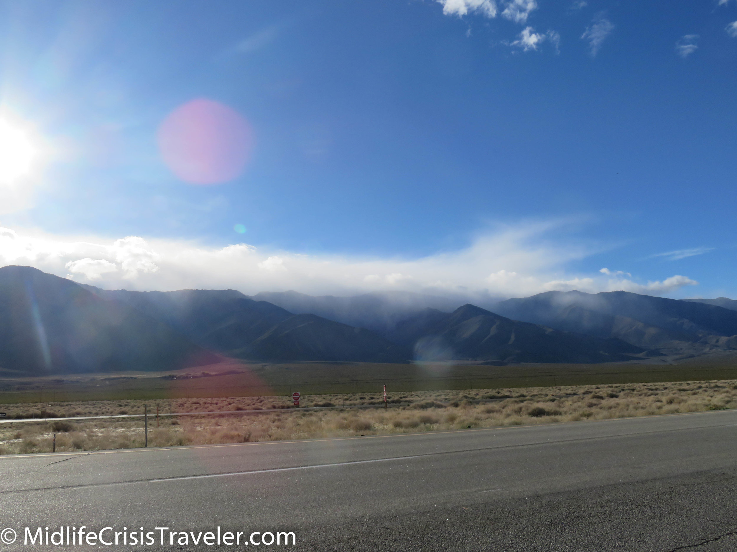
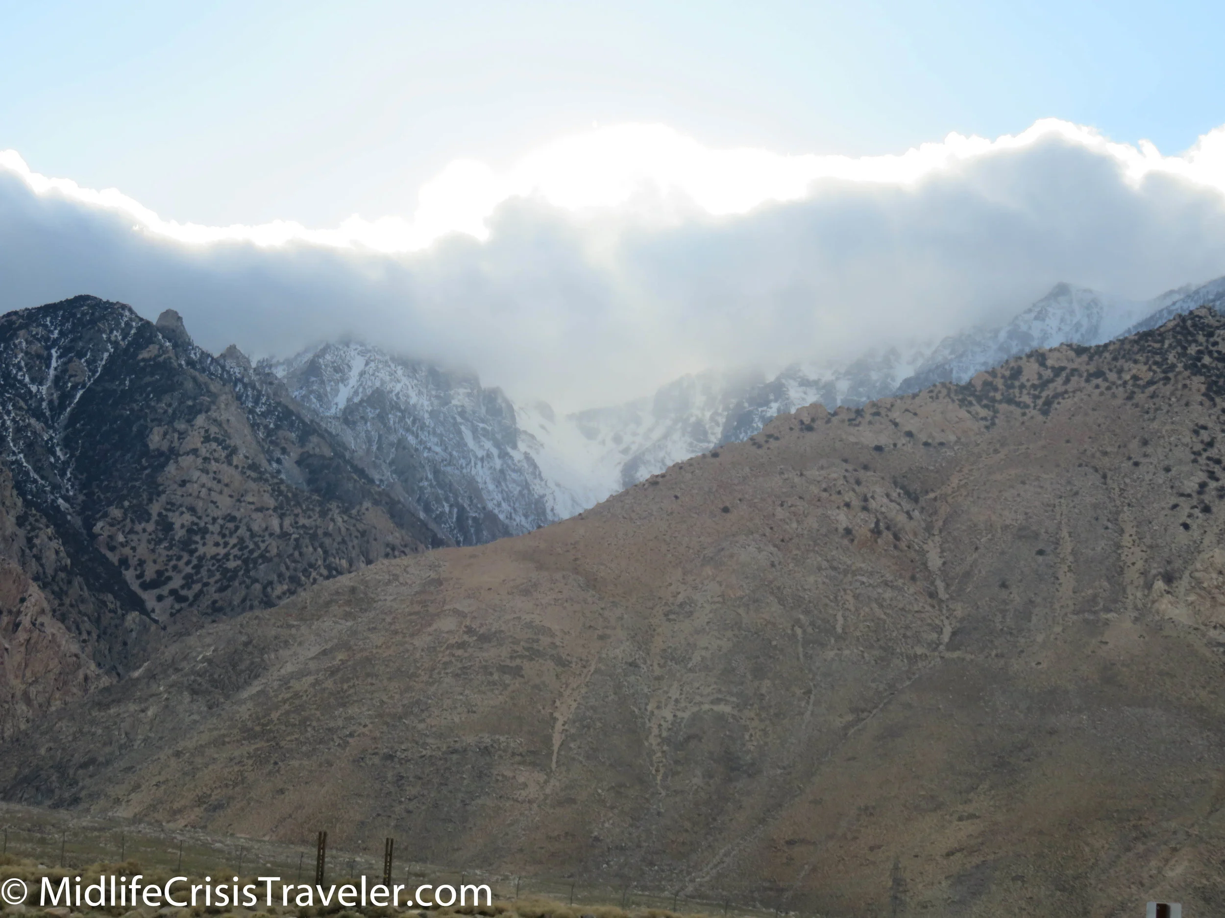
A couple of years ago, I decided to drive through Yosemite National Park on the Tioga Road (which is only open during the summer) and drive south on Route 395.  Looking at the map to prepare for my trip made me think that this could be a very scenic drive.  On my right were the Sierra Nevada mountains which were seeing pockets of rain showers, clouds and fog covering various peaks.  It made for some breathtaking photos even though my Ipad was not the best camera to capture the moment.  I vowed to return in the winter to see if the snow and ice would showcase the jagged edges of the mountains more dramatically.  I was not disappointed. 

Red Rock to Lone Pine-10.jpg
Red Rock to Lone Pine-11.jpg
Red Rock to Lone Pine-1.jpg
Red Rock to Lone Pine-2.jpg
Red Rock to Lone Pine-7.jpg
Red Rock to Lone Pine-13.jpg
Red Rock to Lone Pine-8.jpg
Red Rock to Lone Pine-15.jpg
Red Rock to Lone Pine-12.jpg
Red Rock to Lone Pine-16.jpg
Red Rock to Lone Pine-3.jpg
Red Rock to Lone Pine-17.jpg
Red Rock to Lone Pine-18.jpg
Red Rock to Lone Pine-19.jpg
Red Rock to Lone Pine-20.jpg
Red Rock to Lone Pine-21.jpg
Red Rock to Lone Pine-22.jpg
Red Rock to Lone Pine-24.jpg

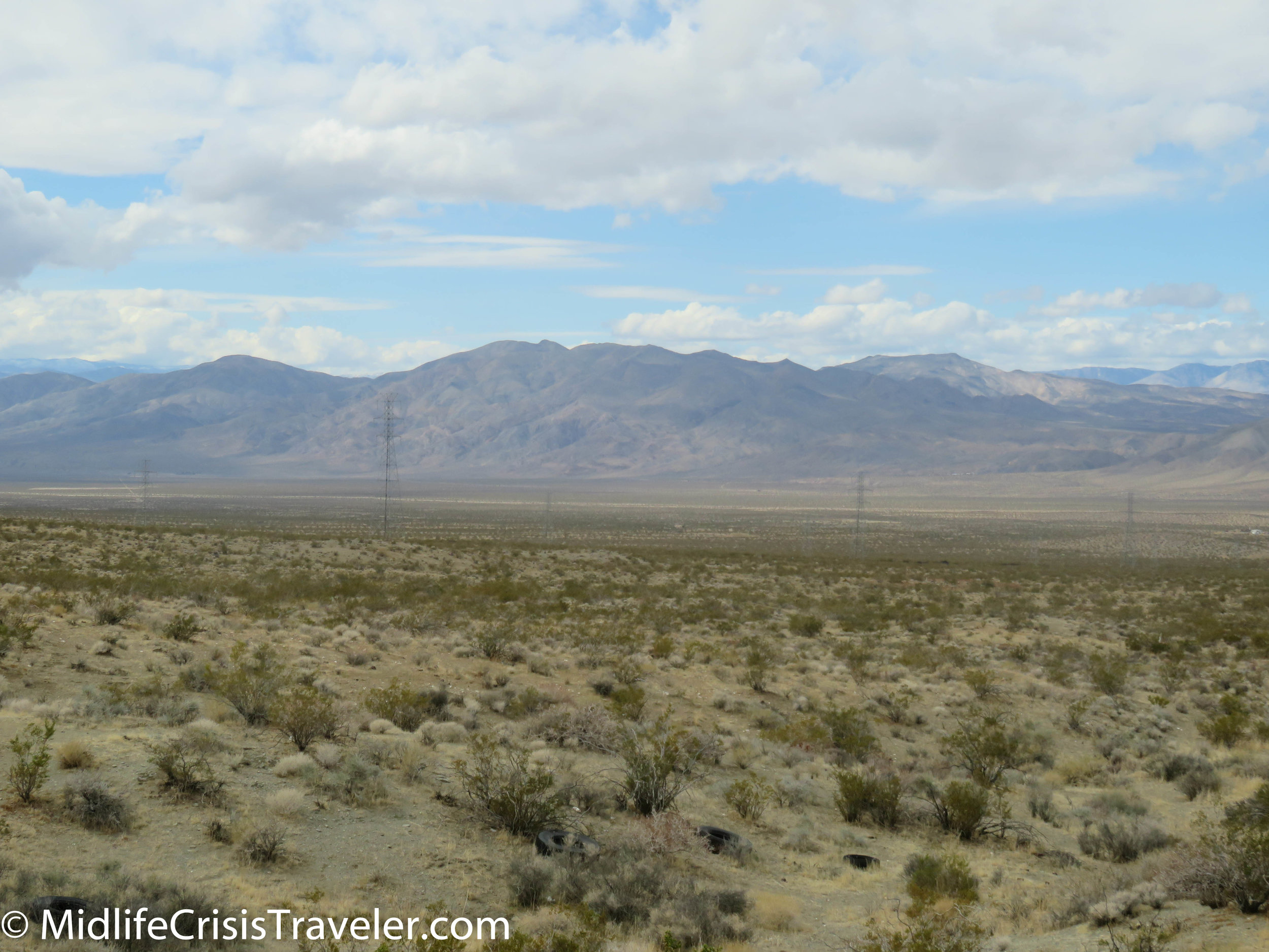
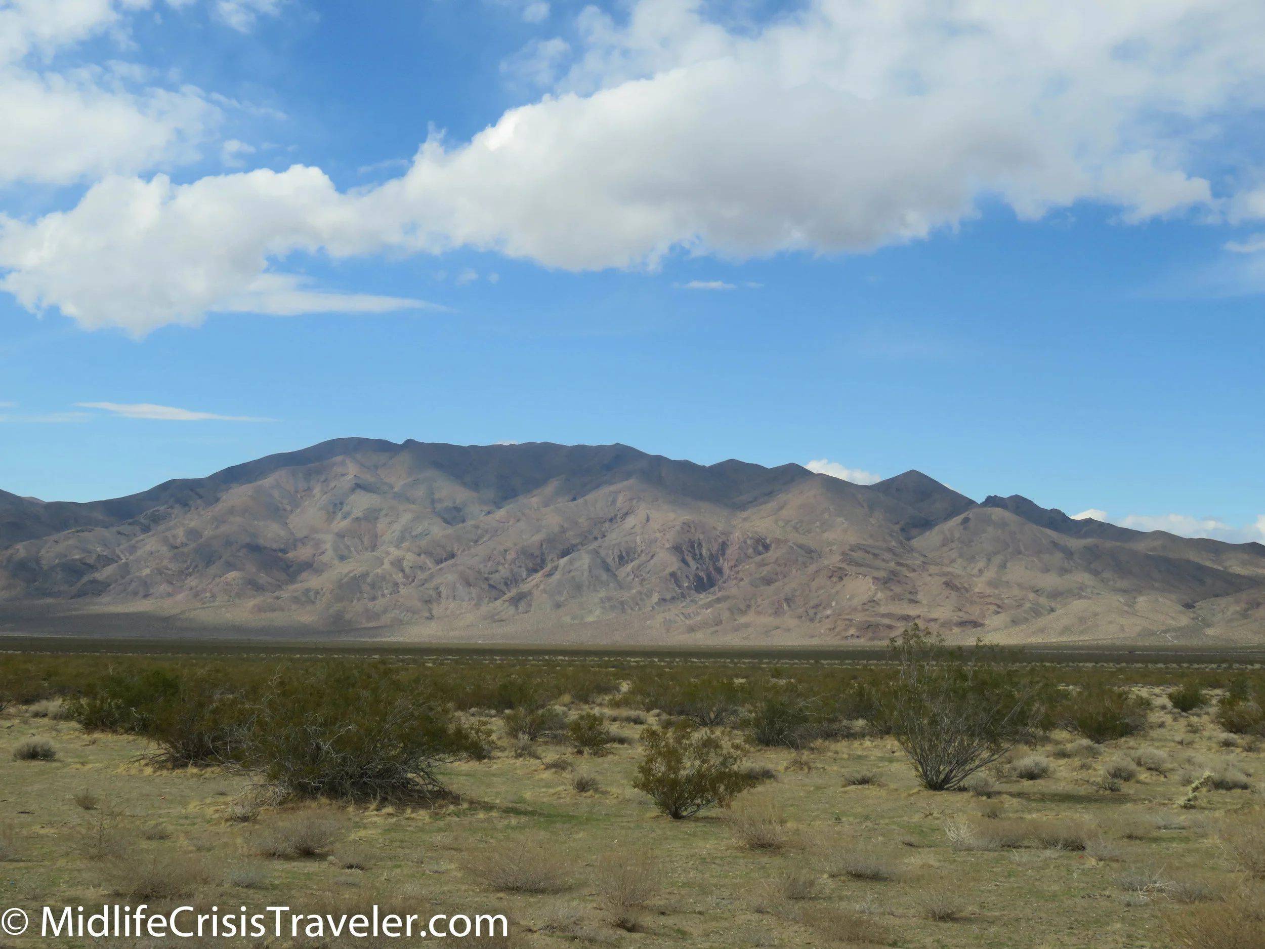
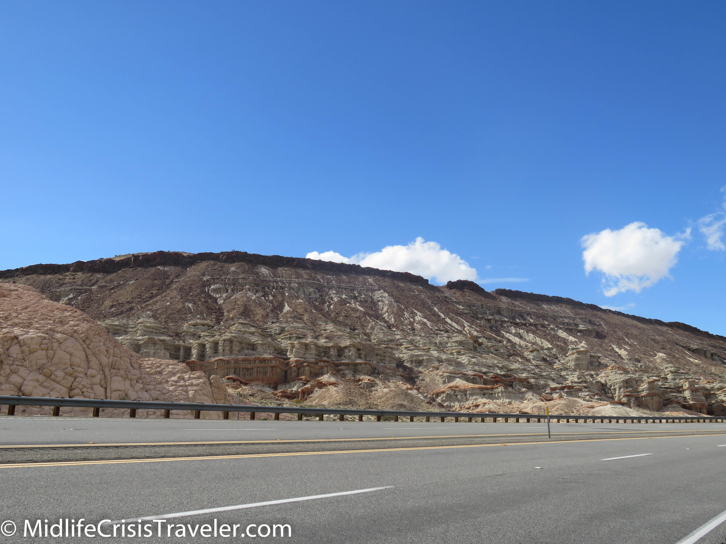
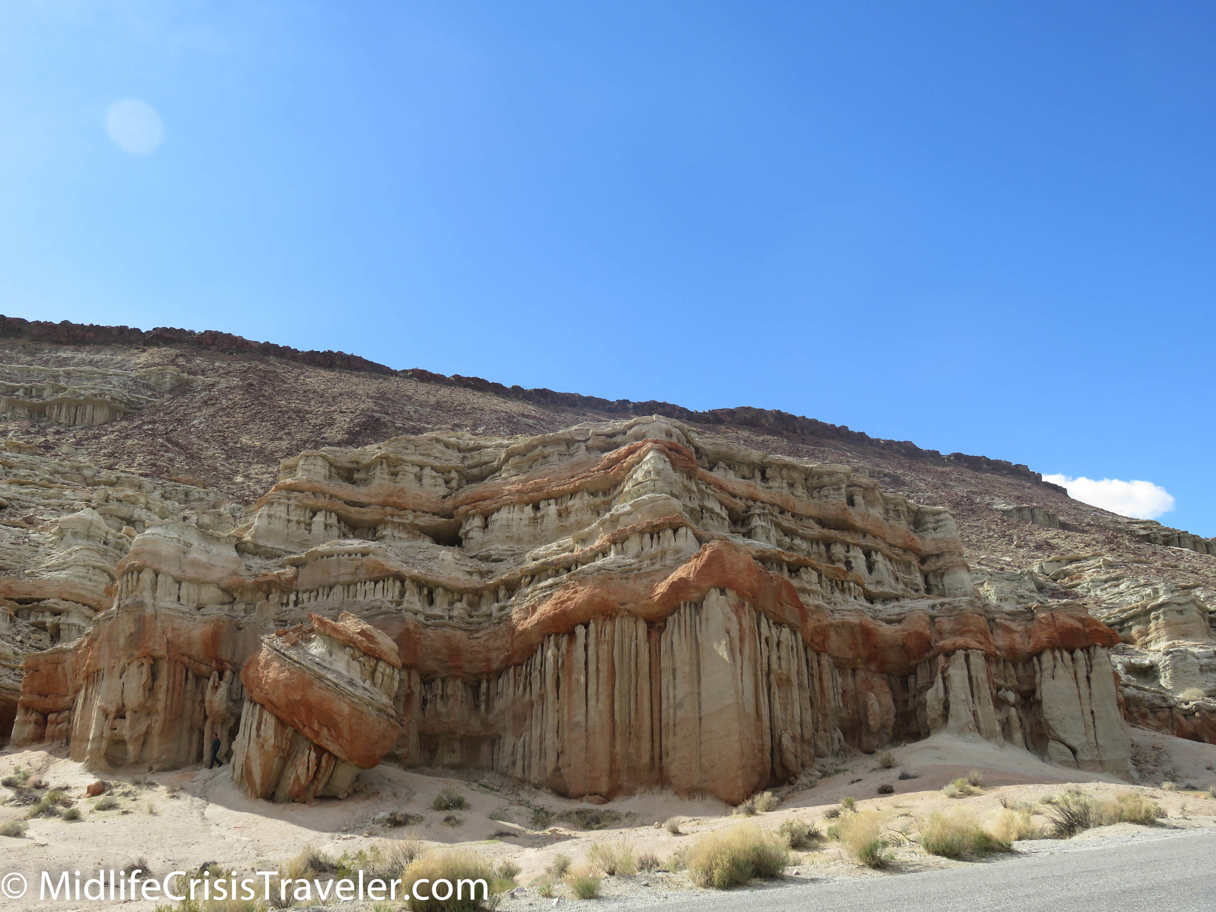
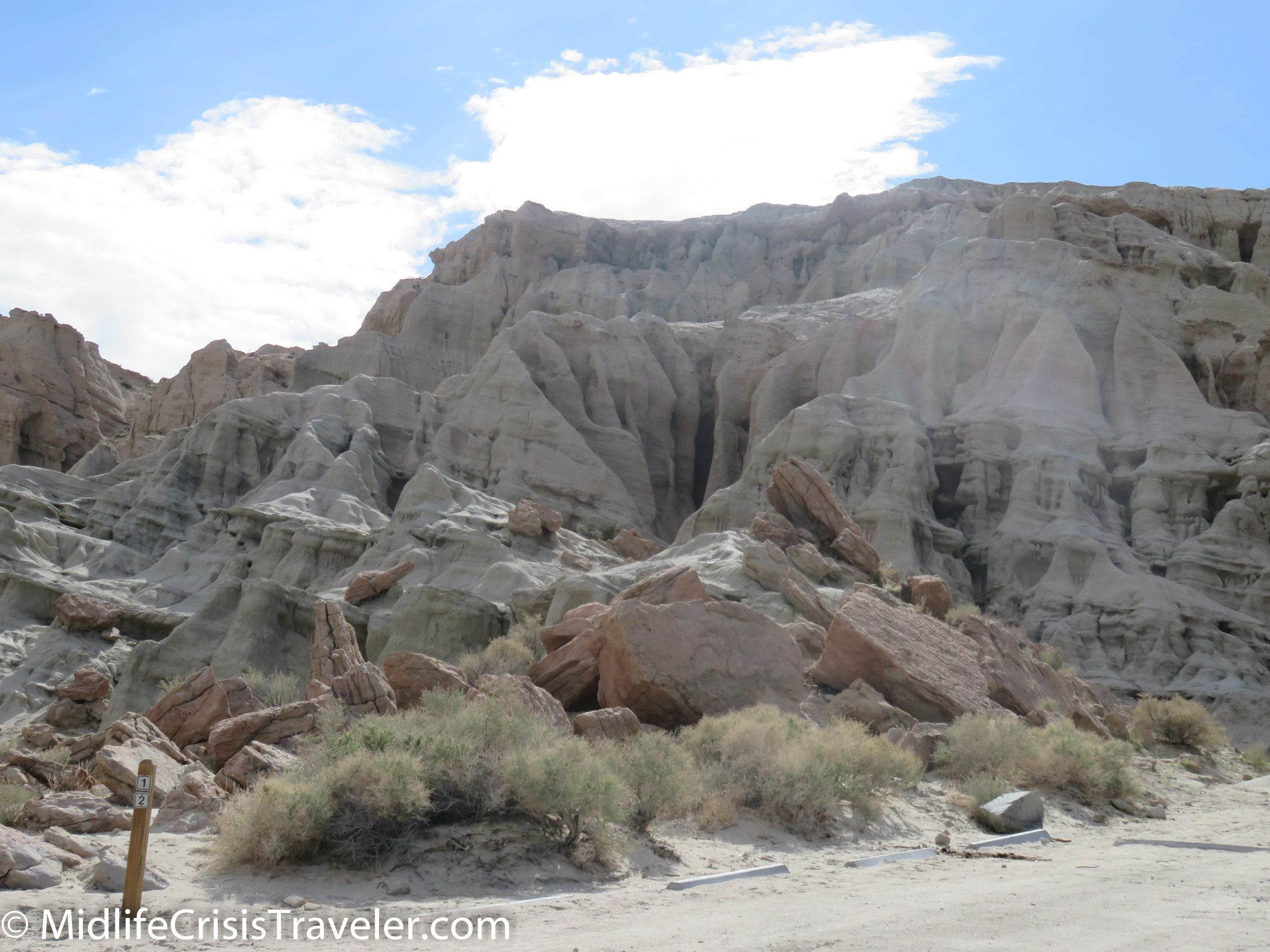
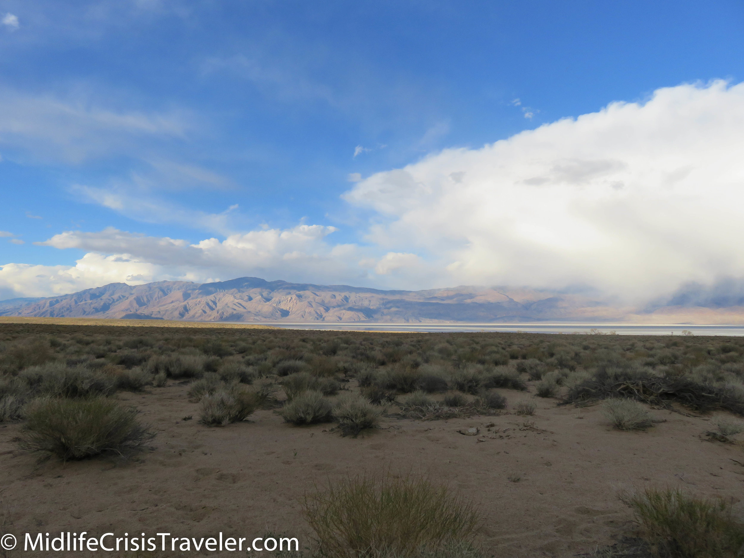
This time, I decided to start driving from the south.  My journey began with Red Rock Canyon State Park.  This is a small park which offers camping spots for tents and RV’s.  It is a beautiful location and has two main areas of interest with Route 14 splitting these areas in half.  Route 14 merges with Route 395 if you drive north about 20 miles.  At that intersection, you start to see the Sierra Nevada mountains on your left and the mountains of Death Valley National Park on your right.  Although the drive to Lone Pine shouldn’t take very long, your urge to stop and take hundreds of pictures of the various angles of the mountains will keep you moving at a snail’s pace.  It’s worth every second. 

Red Rock to Lone Pine-25.jpg
Red Rock to Lone Pine-26.jpg
Red Rock to Lone Pine-27.jpg
Red Rock to Lone Pine-28.jpg
Red Rock to Lone Pine-29.jpg
Red Rock to Lone Pine-30.jpg
Red Rock to Lone Pine-31.jpg
Red Rock to Lone Pine-32.jpg
Red Rock to Lone Pine-33.jpg
Red Rock to Lone Pine-34.jpg
Red Rock to Lone Pine-35.jpg
Red Rock to Lone Pine-36.jpg
Red Rock to Lone Pine-54.jpg
Red Rock to Lone Pine-37.jpg
Red Rock to Lone Pine-38.jpg
Red Rock to Lone Pine-39.jpg
Red Rock to Lone Pine-40.jpg
Red Rock to Lone Pine-41.jpg
Red Rock to Lone Pine-42.jpg
Red Rock to Lone Pine-43.jpg
Red Rock to Lone Pine-44.jpg
Red Rock to Lone Pine-47.jpg
Red Rock to Lone Pine-48.jpg
Red Rock to Lone Pine-49.jpg
Red Rock to Lone Pine-50.jpg
Red Rock to Lone Pine-51.jpg
Red Rock to Lone Pine-52.jpg
Red Rock to Lone Pine-53.jpg
Red Rock to Lone Pine-55.jpg
Red Rock to Lone Pine-56.jpg
Red Rock to Lone Pine-57.jpg
Red Rock to Lone Pine-58.jpg
Red Rock to Lone Pine-59.jpg
Red Rock to Lone Pine-60.jpg
Red Rock to Lone Pine-62.jpg
Red Rock to Lone Pine-63.jpg
Red Rock to Lone Pine-64.jpg

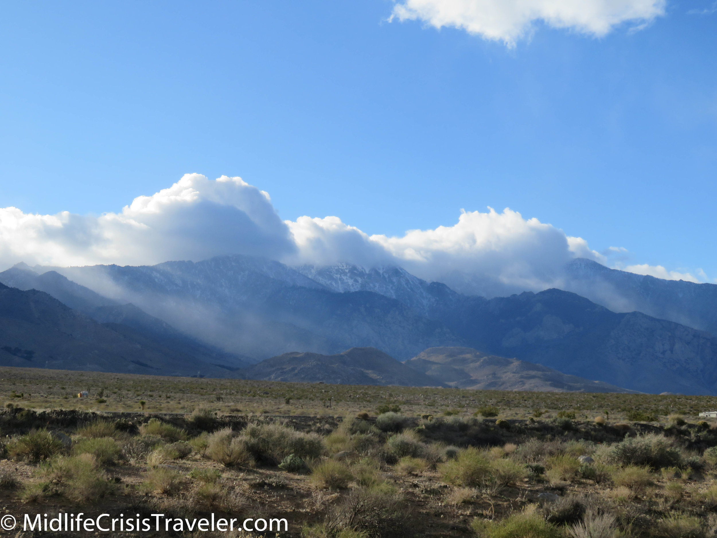
After an early blue sky day, snow clouds moved in and began to dust the Sierra Nevada mountains at various areas in the range.  

Red Rock to Lone Pine-65.jpg
Red Rock to Lone Pine-66.jpg
Red Rock to Lone Pine-67.jpg
Red Rock to Lone Pine-68.jpg
Red Rock to Lone Pine-69.jpg
Red Rock to Lone Pine-70.jpg
Red Rock to Lone Pine-71.jpg
Red Rock to Lone Pine-72.jpg
Red Rock to Lone Pine-73.jpg
Red Rock to Lone Pine-74.jpg
Red Rock to Lone Pine-75.jpg
Red Rock to Lone Pine-76.jpg

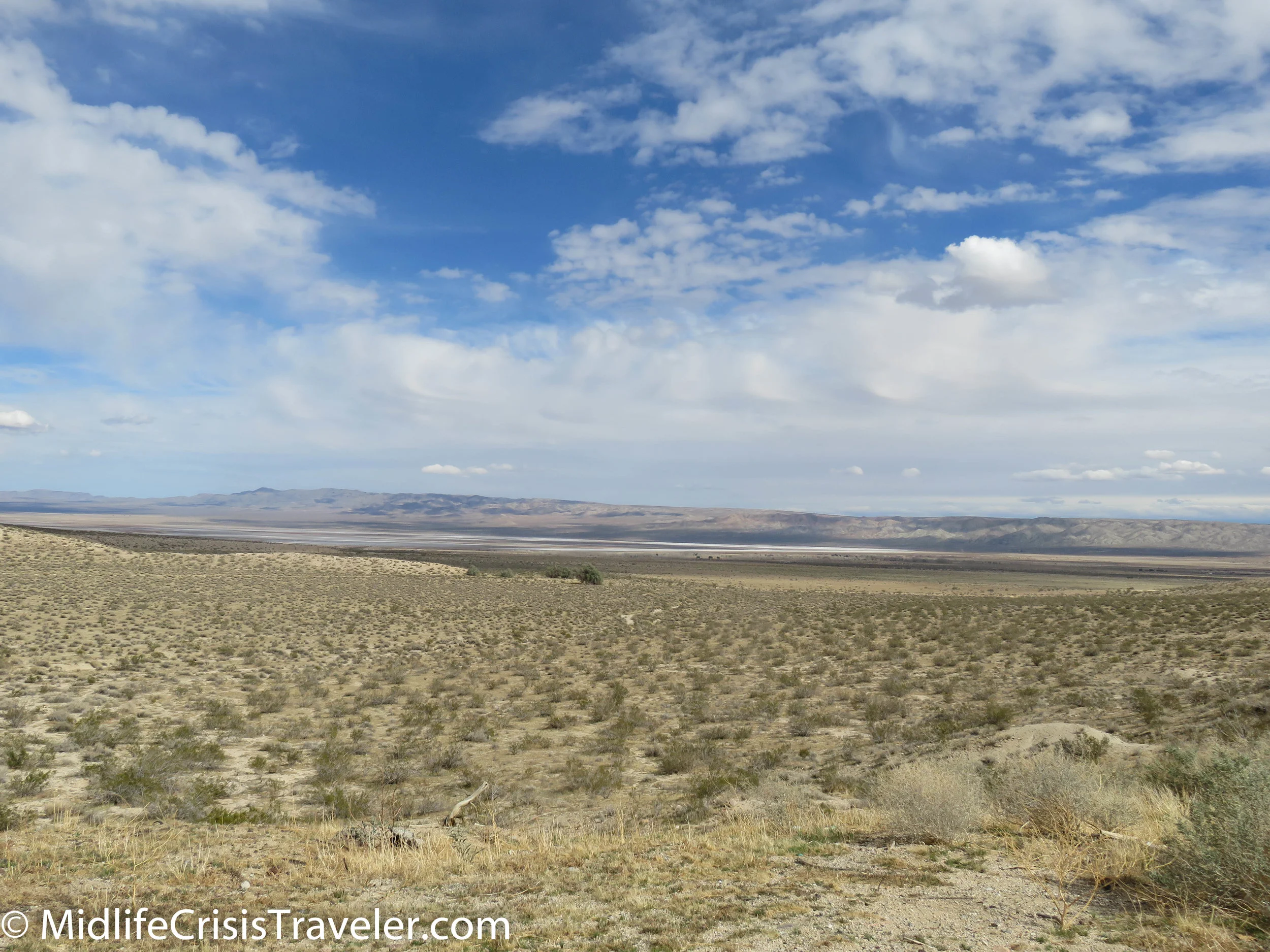
Off to the right, Owens Lake will appear.  If during the winter and early spring, there might be a fog cloud over the water. 

Red Rock to Lone Pine-84.jpg
Red Rock to Lone Pine-87.jpg
Red Rock to Lone Pine-85.jpg
Red Rock to Lone Pine-77.jpg
Red Rock to Lone Pine-80.jpg
Red Rock to Lone Pine-78.jpg
Red Rock to Lone Pine-79.jpg
Red Rock to Lone Pine-81.jpg
Red Rock to Lone Pine-82.jpg
Red Rock to Lone Pine-86.jpg
Red Rock to Lone Pine-89.jpg
Red Rock to Lone Pine-96.jpg
Red Rock to Lone Pine-92.jpg
Red Rock to Lone Pine-90.jpg
Red Rock to Lone Pine-91.jpg
Red Rock to Lone Pine-93.jpg
Red Rock to Lone Pine-94.jpg
Red Rock to Lone Pine-95.jpg
Red Rock to Lone Pine-97.jpg

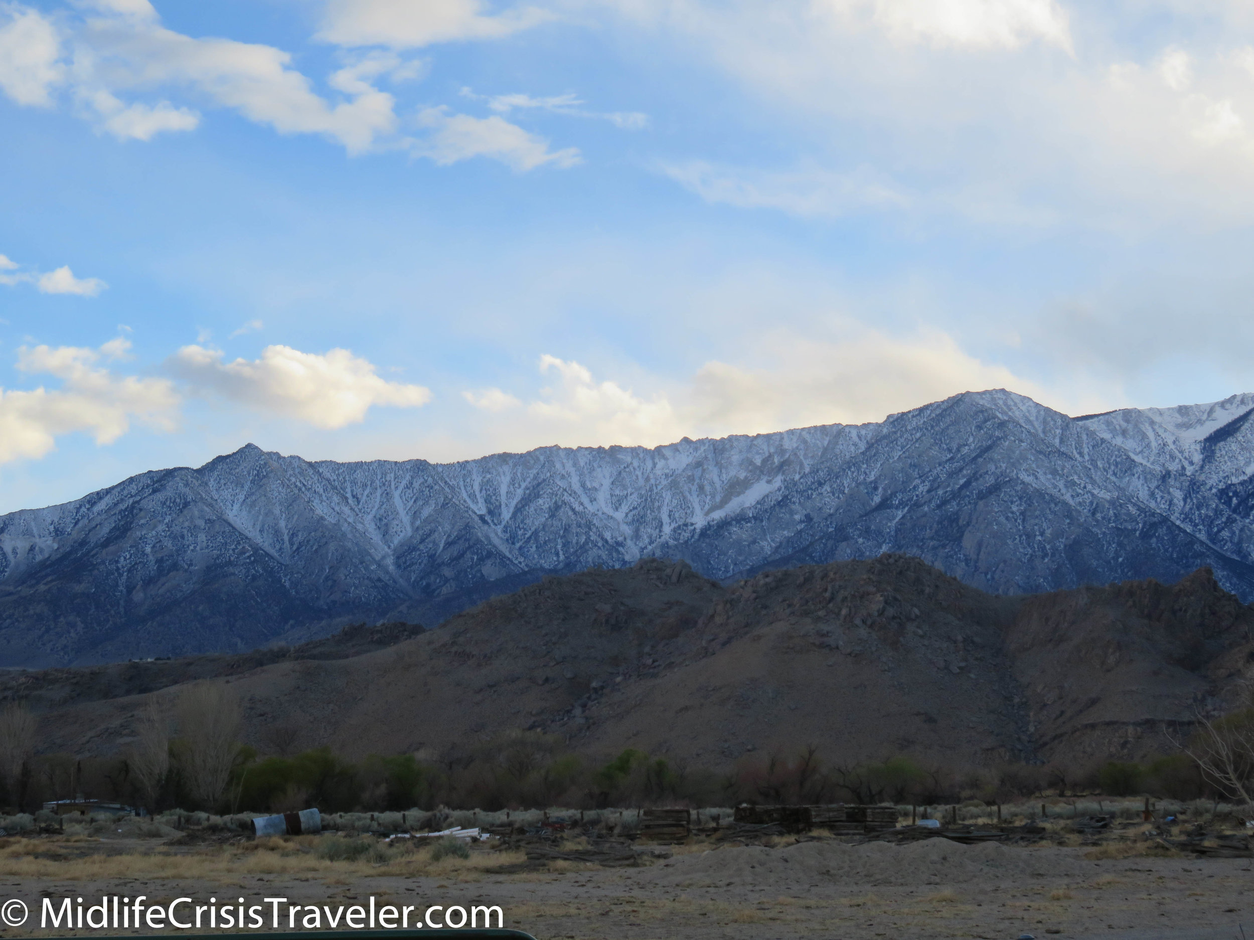
Finally, at Lone Pine, your breath will officially be taken away.  The landscape just got serious.  Mount Whitney is an impressive sight to see.  It is the highest point in the lower 48 states and is accompanied by jagged peaks on its flank.  Lone Pine is the kind of place that you aren’t sure where to look because you are surrounded by such impressive mountains to the east and west.  But this is just the first leg of the journey.  There are many winding roads, partially frozen lakes and massive mountains to come. 

Red Rock to Lone Pine-100.jpg
Red Rock to Lone Pine-101.jpg
Red Rock to Lone Pine-98.jpg
Red Rock to Lone Pine-99.jpg

Have you driven through the Owens Valley?  What was your experience like?  What is your favorite location?  For more information about Red Rock Canyon State Park, click the link below.

https://www.parks.ca.gov/?page_id=631